Active Alerts Addison, IL
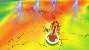
Strong west winds with gusts as high as 50 mph will move acrossthe greater Chicago metropolitan area over the next few hours as acomplex of thunderstorms moves across northern Illinois. Thewinds may begin well before rain arrives, and continue for greaterthan 30 minutes at any given location.In addition, locally stronger winds in excess of 60 mph may occurwhere thunderstorms are strongest of intensify. In thesesituations, Severe Thunderstorm Warnings will be issued.Consider moving indoors until the gusty winds andthunderstorms pass.
The Illinois Environmental Protection Agency has determined that anAir Pollution Action Day will be declared for the greater ChicagoMetropolitan Area and is in effect unitl midnight CDT Monday night.An Air Pollution Action Day is declared when weather conditions aresuch that widespread ozone and or particulate levels are expected tobe at or above the Unhealthy for Sensitive Groups category of theair quality index for multiple days.Active children and adults, especially people with pulmonary orrespiratory disease such as asthma, should limit prolonged outdooractivity.Area residents are urged to reduce pollution levels. Air qualityforecasts and tips on how you can reduce your emissions can be foundat www.airnow.gov.Media contact...Illinois EPA
For your protection move to an interior room on the lowest floor of abuilding.Wind damage with these storms will occur before any rain orlightning. Do not wait for the sound of thunder before taking cover.SEEK SHELTER IMMEDIATELY inside a sturdy structure and stay away fromwindows.
At 518 PM CDT, strong to severe outflow winds from weakeningthunderstorms were located along a line extending from nearWadsworth to Niles to near Homer Glen to near Elwood, moving east at40 mph. This strong surge of outflow winds will produce gusts of 50to locally 60 mph, strong enough to down some trees and powerlines.These strong winds will be accompanied by little or no rain. Do notwait for lightning, thunder, or rain to seek shelter.HAZARD...60 mph wind gusts.SOURCE...Radar indicated.IMPACT...Expect damage to roofs, siding, and trees.These severe storms will be near...Chicago, Joliet, Waukegan, Cicero, Evanston, Skokie, Orland Park,Tinley Park, Oak Lawn, and Berwyn around 525 PM CDT.Chicago Lawn, Bridgeport, Chicago Loop, Blue Island, New City,Auburn Gresham, Near North Side, Evergreen Park, Midlothian, andFrankfort Square around 530 PM CDT.Roseland, Englewood, Harvey, Matteson, Navy Pier, Chatham, HydePark, Country Club Hills, Hazel Crest, and Richton Park around 535PM CDT.South Shore and South Deering around 540 PM CDT.