Active Alerts Mapleside, IA
You should monitor later forecasts and be prepared to take actionshould Flash Flood Warnings be issued.
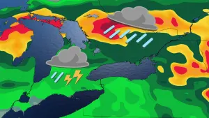
* WHAT...Flash flooding caused by excessive rainfall continues to bepossible.* WHERE...Portions of northwest Iowa, including the following areas,Clay, Dickinson, Lyon, O'Brien, Osceola and Sioux, southwestMinnesota, including the following areas, Cottonwood, Jackson,Nobles and Rock, and southeast South Dakota, including thefollowing areas, Lincoln and Minnehaha.* WHEN...Through this evening.* IMPACTS...Extensive street flooding and flooding of creeks andrivers are possible. Area creeks and streams are running high andcould flood with more heavy rain.* ADDITIONAL DETAILS...- This area has already experienced several days of extremerainfall and is experiencing significant ongoing flooding.Additional thunderstorms this afternoon may bring anadditional 0.5 inches of rainfall, further exacerbatingflooding.- http://www.weather.gov/safety/flood
Turn around, don't drown when encountering flooded roads. Most flooddeaths occur in vehicles.Be especially cautious at night when it is harder to recognize thedangers of flooding.Additional information is available at www.weather.gov.The next statement will be issued by late tonight.
...The Flood Warning continues for the following rivers in Iowa...Floyd River at Alton affecting Plymouth and Sioux Counties....The Flood Warning is extended for the following rivers in Iowa...Floyd River at Sheldon affecting Sioux and O'Brien Counties.Floyd River At Le Mars affecting Plymouth County.* WHAT...Moderate flooding is occurring and major flooding isforecast.* WHERE...Floyd River at Sheldon.* WHEN...Until late Monday evening.* IMPACTS...At 18.0 feet, The railroad tracks are flooded and waterbegins to approach the parking lots of some structures off of N2nd Ave. The bridge on Monroe Ave may be overtopped.* ADDITIONAL DETAILS...- At 1:00 AM CDT Saturday the stage was 14.9 feet.- Recent Activity...The maximum river stage in the 24 hoursending at 1:00 AM CDT Saturday was 14.9 feet.- Forecast...The river is expected to rise to a crest of 17.7feet this morning. It will then fall below flood stage latetomorrow evening.- Flood stage is 12.0 feet.- http://www.weather.gov/safety/flood