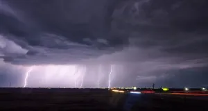
Active Alerts Saint Leo, MN
Turn around, don't drown when encountering flooded roads. Most flooddeaths occur in vehicles.Motorists should not attempt to drive around barricades or drivecars through flooded areas.
...The Flood Warning is extended for the following rivers inMinnesota...Cottonwood River at New Ulm affecting Brown County.Cottonwood River Above Springfield affecting Brown County.South Fork Crow River at Delano affecting Wright and HennepinCounties.South Fork Crow River below Mayer affecting Carver County.Crow River at Rockford affecting Wright and Hennepin Counties.Redwood River near Redwood Falls affecting Redwood County....The Flood Warning continues for the following rivers in Minnesotaand Wisconsin...Minnesota River at New Ulm affecting Blue Earth, Brown andNicollet Counties.Mississippi River at Red Wing affecting Pepin, Goodhue and PierceCounties.Mississippi River at St. Paul affecting Washington, Ramsey andDakota Counties.St Croix River at Stillwater affecting Washington, Pierce and St.Croix Counties.Cannon River at Northfield affecting Dakota and Rice Counties.Minnesota River at Montevideo affecting Chippewa, Lac qui Parleand Yellow Medicine Counties.Minnesota River at Mankato affecting Blue Earth and NicolletCounties.Minnesota River at Savage affecting Carver, Dakota, Scott andHennepin Counties.Minnesota River at Henderson MN19 affecting Sibley, Scott and LeSueur Counties.Minnesota River near Jordan affecting Carver, Scott and SibleyCounties.Minnesota River at Morton affecting Redwood and Renville Counties.Mississippi River at Red Wing L/D 3 affecting Goodhue and PierceCounties.Mississippi River near Hastings L/D 2 (COE) affecting Washington,Dakota and Pierce Counties..Rivers have either reached crest or will reach crest this weekend.River levels are expected to gradually fall throughout the nextseveral days. Additional 1 to 2 inches in the forecast next week mayextend river level recession times.* WHAT...Minor flooding is occurring and minor flooding is forecast.* WHERE...Minnesota River at Montevideo.* WHEN...Until Tuesday evening.* IMPACTS...At 14.0 feet, Low lying areas and some roads along theriver begin flooding, along with some basements of houses alongthe river.* ADDITIONAL DETAILS...- At 900 PM CDT Friday, the stage was 14.3 feet.- Recent Activity...The maximum river stage in the 24 hoursending at 900 PM CDT Friday was 14.3 feet.- Forecast...The river is expected to rise to a crest of 14.3feet just after midnight tonight. It will then fall belowflood stage early Tuesday morning.- Flood stage is 14.0 feet.- Flood History...This crest compares to a previous crest of14.2 feet on 06/25/1991.