Active Alerts Barry, MO
Turn around, don't drown when encountering flooded roads. Most flooddeaths occur in vehicles.This product along with additional weather and stream information isavailable at www.weather.gov/kc/.
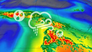
...The Flood Warning continues for the following rivers in Kansas...Missouri...Missouri River at Atchison affecting Buchanan, Atchison andPlatte Counties.Missouri River At Miami affecting Carroll, Saline and CharitonCounties.Missouri River at Napoleon affecting Lafayette, Jackson and RayCounties.Missouri River at Waverly affecting Lafayette, Carroll and SalineCounties.Missouri River at St Joseph affecting Buchanan, Andrew andDoniphan Counties.Missouri River at Leavenworth affecting Platte and LeavenworthCounties.Missouri River above Parkville affecting Wyandotte, Leavenworthand Platte Counties.* WHAT...Minor flooding is forecast.* WHERE...Missouri River at Leavenworth.* WHEN...From Sunday morning to Friday, July 05.* IMPACTS...At 20.0 feet, Lowland flooding occurs along the east andwest banks of the river.At 22.3 feet, Water enters Riverfront Park in Leavenworth. Inaddition, 2nd Street at the waste water treatment plant is closeddue to high water. Persons should vacate the park to avoid theloss of life and property.At 23.4 feet, The Hildebrandt Island north of Fort Leavenworthbegins to flood and families in this area need to evacuate.* ADDITIONAL DETAILS...- At 8:00 PM CDT Thursday the stage was 18.1 feet.- Forecast...The river is expected to rise above flood stageSunday morning to a crest of 22.0 feet Wednesday morning. Itwill then fall below flood stage Thursday, July 04.- Flood stage is 20.0 feet.- http://www.weather.gov/safety/flood
Turn around, don't drown when encountering flooded roads. Most flooddeaths occur in vehicles.This product along with additional weather and stream information isavailable at www.weather.gov/kc/.
...The Flood Warning continues for the following rivers in Kansas...Missouri...Missouri River at Atchison affecting Buchanan, Atchison andPlatte Counties.Missouri River At Miami affecting Carroll, Saline and CharitonCounties.Missouri River at Napoleon affecting Lafayette, Jackson and RayCounties.Missouri River at Waverly affecting Lafayette, Carroll and SalineCounties.Missouri River at St Joseph affecting Buchanan, Andrew andDoniphan Counties.Missouri River at Leavenworth affecting Platte and LeavenworthCounties.Missouri River above Parkville affecting Wyandotte, Leavenworthand Platte Counties.* WHAT...Minor flooding is forecast.* WHERE...Missouri River above Parkville.* WHEN...From Sunday evening to Friday, July 05.* IMPACTS...At 28.0 feet, Water reaches the bottom of the South MainStreet Bridge and a significant portion of English Landing Parkfloods.* ADDITIONAL DETAILS...- At 8:45 PM CDT Thursday the stage was 22.5 feet.- Forecast...The river is expected to rise above flood stageSunday evening to a crest of 26.5 feet early Wednesdayafternoon. It will then fall below flood stage Thursday, July04.- Flood stage is 25.0 feet.- http://www.weather.gov/safety/flood