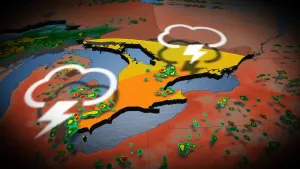
Active Alerts Bloomingdale, SD
You should monitor later forecasts and be prepared to take actionshould Flash Flood Warnings be issued.
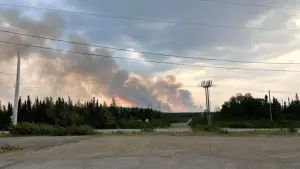
* WHAT...Flash flooding caused by excessive rainfall continues to bepossible.* WHERE...Portions of northwest Iowa, including the following areas,Buena Vista, Cherokee, Clay, Dickinson, Lyon, O'Brien, Osceola,Plymouth and Sioux, southwest Minnesota, including the followingareas, Cottonwood, Jackson, Lincoln, Lyon, Murray, Nobles,Pipestone and Rock, and South Dakota, including the followingareas, Aurora, Beadle, Bon Homme, Brookings, Brule, Charles Mix,Clay, Davison, Douglas, Gregory, Hanson, Hutchinson, Jerauld,Kingsbury, Lake, Lincoln, McCook, Miner, Minnehaha, Moody,Sanborn, Turner, Union and Yankton.* WHEN...Through Saturday morning.* IMPACTS...Extensive street flooding and flooding of creeks andrivers are possible. Area creeks and streams are running high andcould flood with more heavy rain.* ADDITIONAL DETAILS...- Widespread heavy rain is expected Friday evening throughFriday night. Storm total rainfall may reach 2 to 4 inchesin many locations with potential for higher amounts. Thisrainfall, on top of already saturated ground, will lead toflash flood and river flood potential.- http://www.weather.gov/safety/flood
Motorists should not attempt to drive around barricades or drivecars through flooded areas.Turn around, don't drown when encountering flooded roads. Most flooddeaths occur in vehicles.Be especially cautious at night when it is harder to recognize thedangers of flooding.Additional information is available at www.weather.gov.The next statement will be issued by this afternoon.
...The Flood Warning is extended for the following rivers in SouthDakota...Firesteel Creek near Mount Vernon affecting Davison County.East Fork Vermillion River near Parker affecting Turner County.Big Sioux River at Sioux Falls I-90 affecting Minnehaha County.Big Sioux River below Dell Rapids affecting Minnehaha County.Big Sioux River near Brookings affecting Moody and BrookingsCounties....The Flood Warning continues for the following rivers in SouthDakota...Iowa...Minnesota...James River near Mitchell affecting Davison and Hanson Counties.James River near Forestburg affecting Sanborn County.James River near Scotland affecting Bon Homme, Yankton andHutchinson Counties.Vermillion River near Chancellor affecting Turner County.East Fork Vermillion River below Montrose affecting McCook County.Turkey Ridge Creek near Centerville affecting Turner County.Vermillion River near Wakonda affecting Clay County.Vermillion River near Davis affecting Lincoln and Turner Counties.Big Sioux River at Brandon affecting Minnehaha, Lyon and LincolnCounties.Big Sioux River at Akron affecting Plymouth and Union Counties.Big Sioux River above Hawarden affecting Union, Sioux and LincolnCounties.Pipestone Creek below Pipestone affecting Pipestone, Moody andMinnehaha Counties.N. Branch Pipestone Creek near Pipestone affecting PipestoneCounty.Little Rock River near George affecting Lyon County.Mud Creek near Lester affecting Lyon County.Rock River near Hardwick affecting Rock County.Ocheyedan River near Everly affecting O'Brien and Clay Counties.Little Sioux River near Montgomery affecting Dickinson County.West Fork Little Sioux River near Lake Park affecting DickinsonCounty.Little Sioux River near Milford affecting Dickinson County.Little Sioux River above Spencer / Highway 18 affecting ClayCounty.West Fork Des Moines River near Avoca affecting Cottonwood andMurray Counties....The Flood Warning is cancelled for the following rivers in SouthDakota...Iowa...East Fork Vermillion River near Montrose affecting McCook County.Skunk Creek near Hartford affecting Minnehaha County.Little Floyd River near Sanborn affecting O'Brien County.* WHAT...Minor flooding is occurring and major flooding is forecast.This approaches the flood of record.* WHERE...Vermillion River near Wakonda.* WHEN...Until further notice.* IMPACTS...At 17.5 feet, The bridge on 304th Street west ofDalesburg is overtopped. Water reaches the bottom of the bridge onHighway 19 at the gauge location.* ADDITIONAL DETAILS...- At 11:00 AM CDT Friday the stage was 14.5 feet.- Recent Activity...The maximum river stage in the 24 hoursending at 11:00 AM CDT Friday was 14.5 feet.- Forecast...The river is expected to rise to 17.4 feet earlytomorrow afternoon. Additional rises are possible thereafter.- Flood stage is 14.0 feet.- http://www.weather.gov/safety/flood