Active Alerts Jones Creek, TX
Take the necessary actions to protect flood-prone property. Iftravel is required, do not drive around barricades or throughwater of unknown depth.
* WHAT...Significant coastal flooding.* WHERE...Gulf-facing beaches, including the MatagordaPeninsula, Brazoria County beaches, Galveston Island and theBolivar Peninsula.* WHEN...Until 7 AM CDT Thursday.* IMPACTS...Numerous roads may be closed. Low lying propertyincluding homes, businesses, and some critical infrastructurewill be inundated. Some shoreline erosion will occur.
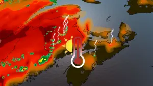
HLSHGXThis product covers Southeast Texas**TROPICAL STORM ALBERTO FORMS OVER THE WESTERN GULF OF MEXICO**NEW INFORMATION---------------* CHANGES TO WATCHES AND WARNINGS:- None* CURRENT WATCHES AND WARNINGS:- A Tropical Storm Warning is in effect for Brazoria Islands,Coastal Brazoria, Coastal Jackson, Coastal Matagorda, andMatagorda Islands* STORM INFORMATION:- About 490 miles south of Galveston TX or about 440 milessouth-southeast of Port O'Connor TX- 22.2N 95.0W- Storm Intensity 40 mph- Movement West or 270 degrees at 9 mphSITUATION OVERVIEW------------------Tropical Storm Alberto has formed in the Western Gulf, and the systemcontinues to slowly approach the Eastern Coast of Mexico. While the stormhas received a name, its expected impacts to SE TX remain unchanged.Reports from emergency managers have indicated ongoing coastal floodingacross the SE TX coast, including along Galveston Island, the Bolivar Peninsula,and coastal Brazoria and Matagorda Counties. Additional coastal flooding ispossible through the next high tide. Some downpours are also possible as thesystem continues to jog to the west, particularly around Matagorda Bay.Starting at San Luis Pass, Tropical Storm Warnings are in effect for thecoast southwards. Occasional strong wind gusts will be possible for therest of the the southeast Texas coast, so a Wind Advisory is also in effectfrom San Luis Pass to High Island. Strong winds will also be felt over thecoastal waters where wind gusts up to 50 knots will be possible causingseas to rise to near 17 feet. Winds will slowly decrease through theday on Thursday, but elevated tides will continue to be possible through Friday.POTENTIAL IMPACTS-----------------* SURGE:Potential impacts from the main surge event are now unfolding acrosscoastal southeast Texas. Remain well away from life-threateningsurge having possible significant impacts. If realized, these impacts include:- Areas of inundation with storm surge flooding accentuated bywaves. Damage to several buildings, mainly near the coast.- Sections of near-shore escape routes and secondary roads becomeweakened or washed out, especially in usually vulnerable lowspots.- Major beach erosion with heavy surf breaching dunes. Strong andnumerous rip currents.- Moderate damage to marinas, docks, boardwalks, and piers.Several small craft broken away from moorings, especially inunprotected anchorages.* FLOODING RAIN:Potential impacts from the flooding rain are still unfolding acrossportions of coastal southeast Texas. Remain well guarded againstlife-threatening flood waters having possible extensive impacts.If realized, these impacts include:- Major rainfall flooding may prompt many evacuations and rescues.- Rivers and tributaries may rapidly overflow their banks inmultiple places. Small streams, creeks, canals, and ditches maybecome dangerous rivers. Flood control systems and barriers maybecome stressed.- Flood waters can enter many structures within multiplecommunities, some structures becoming uninhabitable or washedaway. Many places where flood waters may cover escape routes.Streets and parking lots become rivers of moving water withunderpasses submerged. Driving conditions become dangerous.Many road and bridge closures with some weakened or washed out.Potential impacts from the flooding rain are still unfolding acrossportions of coastal southeast Texas. Remain well guarded against dangerousflood waters having possible limited to significant impacts.Elsewhere across Southeast Texas, little to no impact is anticipated.* WIND:Potential impacts from the main wind event are now unfolding acrossportions of coastal southeast Texas. Remain well sheltered from hazardouswind having possible limited impacts. If realized, these impacts include:- Damage to porches, awnings, carports, sheds, and unanchoredmobile homes. Unsecured lightweight objects blown about.- Many large tree limbs broken off. A few trees snapped oruprooted, but with greater numbers in places where trees areshallow rooted. Some fences and roadway signs blown over.- A few roads impassable from debris, particularly within urbanor heavily wooded places. Hazardous driving conditions onbridges and other elevated roadways.- Scattered power and communications outages.Elsewhere across Southeast Texas, little to no impact is anticipated.* TORNADOES:Potential impacts from tornadoes are still unfolding across SoutheastTexas. Remain well braced against a tornado event having limited impacts.If realized, these impacts include:- The occurrence of isolated tornadoes can hinder the executionof emergency plans during tropical events.- A few places may experience tornado damage, along with powerand communications disruptions.- Locations could realize roofs peeled off buildings, chimneystoppled, mobile homes pushed off foundations or overturned,large tree tops and branches snapped off, shallow-rooted treesknocked over, moving vehicles blown off roads, and small boatspulled from moorings.PRECAUTIONARY/PREPAREDNESS ACTIONS----------------------------------* OTHER PREPAREDNESS INFORMATION:If you are prone to flooding or in an area under a storm surge watchor warning, be prepared for the possibility of a quick and dramaticrise in water levels.If a tornado warning is issued for your area, quickly move to thesafest place within your shelter. Protect your head and body.* ADDITIONAL SOURCES OF INFORMATION:- For information on appropriate preparations see ready.gov- For information on creating an emergency plan see getagameplan.org- For additional disaster preparedness information see redcross.orgNEXT UPDATE-----------The next local statement will be issued by the National WeatherService in Houston/Galveston TX around 4 PM CDT, or sooner ifconditions warrant.
You should monitor later forecasts and be prepared to take actionshould Flash Flood Warnings be issued.
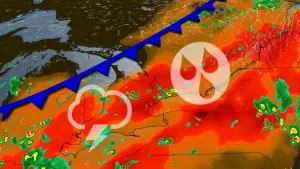
* WHAT...Flash flooding caused by excessive rainfall continues to bepossible.* WHERE...Portions of south central and southeast Texas, includingthe following areas, in south central Texas, Coastal Jackson andInland Jackson. In southeast Texas, Brazoria Islands, CoastalBrazoria, Coastal Galveston, Coastal Matagorda, Galveston Island,Inland Brazoria, Inland Galveston, Inland Matagorda, MatagordaIslands and Wharton.* WHEN...Through late tonight.* IMPACTS...Excessive runoff may result in flooding of rivers,creeks, streams, and other low-lying and flood-prone locations.Creeks and streams may rise out of their banks. Flooding may occurin poor drainage and urban areas.* ADDITIONAL DETAILS...- Widespread showers and thunderstorms associated with anapproaching tropical disturbance in the Western Gulf areexpected throughout the day. Locally heavy rainfall may leadto minor urban and small stream flooding with the potentialfor isolated instances of flash flooding. There will be atight gradient of rainfall amounts. The window for theheaviest rainfall is now through this afternoon.- http://www.weather.gov/safety/flood