Active Alerts Surfside, TX
You should monitor later forecasts and be prepared to take actionshould Flash Flood Warnings be issued.
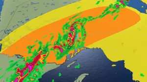
* WHAT...Flash flooding caused by excessive rainfall continues to bepossible.* WHERE...Portions of south central and southeast Texas, includingthe following areas, in south central Texas, Coastal Jackson andInland Jackson. In southeast Texas, Austin, Bolivar Peninsula,Brazoria Islands, Chambers, Coastal Brazoria, Coastal Galveston,Coastal Harris, Coastal Matagorda, Colorado, Fort Bend, GalvestonIsland, Inland Brazoria, Inland Galveston, Inland Harris, InlandMatagorda, Matagorda Islands, Southern Liberty, Waller, Washingtonand Wharton.* WHEN...From this evening through late Wednesday night.* IMPACTS...Excessive runoff may result in flooding of rivers,creeks, streams, and other low-lying and flood-prone locations.Creeks and streams may rise out of their banks. Flooding may occurin poor drainage and urban areas.* ADDITIONAL DETAILS...- Widespread showers and thunderstorms associated with anapproaching tropical disturbance in the Western Gulf willproduce up to 4-6 inches of rainfall generally along andsouth of I-10 with isolated higher amounts of 8"+ possible.There will be tight gradient of rainfall amounts with areasnorth of I-10 potentially only receiving up to 1-3" withlocally higher amounts possible. The heaviest rainfall isexpected to occur between tonight through Wednesdayafternoon.- http://www.weather.gov/safety/flood
Winds this strong can make driving difficult, especially for highprofile vehicles. Use extra caution.Secure outdoor objects.
* WHAT...East winds 20 to 30 mph with gusts up to 35 mph expected.* WHERE...Portions of south central and southeast Texas.* WHEN...From 3 PM this afternoon to 7 AM CDT Thursday.* IMPACTS...Gusty winds will blow around unsecured objects. Treelimbs could be blown down and a few power outages may result.
Take the necessary actions to protect flood-prone property. Iftravel is required, do not drive around barricades or throughwater of unknown depth.Swim near a lifeguard and away from rocks, jetties, and piers. Ifcaught in a rip current, relax and float. Don't swim against thecurrent. If able, swim in a direction following the shoreline. Ifunable to escape, face the shore and call or wave for help.
* WHAT...For the High Rip Current Risk, dangerous rip currents.For the Coastal Flood Warning, significant coastal floodingexpected.* WHERE...Gulf-facing beaches, including the MatagordaPeninsula, Brazoria County beaches, Galveston Island and theBolivar Peninsula.* WHEN...For the Coastal Flood Warning, until 7 AM CDT Thursday.For the High Rip Current Risk, through late Wednesday night.* IMPACTS...Numerous roads may be closed. Low lying propertyincluding homes, businesses, and some critical infrastructurewill be inundated. Some shoreline erosion will occur. Ripcurrents can sweep even the best swimmers away from shore intodeeper water.


