Active Alerts Melnik, WI
Flood Watch
Issued at Fri 12:43 PM Jun. 21
Issued by: National Weather Service
Description
Full details
Hydrologic Outlook
Issued at Fri 12:18 PM Jun. 21
Issued by: National Weather Service
Description
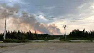
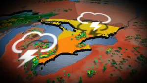
ESFGRBSeveral rounds of showers and thunderstorms will bring heavy rain tothe region through Saturday evening. Right now, it appears theheaviest rainfall will occur across central and east centralWisconsin, where 2 to 3 inches with locally higher amounts will bepossible.Urban and small stream flooding is likely during the periods ofheaviest rains. Some river flooding could be possible later in theweekend or early next week, as water from small streams run into thelarger rivers.Now would be a good time to check your sump pump, and move propertyaway from the water if you live near a small stream. Campgroundsshould monitor the weather and ensure the safety of campers nearrivers and streams.
More News from The Weather Network


Advertisement
Advertisement
Advertisement