Winter 2020 was the hottest on record without a super El Niño

This year is off to a very warm start
Winter 2020 is now the second warmest in the record books, according to NOAA, but it would rank even higher if it weren't for El Niño.
March 1 marked the beginning of Meteorological Spring. With that, NOAA has now tallied up temperatures from across the globe, from December 1, 2019 to February 29, 2020. Based on their records, the season - Northern Hemisphere Winter/Southern Hemisphere Summer - already drops into the record books at an alarming position.
"The second warmest December, warmest January, and second warmest February gave way to the second warmest December–February seasonal period in the 141-year record," the latest NOAA Global Climate Report for February 2020 reads. NOAA's climate records stretch back to 1879.
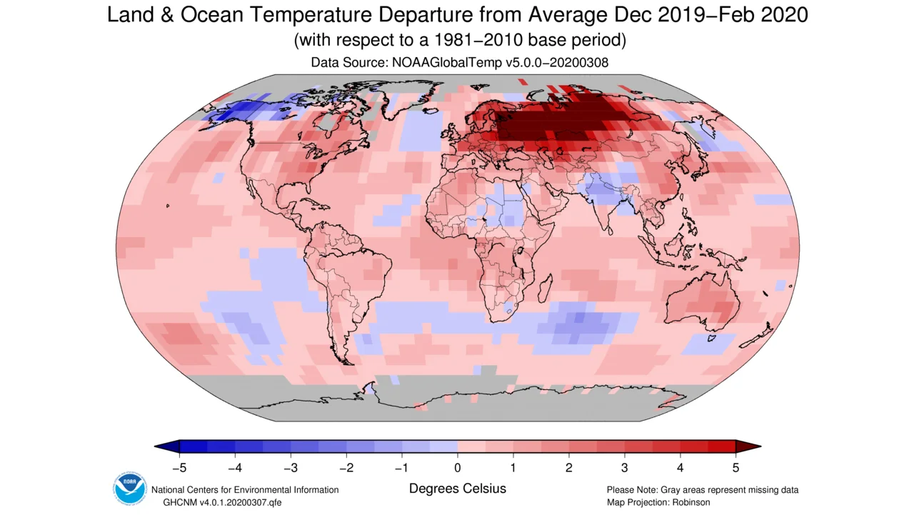
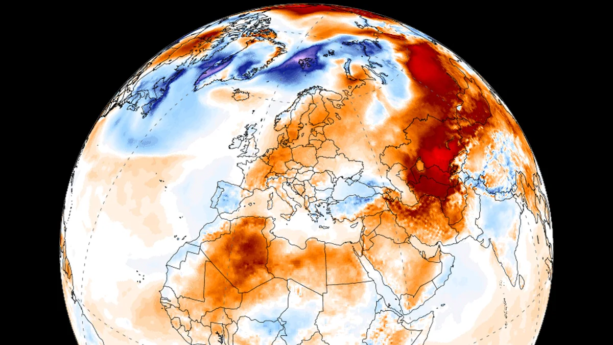
Temperature anomaly map for the globe, from December 2019-February 2020. Note the extreme heat across Russia. Credit: NOAA NCEI
According to the report, the global average surface temperature (across both land and ocean) for December-February was 1.12°C above the 20th century average of 15.6°C.
The only December-February period that had a higher temperature departure was December 2015 to February 2016, at +1.18°C.
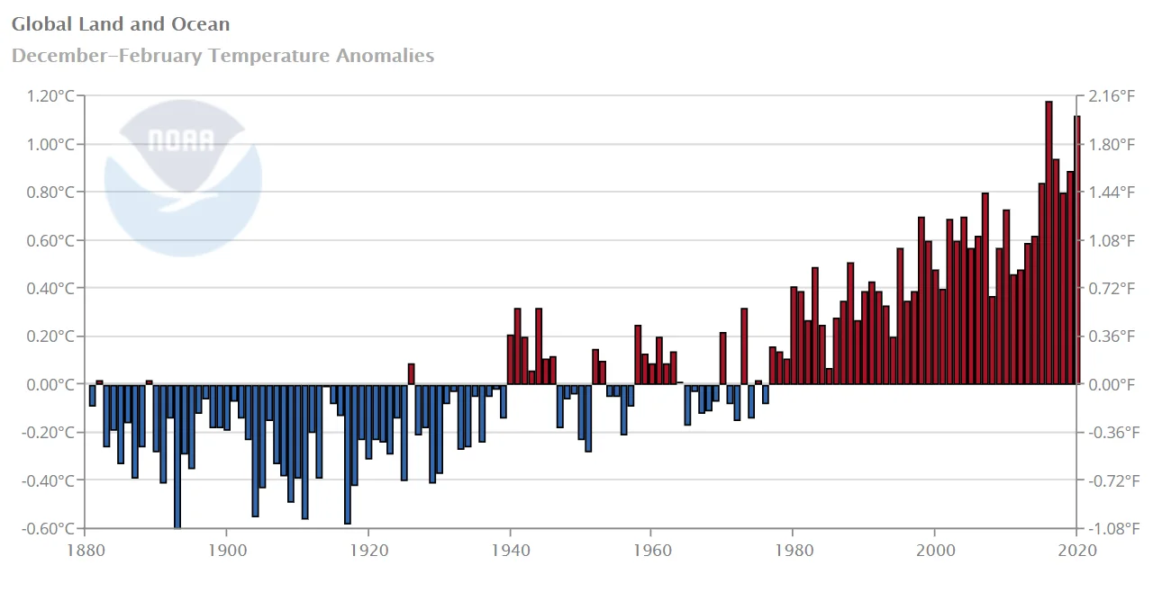
Winter 2020 ranks as 2nd warmest after El Nino-fueled heat of Winter 2016. Credit: NOAA
SOME PERSPECTIVE
Winter 2015-16 was a somewhat peculiar one, due to an extreme El Niño event happening in the equatorial Pacific Ocean. In fact, based on observations at the time and a thorough investigation after the fact, the 2015-2016 event is now ranked as the strongest El Niño ever recorded.
In early 2016 NASA climate scientist Gavin Schmidt estimated the contribution of El Niño to global temperatures in 2015 as +0.07°C. For 2016, as the event dissipated, dumping a good portion of the built-up ocean heat into the atmosphere, El Niño's contribution to global temperatures was estimated at +0.12°C.
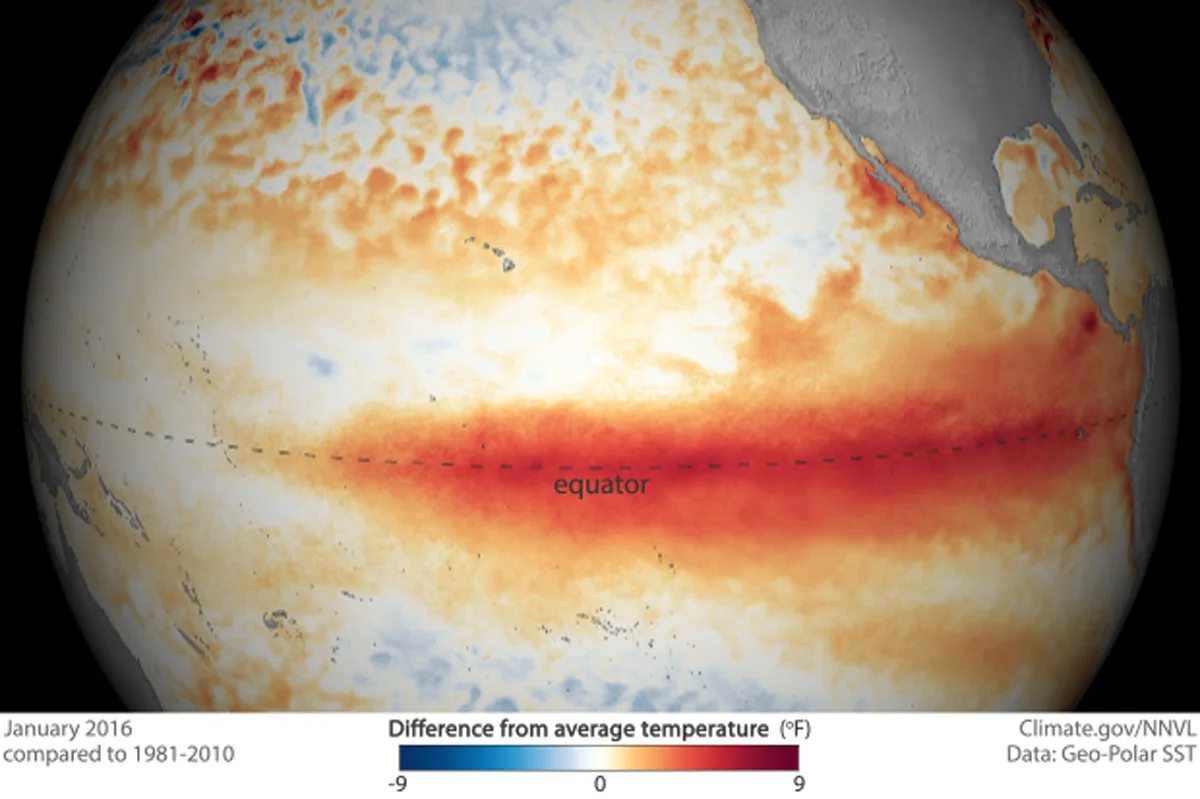
Map of tropical Pacific Ocean temperature anomalies from January 2016 shows this record El Niño still exerting its influence over the world. Credit: Climate.gov
While those contributions indicate El Niño's influence over annual temperatures for both years, the event had its most intense impact during the period of October 2015 to February 2016.
NOAA's Oceanic Niño Index (ONI), which logs the average sea surface temperature across the central tropical Pacific Ocean, had a value of +2.6°C from November 2015 to January 2016 (the highest it has ever reached). In December 2015 to February 2016, it was still at +2.5°C. Without that influence, Winter 2015-2016 would have been far cooler, and likely nowhere near the +1.12°C above normal value for December 2019-February 2020.
RELATED: CORONAVIRUS LOCKDOWNS ARE HAVING A SERIOUS EFFECT ON EMISSIONS
ALREADY OMINOUS
It is still early in 2020, at the moment. There is a lot that could happen with global temperatures, as the year progresses.
Be that as it may, global temperature averages, so far for this year, are already setting a rather alarming trend.
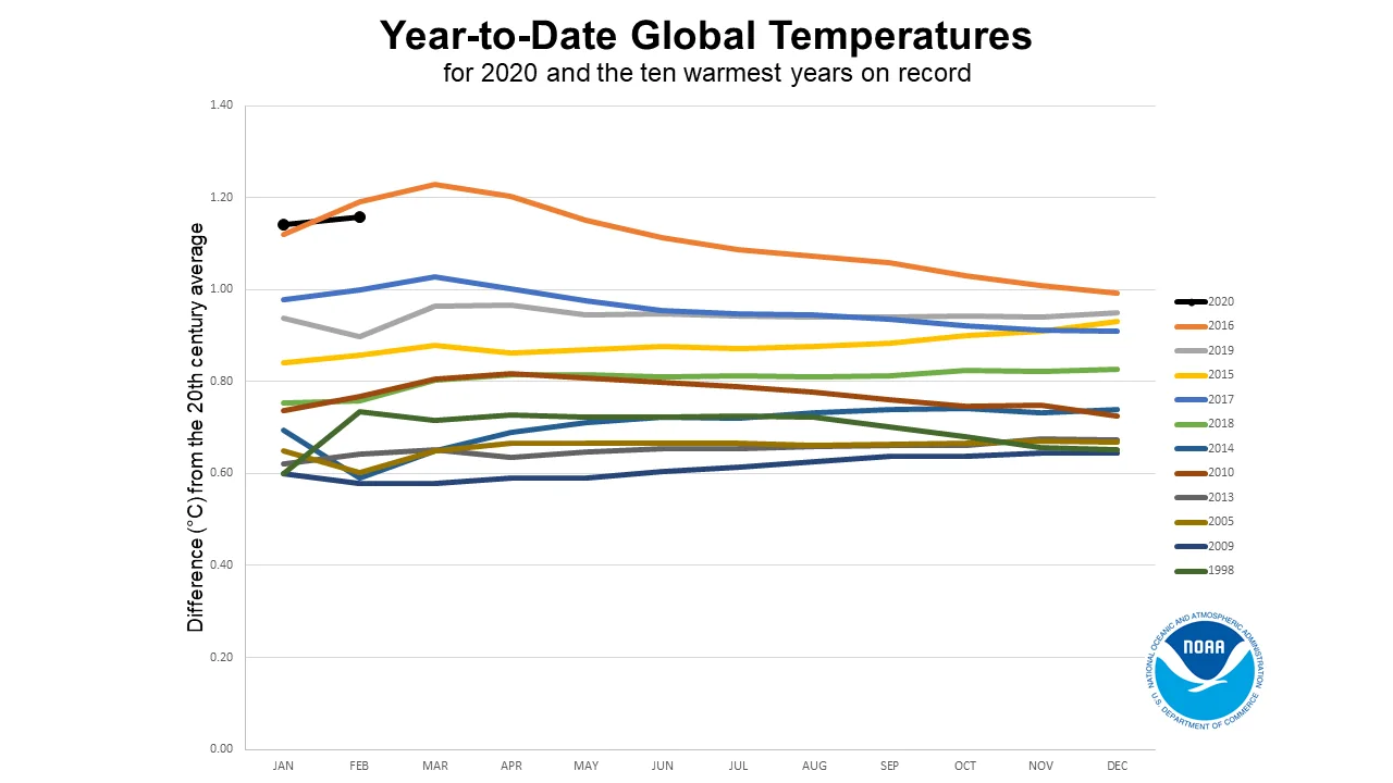
The 2020 'horserace' graph of temperature anomaly running averages tracks the temperature trends of the year compared to the 10 previous hottest years. Credit: NOAA
This graph is NOAA's 'horserace' graph of temperature anomalies, up to February 2020. Each line represents a running average. Thus, the January value is only the January global temperature anomaly. The February value is the average of the January and February global temperature anomalies, the March value will be the average of the January, February and March global temperature anomalies, and so on. The results provide an excellent tool for making predictions. For example, just by looking at this one graph, even by November of 2019, it was becoming clear that the year would be one of the top three hottest on record.
2020 is starting off far warmer than 2019 did, running neck-and-neck with 2016, and without an El Niño pattern in the Pacific. There is still time for global temperature anomalies to cool, and bring that running average down. Still, we will have to observe this trend carefully throughout the year.
Thumbnail image courtesy Climate Reanalyzer
Credit: NOAA | NASA | RealClimate