Navigating the challenges and opportunities of water management in dense cities

In his episode of Climate Refuge, The Weather Network meteorologist Mark Robinson examines how we build cities in relation to nature, what mistakes we have made in the past, and how we are building the neighbourhoods of tomorrow. He talks to Christopher Glaisek, chief planning and design officer of the Port Lands Project.
Rome wasn’t built in a day, and our own cities can’t be rebuilt in that same time period either. However, if it’s a community in the Great Lakes region, that’s what might need to happen.
As climate change begins to truly bite, the Great Lakes area is beginning to look like a viable place to become a refuge for people who are looking for a stable and prosperous region to live in. Tens of thousands, if not millions, of people will be heading into the region as their present living conditions become more and more unstable. This migration is not simple, nor will it come without costs. Planning and building for this migration must happen now instead of scrambling to accommodate those people after they arrive.
One of the most critical aspects of this planning is how we grow the cities in the region in order to both provide a viable living space for new residents while not destroying that which makes this area such a draw: the lakes themselves.

As climate change hits harder, the Great Lakes region is emerging as a potential haven for those seeking a secure and thriving community.
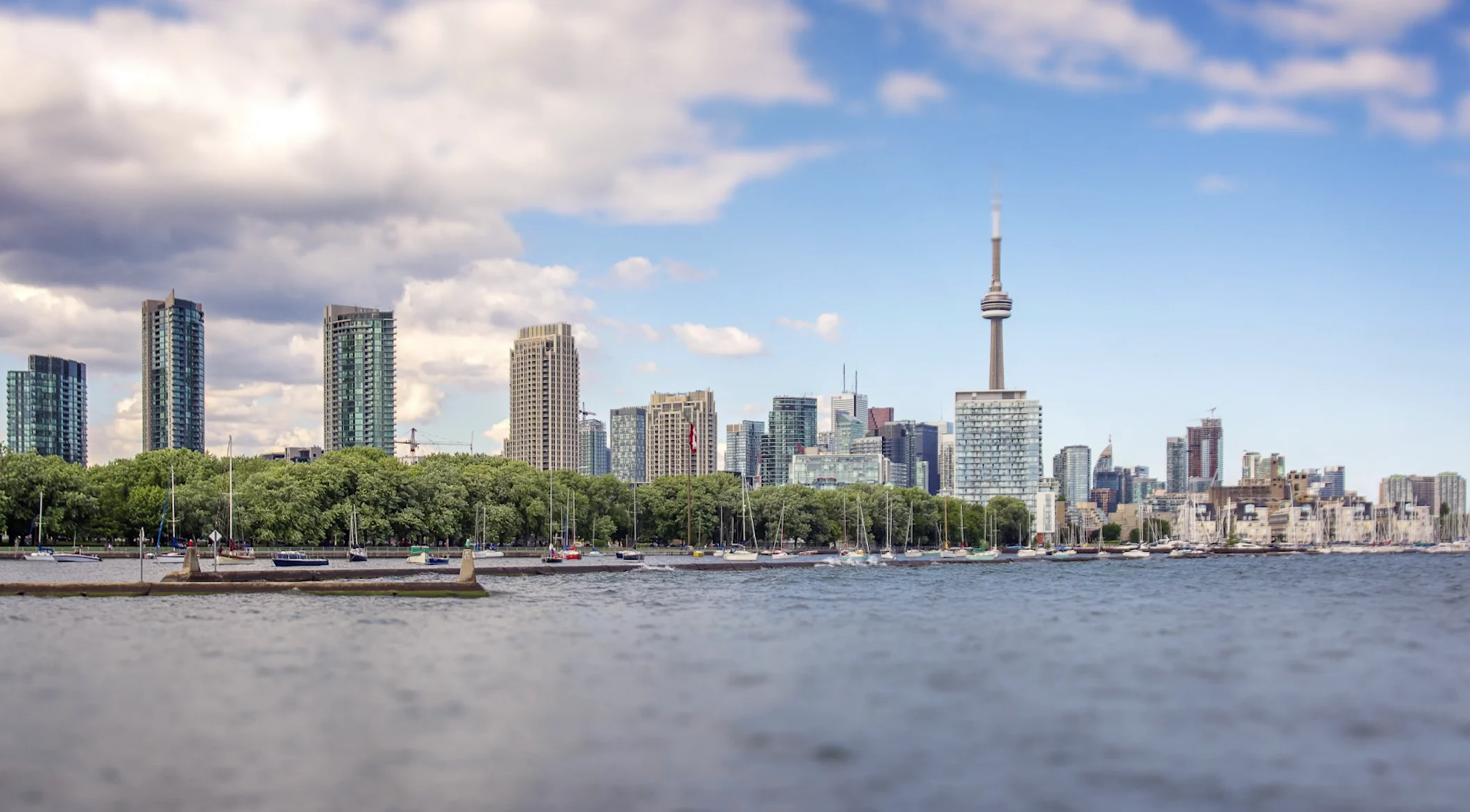
In the past, city planning was taken more as “let’s control nature” as opposed to trying to work with the natural environment. One of the best examples of this is the Port Lands area in Toronto. When Europeans first arrived in the place that would become Toronto, they found a vast river delta and wetlands at the mouth of the Don River. This was seen as a useless, pestilential swamp, and they moved fast to fill it in and then build a bunch of factories on the “reclaimed” land.
This attitude has now been flipped on its head, and I wanted to see exactly how. At the same time, I wanted to understand how these types of projects contribute to preparing our cities for the influx of people.
I headed to the vast construction area that the Port Lands had become to meet up with one of the chief architects of the project, Chris Glaisek. The day was cold and the wind was biting, but Chris barely noticed the chill as he talked, a strong note of pride in his voice: “It’s got a long history. It started probably back in the 1970s, when the environmental movement was first getting started. A group of people got together to try and do something to improve the mouth of the Don River. So today, the Don flows through the Keating Channel, which was built around 1910 and has no habitat, no environmental advantages that the original river did.”
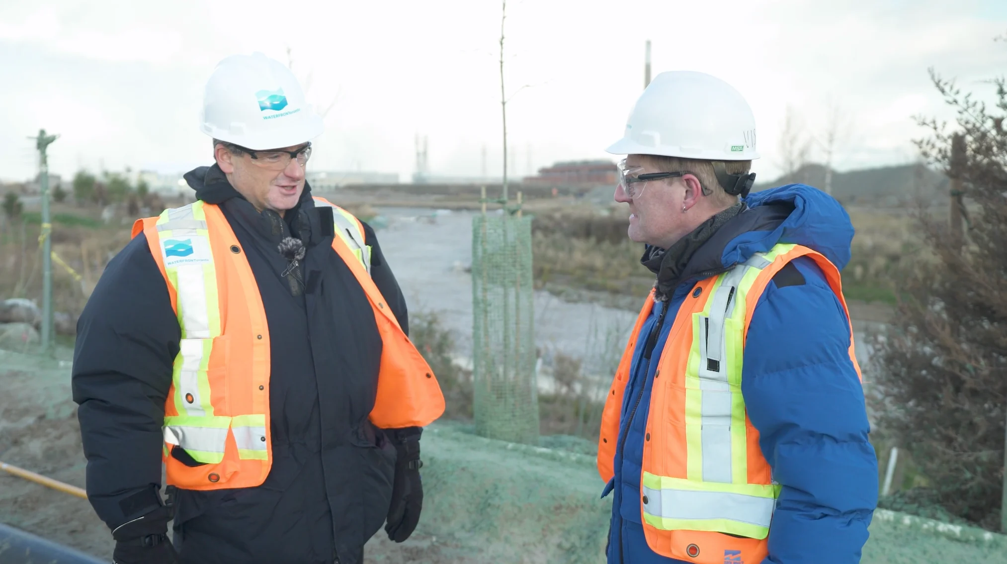
Chris Glaisek (left), seen here with Mark Robinson, is the chief planning and design officer for Waterfront Toronto, the tri-government body overseeing the Port Lands project. (The Weather Network)
The group, The Task Force to Bring Back the Don, created and grew awareness of how the original construction of the river diversion was creating major flood issues in the lower regions of the Don. They also pointed out the increased pollution in Lake Ontario thanks to the proliferation of heavy industry in the reclaimed areas. As those industries moved out, the land lay mostly abandoned, and this is where the Task Force stepped in.
“There hasn’t been too many instances where a river has been fully rerouted to put in into a fully naturalized, new river mouth, so we’re doing something you don’t see very often, and we’re doing it to foster urban development, so the river is going to be the heart of several new neighbourhoods.”
This is more important than it might seem, as these lands were not suitable for urban living as the potential for flooding was far too high for building homes or condos. This meant that the land lay abandoned, despite being so close to the heart of the city. Once the Don Lands Project got underway, the land was now open for the creation of new homes, helping to alleviate the housing shortage in Toronto.
This style of project, working with, instead of against, the ebb and flow of the natural world, gives urban planners insight into how to grow the cities of the Great Lakes region without overwhelming the environment that we depend on.
The project is still ongoing, so we don’t yet have a full understanding of how well everything will work. Despite the fact that the Great Lakes region is likely to be the least affected by climate change in the future, there will still be changes. Issues such as heavier downpours with summer thunderstorms and the lack of winter ice increasing erosion along the shorelines will test the limits of the Port Lands, but the data collected will help with future city growth projects.
Given the sheer scale of the housing crisis in just Toronto, nevermind all the other cities on the Lakes, the Don Lands is going to be just one small contribution to alleviating the problem. However, it’s one of the best examples anywhere of how to ensure growth without the shortsighted destruction of areas, like the Greenbelt, critical to the continued high standard of living Toronto enjoys.
The next question is: can we take these lessons to heart, and how do we grow our cities in order to maintain what we now have?