Satellites can 'see' the turbulence that your next flight may hit

Turbulence is sometimes impossible to predict. But there are tools available to make a bumpy flight less of a surprise
Turbulence is the bane of any nervous flier’s travels. A few bumps in the blue are unavoidable, but fly enough and you’ll eventually take a jostling you never forget.
Pilots do their best to provide a heads-up when rough skies lie ahead, but it’s not always possible to know in advance when rocky secrets lurk along a seemingly serene flight path.
There are plenty of ways a flight crew can steer clear of bumps before they turn into an uncomfortable journey. It turns out that satellites can even ‘see’ the turbulence we can’t.
DON’T MISS: Buckle up: Severe turbulence is on the rise. Here's why
Turbulence is (mostly) harmless
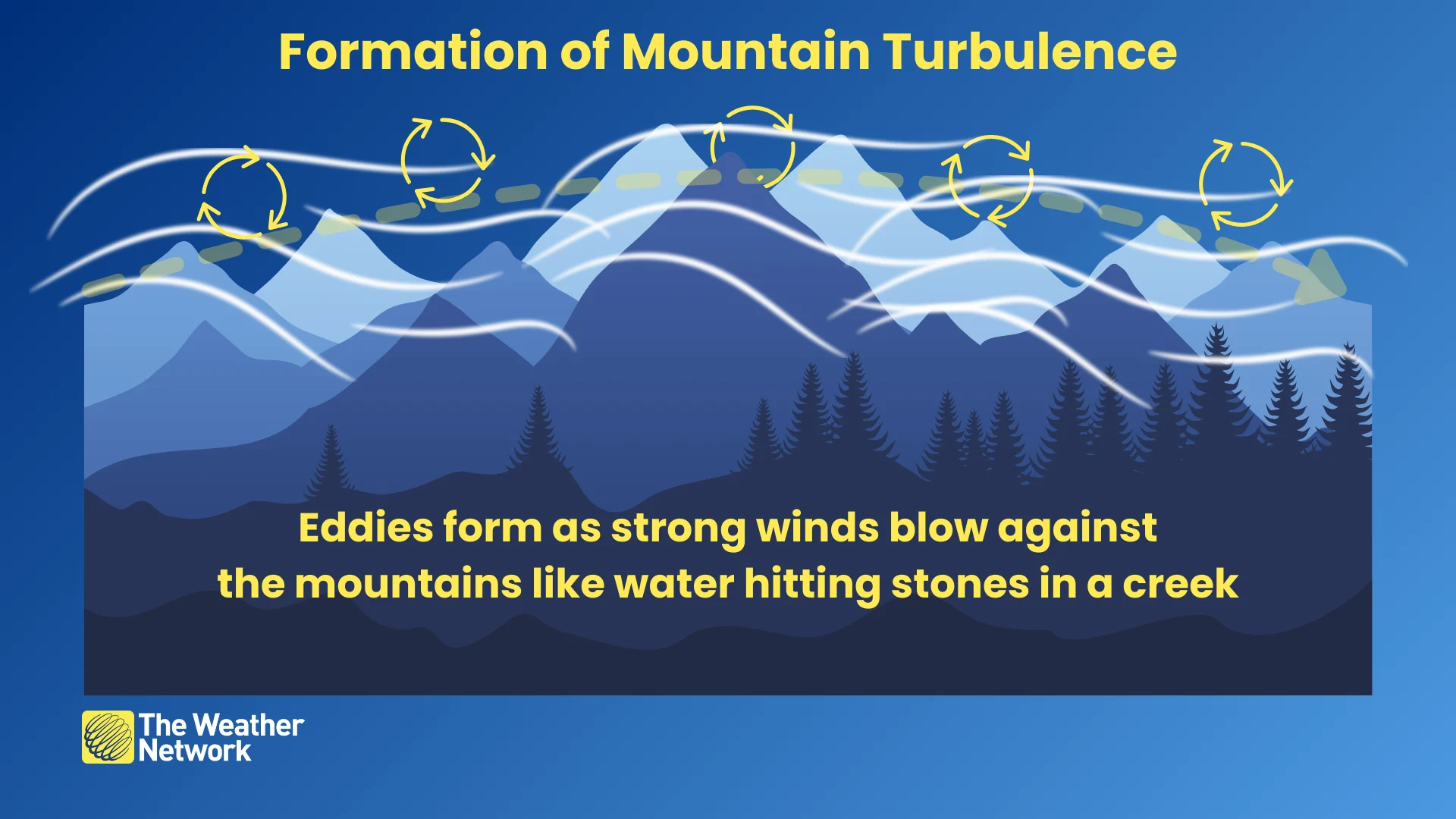
Modern jet aircraft fly at more than 500 km/h when they’re at cruising altitude. Hit a sudden wind shift or fly through the eddies of air tumbling over a mountain range and the choppiness will jolt the aircraft like hitting a pothole on a highway.
It’s easy to forget that most turbulence is harmless as long as you’re buckled in and nobody’s drink takes a tumble. Extreme turbulence can be dangerous. While planes are able to withstand a remarkable amount of choppy air, damage can occur if pilots don’t act to avoid these hazardous areas.
But even if a badly stricken aircraft is structurally sound all the way to landing, it’s exceptionally dangerous to have bags, phones, and galley carts bouncing around the cabin.
That’s where turbulence forecasting and avoidance come into play.
Meteorologists can predict conditions favourable for turbulence
Aviation forecasting is an entire industry within meteorology that focuses on keeping millions of people safe every day as they embark on commercial and private flights around the world.
“Turbulence is very difficult to forecast,” says Michael Carter, a meteorologist for The Weather Network. “The processes that create turbulence occur at scales much smaller than weather models can resolve,” he added.
MUST SEE: What is turbulence and how predictable is it?
Carter added that most of the turbulence we encounter on a daily basis is clear air turbulence, or the kind of choppy air that doesn’t leave any fingerprints on the surrounding clouds.
Given these limitations, much of turbulence forecasting comes down to using satellite, radar, and a practice called ‘nowcasting’—a term used for relying on current observations to avoid turbulence as it’s reported.
Satellites and radar can ‘see’ turbulence
One of the great aspects of satellites and radar is that they’re incredible tools for spotting more than just clouds and rain.
Weather satellites can sometimes ‘see’ turbulence that’s otherwise invisible to the naked eye. Water vapour imagery is a phenomenal tool meteorologists use to track moisture. This type of imagery also has a knack for pointing out turbulence in clear skies.

RELATED: Six annoying ways weather forces airlines to cancel your flight
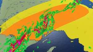
The above water vapour image from February 25, 2024, shows a remarkable pattern of turbulence downwind from Colorado’s Rocky Mountains.
A streak of winds blowing from west to east rose up and over the mountain range, creating a long series of ripples in the clear blue that were only visible by looking at moisture patterns in the region. Each of those ripples carried the potential for a bumpy flight over Colorado.

Visible and infrared satellite imagery can also spot patterns within the clouds that may indicate turbulence. The above satellite picture shows "transverse banding" in the clouds over the eastern Great Lakes region. These rumble-strip-like features often result from areas of turbulence.
Doppler radar imagery can also spot undulating wave patterns in clear skies that we can’t see with the naked eye.
When all else fails, learn from others before you
Sometimes a pilot doesn’t even have to spot the turbulence in advance—they just have to take advice from other flights that flew ahead of them. Pilots usually let air traffic control know when they’ve hit moderate to severe turbulence along their routes.
Controllers relay this information to other pilots so they’re aware of what lies ahead. Much of the information is released to the public in real time, allowing anyone to track reports of bad turbulence around the world.
The U.S. National Weather Service’s Aviation Weather Center offers robust tracking and map products that compiles turbulence reports for locations across North America and around the world.
Environment and Climate Change Canada covers turbulence as part of its aviation forecasting efforts. NavCanada’s flight planning website for pilots compiles turbulence reports throughout the country.
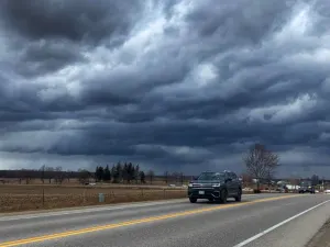
Header image created using imagery from Canva.