How an explosive thunderstorm can burst into the stratosphere

Sometimes there's nothing that can stop a powerful thunderstorm as it towers into the heavens, leading to some of the most striking sights nature can provide
Watching a sculpted thunderstorm bubble on the horizon is one of the most satisfying pleasures of summertime weather. The storms' billowing clouds shove through the muggy air as they lurch skyward and seemingly scrape the edge of space.
These healthy storms eventually stop growing once they hit the top of the troposphere—the layer of the atmosphere in which we live—covering the afternoon sky in a beautiful anvil cloud that spreads out like a blanket.
DON’T MISS: Heads up! These six special clouds linger in our skies every day
But some thunderstorms are so powerful that they can actually burst above this ceiling and push into the stratosphere, climbing higher than the cruising altitude of a passenger jet.
A tall thunderstorm reaching the stratosphere is a bold expression of nature’s power, and these towering masses are a common sight around Canada during the heart of the summer.
Anvils are a sight to see
Every formidable thunderstorm begins with a single column of rising air. This updraft is fuelled by the temperature difference between warm air near the ground and cold air aloft.
Warmer air is less dense than colder air, giving it buoyancy—kind of like a bubble rising to the surface of a lake. This air will continue to rise as long as it’s warmer and less dense than the air around it.
Eventually, though, the rising air will cool off enough that it matches the frigid temperatures of the upper atmosphere.

A thunderstorm with an anvil cloud near Brampton, Ontario, in June 2023. (Photo courtesy of Jarrett T.)
MUST SEE: Super-cold thunderstorm sets record with -111°C cloud temperature
The point where an updraft cools down enough that it stops rising is about 10 to 12 km above the surface, usually the level that also separates our troposphere from the stratosphere above. Rising air runs into this equilibrium level like it’s a ceiling, spreading out before sinking back toward the ground.
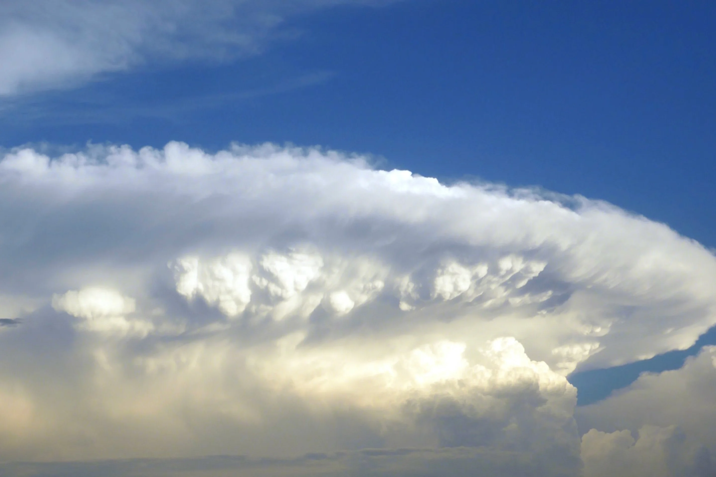
Some of the moisture in that rising air condenses as it spreads out against this invisible ceiling high in the atmosphere, leaving behind a thin, flat formation called a cumulonimbus incus—more commonly known as an anvil cloud. These flat clouds earned their nickname because they make the entire storm look like a blacksmith’s anvil.
Anvils commonly fill the skies on a stormy day, sometimes stretching for dozens of kilometres around a single storm. It’s these formations that often lend a thunderstorm its classic shape as it looms over the horizon, even casting lengthy shadows if they happen around sunrise or sunset.
WATCH: A thunderstorm towering over Barcelona develops a gorgeous anvil cloud
It takes extreme instability to breach the stratosphere
Some thunderstorms grow so strong that their raging updrafts blow past the equilibrium level and jut into the stratosphere.
Updrafts grow more vigorous with greater temperature differences between the lower levels and higher levels. If there’s a really sharp temperature gradient, this extreme instability can allow updrafts to rise very quickly—sometimes blowing upward at a rate of 100+ km/h.
RELATED: Tonga volcano eruption was so violent it blew ash halfway to space
When an updraft is howling into the heavens at highway speeds, plowing into the equilibrium level sometimes isn’t enough to slow it down. Some of the air does spread out and create an anvil cloud when it reaches this point, but the core of the speedy updraft can easily blow into the stratosphere.
The cumulonimbus clouds that reach above an anvil and into the stratosphere are aptly called overshooting tops. The combination of an overshooting top and anvil cloud creates the ‘classic’ view of a thunderstorm that’s in just about every textbook and stock image.
Powerful updrafts can support powerful hazards
A picturesque thunderstorm roiling away on the summertime horizon is an awe-inspiring testament to the power of our natural world. But a storm intense enough to break into the stratosphere is also a solid warning that rough conditions might not be far off.
Overshooting tops are a pretty good sign that severe weather is likely as that thunderstorm passes overhead. It takes a powerful updraft to support large hail, and the strongest among them can generate hail the size of baseballs or larger.

Overshooting tops in the western Pacific's Typhoon Kammuri in November 2019. (Image courtesy of NOAA/CIMSS/UW-Madison.)
Very strong wind gusts are common in these intense thunderstorms, especially if that updraft suddenly weakens and the storm begins to collapse. Tornadoes are also a hazard if the storm begins to rotate.
Meteorologists even look for overshooting tops in the thunderstorms within a hurricane's eyewall, where they can serve as a red flag that a hurricane is on the cusp of rapid intensification.
The updrafts that create overshooting tops in a strengthening hurricane are sometimes so intense that they generate gravity waves that undulate through the clouds like ripples on a still pond.
Thumbnail image courtesy of NOAA.


