CAPE is the potent fuel that powers a thriving thunderstorm

A mighty thunderstorm requires a powerful updraft in order to rage across the horizon. Here’s a look at how we measure a storm’s potential using instability.
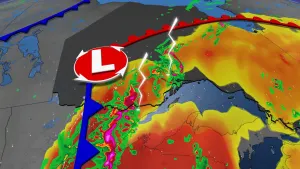
Few forces can show off nature’s awe-inspiring power quite like a raging thunderstorm. But even the mightiest storm that towers to the edge of the atmosphere begins life as an unassuming cloud.
It takes an immense amount of rising air to create these fierce storms. Meteorologists measure the instability that fuels a growing storm using a value called CAPE.
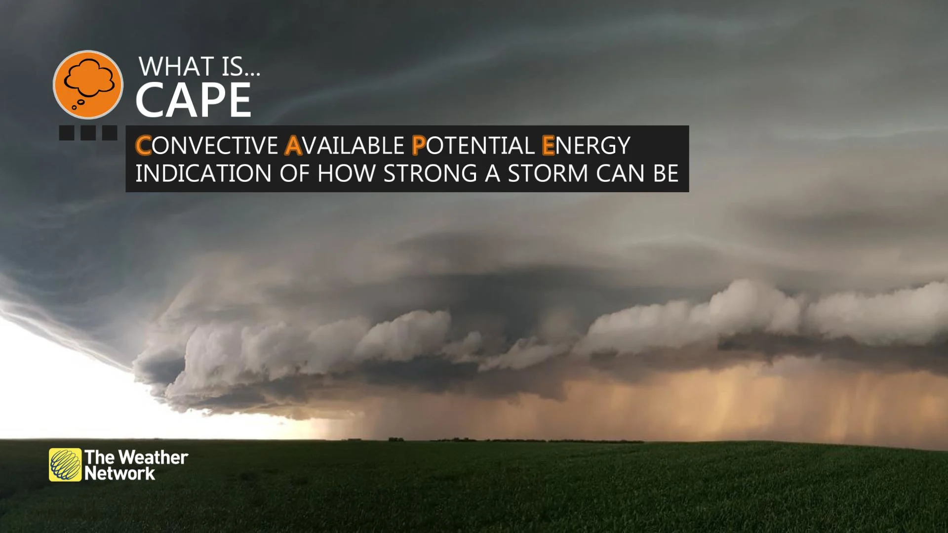
CAPE is a measure of instability
CAPE stands for Convective Available Potential Energy, a measure of the amount of instability present in the atmosphere. The metric is also sometimes called “thunderstorm energy” on weather maps.
READ MORE: Why nocturnal thunderstorms can be particularly dangerous
We measure CAPE using joules per kilogram (j/kg)—the precise units don’t really matter, though. What we really care about is how high or low the CAPE is at any given location.
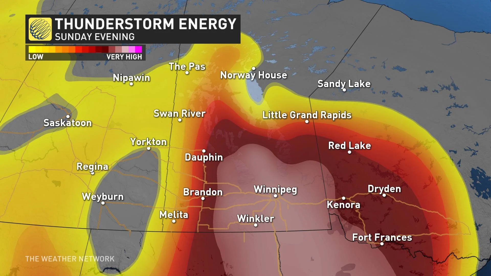
Higher CAPE values indicate higher instability that can fuel stronger thunderstorms.
What sparks a storm
A storm needs moisture, instability, and a trigger in order to form. Triggers are usually boundaries like cold fronts, lake breezes, troughs, and even the “urban heat island” effect of hot city centres.
While triggers set a storm into motion, instability is the bread and butter of a thunderstorm’s existence.
On a typical sunny day, temperatures are warm near the surface and steadily cool with height. A trigger such as a lake breeze can nudge that low-lying warm air skyward, allowing it to rise through the cooler air thousands of metres above the surface.
STAY PREPARED: Essential items for your emergency "grab-and-go" kit
The temperature difference between air at the surface and air high in the atmosphere determines how much instability is present.
A sharper temperature gradient between lower altitudes and higher altitudes creates more instability, allowing air to rise faster and faster as it climbs several kilometres into the atmosphere.
Weather models and weather balloon observations give meteorologists a great idea of how much instability is available for thunderstorms to work with, which can tell forecasters how strong those storms could grow.
As a general rule of thumb, lower CAPE values result in showers and weak thunderstorms, while very high CAPE values can support supercells that generate large hail, destructive winds, and even tornadoes.
High instability doesn’t always generate an explosive storm
There are some caveats, of course.
“Potential” is the key word in “Convective Available Potential Energy.” We often see unstable days with mammoth CAPE values fail to produce any thunderstorms at all. There are a few culprits behind a high-CAPE day that fails to deliver any raucous thunderstorms.
READ MORE: How hot water fuels the world’s most powerful hurricanes
Capping frequently thwarts any storms that attempt to form. A cap is a temperature inversion, or a layer of warmer air sandwiched between layers of colder air aloft. This warm air can act like a ceiling—or a cap—that stops rising air in its tracks.
Vivacious thunderstorms can result from rising air breaking through a weak cap. However, a strong cap can turn a once-promising thunderstorm risk into little more than a partly cloudy day.
Caps are often the reason you’ll hear meteorologists talk about a “conditional” risk for thunderstorms. Some days will see a trigger strong enough to break through the cap and allow storms to blossom. But sometimes there’s just enough of a lid on the atmosphere to keep a check on even the most unstable environment.
Thumbnail courtesy of Unsplash.