Tropical systems don’t need a name to trigger devastating floods

The intense focus on named systems during hurricane season often covers up the dire threat posed by unnamed disturbances rolling ashore
Hurricane season is a dangerous time to live along the coast. Historic storms can bubble on the horizon any time during that long stretch of the year.
But sometimes it’s the storms that never earn a name that leave the biggest mark.
Beware the unnamed tropical disturbances if you’re heading to sunny destinations for summer vacation or a fall getaway.
Check out The Weather Network’s hurricane hub page for all the latest news and information you need throughout the season.
Names wrongfully take the focus
Meteorologists began naming tropical storms in the 1950s to make it easier to keep track of these systems as they swirled across the ocean. Forecasters formalized our current naming system in the 1970s as a way to easily convey forecasts and warnings to the public.
MUST SEE: A hurricane in Louisiana is a threat that keeps meteorologists awake at night
For all the benefits of naming tropical systems, the practice’s glaring downside is that many folks tend to tune out any threat that doesn’t have a name attached to it.
Hurricane Katrina is a household name. But an unnamed disturbance that brought immense flooding to Louisiana in 2016 barely registered outside communities that were inundated beneath raging waters.
WATCH: Don't forget these important items in your emergency kit
Disturbances are unnamed hazards
A tropical disturbance is an area of unsettled weather that originates in the tropics. Disturbances are often the seeds that grow into full-fledged tropical storms and hurricanes.
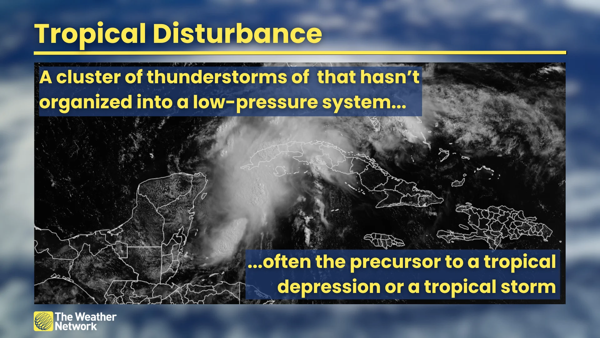
We see regular disturbances move across the Caribbean, Central America, and the southern U.S. during hurricane season, some of which grow quite potent without ever organizing into a named tropical storm.
Even though these disturbances never quite get their act together, they can still pack a punch for communities in the path of their drenching thunderstorms—especially if the disturbance is a slow mover.
DON’T MISS: How hot water fuels the world’s most powerful hurricanes
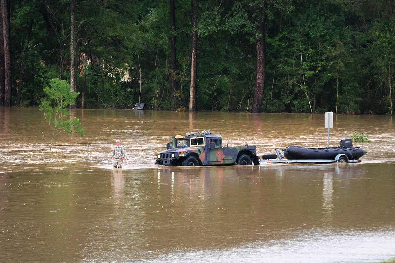
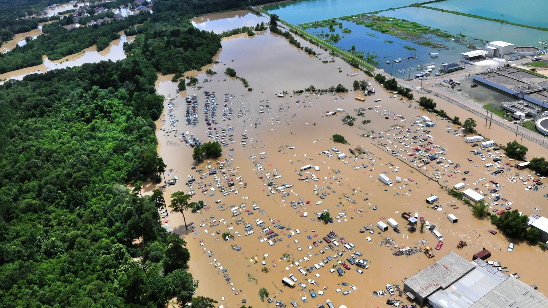
(Flooding in Baton Rouge, Louisiana, in August 2016. Photo courtesy of the U.S. Dept. of Agriculture via Flickr.)
That unnamed disturbance that drenched southern Louisiana in 2016 dropped more than 780 mm of rain over just a couple of days, unleashing horrendous flash floods that required thousands of rescues and severed entire communities from the outside world until the waters receded.
Back in 2022, a disturbance dropped 388 mm of rain near Miami, Florida, as it tracked across the southern tip of the state. That trough didn’t become Tropical Storm Alex until a day later later when it was over the open Atlantic Ocean, far away from land.
Staying safe
Freshwater flooding from heavy rain is the deadliest single aspect of any landfalling tropical system—named or not.
The best way to prepare for flooding rain is to have a plan in place before storm clouds ever darken the skies. Evacuation plans, alternate travel routes, and emergency kits are a necessity ahead of any disaster.
SEE ALSO: Get ahead of disaster: Six tips to manage flooding
If you're on vacation in destinations like the Caribbean or Gulf Coast, keep up with the latest weather forecasts, watches and warnings, and be ready to take shelter or move locations if severe storms or flooding rains threaten your location.
And always remember: Never try to drive across a flooded roadway. It's impossible to tell how deep the water is until it's too late, and sometimes the road is washed out beneath the floodwaters. It only takes 15-20 cm of moving water to lift a vehicle and carry it downstream.
Header image courtesy of the U.S. Dept. of Agriculture via Flickr.