NOAA's brand new weather satellite shares striking views of Earth from space

GOES-18 is on the fast-track to providing next-gen weather coverage across the western half of North America.
A new advanced weather satellite, freshly settled into its new home in geostationary orbit, is treating us to spectacular views of our planet from its vantage point in space.
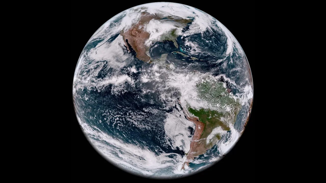
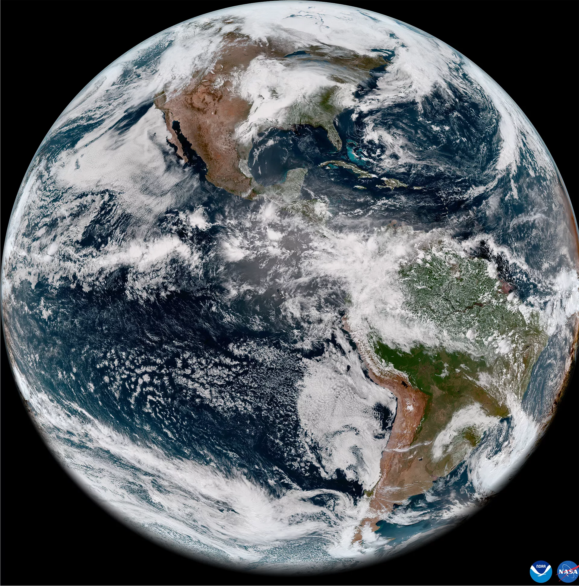
This 'full disk' image of Earth was captured by GOES-18 on May 5, 2022. Link to embiggen. Credit: NOAA/NASA
Launched in March of this year, GOES-18 is the third of NOAA's next-gen, 21st-century Geostationary Operational Environmental Satellites.
Starting with GOES-16 and following up with the launch of GOES-17, tracking weather across the western hemisphere received a significant upgrade.
According to NOAA, the primary camera on these satellites, the Advanced Baseline Imager or ABI, "collects three times more data and provides four times better resolution and more than five times faster coverage than previous GOES."
Simply put, compared to the previous 15 GOES satellites, these delivered the highest resolution images of our weather ever, and at multiple wavelengths across the electromagnetic spectrum to get the most out of what we were seeing. They also provided those images faster than we ever received them before, sometimes as quickly as every 30-60 seconds, to closely monitor severe weather.
Watch below: NOAA's next-gen weather satellites carry us into the 21st century
In total, NOAA planned for four of these advanced weather satellites to be launched into space. Experience has taught them that these satellites can fail — sometimes temporarily and other times permanently. Thus, GOES-18 and the upcoming GOES-T (to be renamed GOES-19 after launch) were meant as backups, which would stand by in orbit to step in should they be needed.
However, GOES-18 is due for an early promotion.

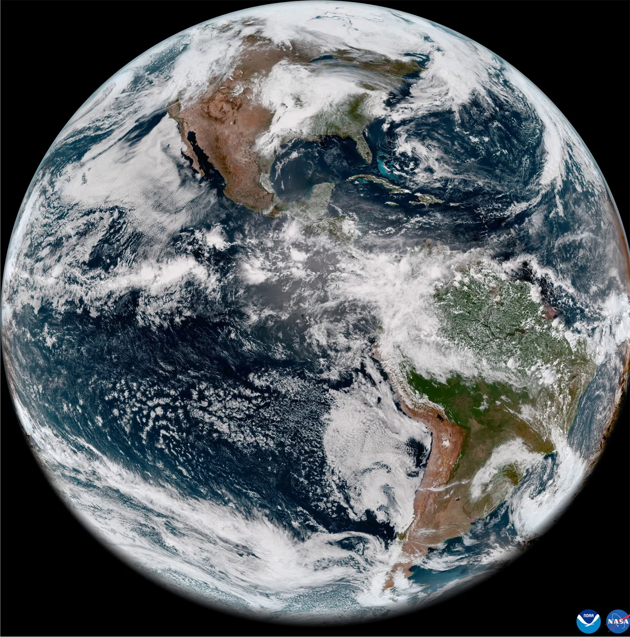
Multi-spectrum views of North American weather from May 5, 2022, as imaged by GOES-18. Credit: NOAA/NASA
Shortly after GOES-17 launched, NOAA noticed that its camera wasn't working properly. Due to a malfunction with the camera's cooling system, infrared images captured by the satellite were being polluted by excess heat.
Infrared satellite images are vital for weather monitoring and forecasting. They are the primary method of tracking clouds and weather systems at night. They also provide a range of crucial data, such as the amount of water vapour in the atmosphere. The above multi-panel image shows all 16 'channels' of the Advanced Baseline Imager. Only the first two, top left, are visible light images. Infrared imagery is so important that they take up the other 14 channels of data collected by the ABI.
So, rather than taking up a backup position, GOES-18 is now expected to take GOES-17's place. NOAA says "GOES-18 will assist GOES-17 with GOES West operations in late summer 2022 and again in early fall. NOAA plans for GOES-18 to replace GOES-17 as GOES West in early 2023."


