Spring 2019: Furious winter finish, strong start to spring

The details on how this temperamental season will play out for your part of Canada
(Visit our Complete Guide to Spring 2019 for an in depth look at the Spring Forecast, tips to plan for it and much more.)
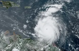
A furious finish to winter is expected east of the Rockies with some wild winter weather through early March. The map below shows the pattern that we expect during early March.
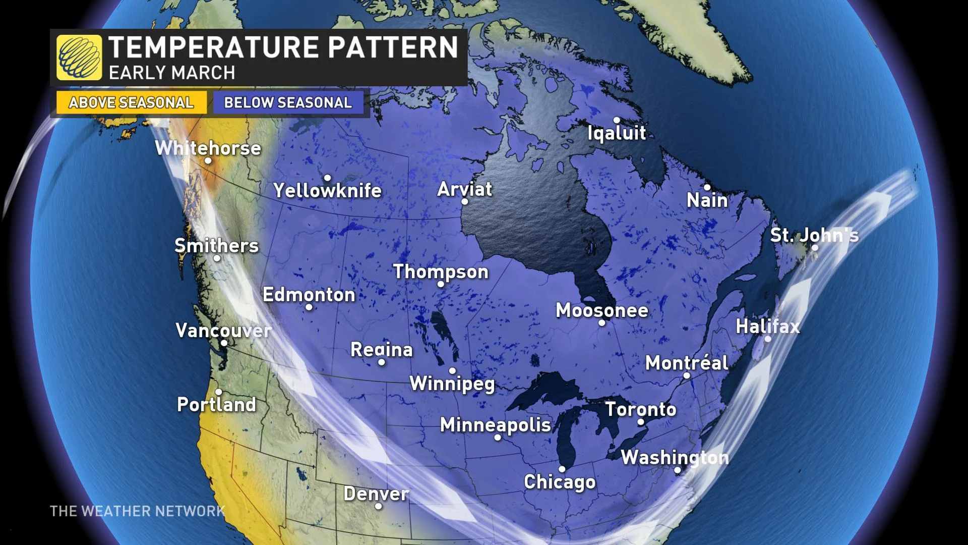
For most of Canada this is continuation of the frigid and active pattern that has dominated February with a couple of exceptions. For southern Ontario we will see more consistency in the cold pattern, while B.C. will see the frigid pattern relax with temperatures closer to seasonal.
However, during mid-March we expect a national pattern change which will feature a quick transition from winter to spring weather. The map below shows the pattern that we expect to dominate during the second half of March and into early April.

This is a sharp contrast to what we saw during the same time last year when much colder than normal temperatures dominated late March and April from Alberta to Atlantic Canada.
SPRING TEMPERATURE PATTERN
However, it won’t be clear sailing all the way until summer. It is important to remember that spring is a tumultuous season, and this year will be not be an exception. We will still have some chilly interruptions to the warmer pattern well into April and May.
The map below shows the temperature pattern that we expect for the spring season as a whole.

Near normal or above normal temperatures are expected to dominate across most of the country -- a welcome contrast to the second half of winter.
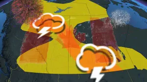
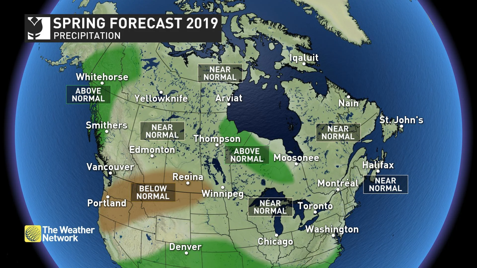
SPRING PRECIPITATION PATTERN
We expect near normal precipitation across most of Canada, but above normal precipitation is expected for parts of northern Ontario and Manitoba and from the central coast of B.C. to the Yukon. We are also watching the risk for drier than normal conditions across parts of the southern Prairies.
We expect fewer than normal storms across Canada this spring, but a few of the storms will tap into subtropical moisture and bring substantial rainfall totals. This will result in seasonal totals that are close to normal.
Flooding is also a major concern this spring for many regions of the country where we will have well above normal amounts of snow on the ground when the pattern reversal occurs. The cold pattern during early March will allow the snowpack to continue to increase at a time when normal temperatures are climbing above freezing. Rapid snow melt will then occur when we shift to above normal temperatures.
For more regional details on our forecast for March, April, and May for each region of the country, please read on.
BRITISH COLUMBIA
After a frigid and snowy February, a milder and gentler pattern will finally arrive as we head into March. Above seasonal temperatures are expected to dominate during the spring, but it will definitely not be smooth sailing all the way to summer as periods of cooler and unsettled weather will still occur at times. During the periods of warmer and wet weather we will have a heightened threat for spring flooding. On the flip side, though, the abundance of snow from the winter will allow for some excellent spring skiing.
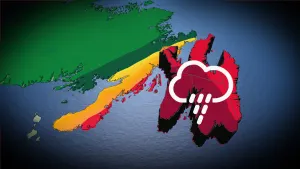
FORECAST FOCUS: 'HARD TO BELIEVE' B.C. SPRING
THE PRAIRIES
A rather wintry pattern will continue through early March, but a remarkable pattern change will finally bring some long-awaited relief during mid to late March. Unfortunately, this will also bring the risk for spring flooding across the regions where there is deeper than normal snow cover (especially near and north of the Yellowhead Highway). However, the Prairies are notorious for their wild swings in weather, and this spring should solidify that reputation. After a period of warmer spring weather, we will still have to watch the threat for shots of colder, wintry weather through the season.
FORECAST FOCUS: 'ABRUPT ARRIVAL' FOR PRAIRIE SPRING
ONTARIO AND QUEBEC
Early March will feature weather more typical of January, but a pattern reversal is expected during mid-March with an extended period of warmer spring weather for the second half of March and into early April. This will bring a heightened threat for spring flooding, especially across northern Ontario and the Ottawa Valley where the snow depth going into spring will be well above normal. This extended period of warmer spring weather will be a welcome contrast to last year which featured one of the coldest Aprils on record. However, after a strong start, spring will struggle at times with significant shots of colder weather that will interrupt the mild pattern later in April and into May.
FORECAST FOCUS: ONTARIO, QUEBEC SPRING 'QUITE PLEASANT'
ATLANTIC CANADA
As is often the case, the first half of March will bring significant winter weather with the threat for winter storms. The rest of the season will bring back and forth swings in the temperatures which should come close to offsetting each other during April and May. Overall, we expect fewer storms than normal, but near normal total precipitation as a few of the storms will tap into subtropical moisture and bring heavy rainfall. This will also heighten the threat for flooding, especially across regions that have deeper than normal snow cover heading into spring.
FORECAST FOCUS: THE RISK FOR FLOODING IN ATLANTIC CANADA
NORTHERN CANADA
Above normal temperatures are expected across the Yukon and the western half of the Northwest Territories. Near normal temperatures are expected across the rest of the region, including the eastern half of the Northwest Territories and Nunavut. Above normal precipitation is expected across the Yukon and into adjacent parts of the Northwest Territories with near normal precipitation elsewhere.
SNEAK PEEK TO SUMMER
As we progress through the spring season, one of the keys to the summer forecast that we will be watching will be the progression of the weak El Niño event that was officially declared earlier in February. However, the impact of El Niño on the global weather pattern is typically weaker during the summer than it is during the winter and there are numerous other factors that that we will consider as we develop our final summer forecast.
At this point it looks like warmer than normal temperatures will dominate the summer across B.C. and Atlantic Canada. In between we will have a large region in which we expect near normal temperatures and embedded within that region we will have the potential for cooler than normal weather.
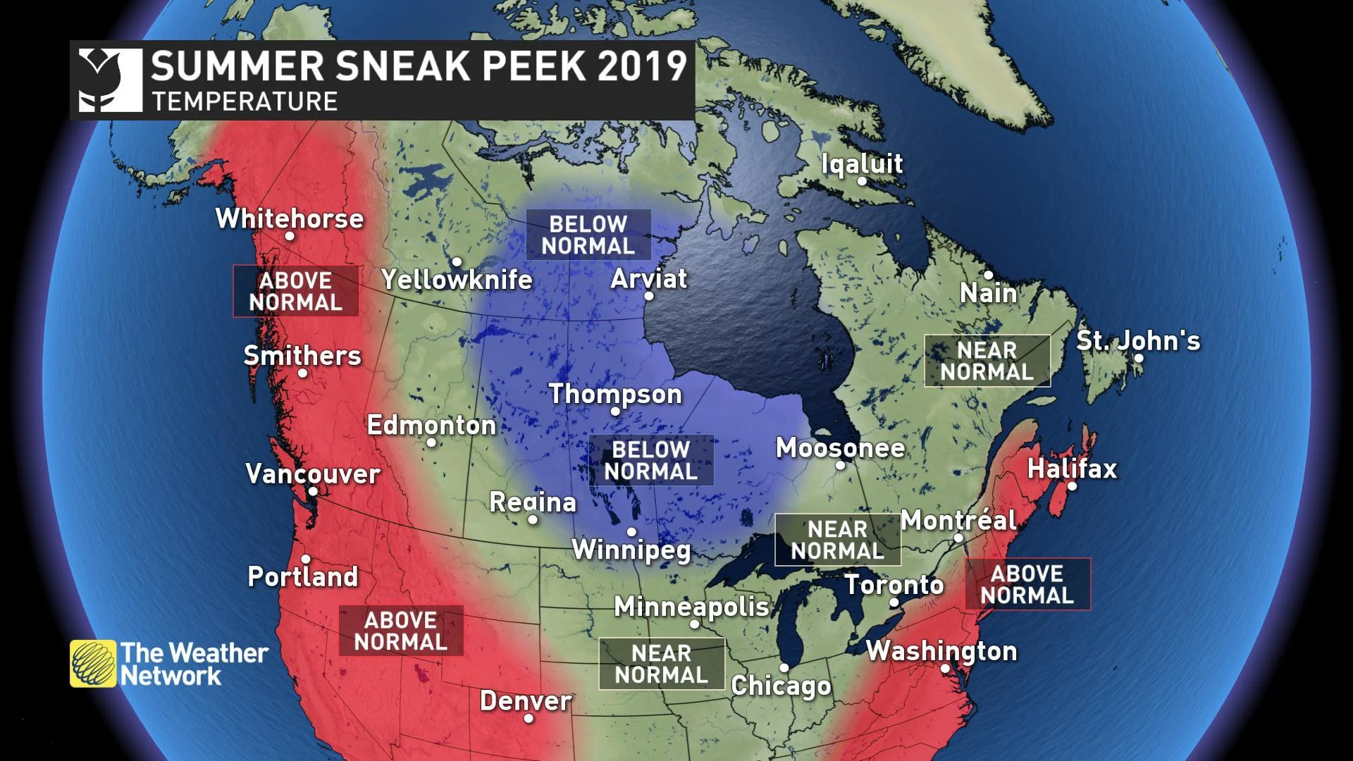
However, we are unsure as to whether this cooler weather will be centred across the Prairies or further east towards the Great Lakes. If El Niño remains weak, then the cooler weather will likely be further west with another warm to hot summer for southern Ontario and southern Quebec. Stronger El Niño conditions could result in the cooler weather shifting further to the east.