A hot, muggy week in Ontario and Quebec could break records

A hard pattern flip in the days ahead will crank up the heat for much of Ontario and Quebec
The week ahead will be a brutal reminder that the heart of summer is here and the heat is in charge across much of the country.
Folks across Ontario and Quebec will have to sweat it out for the first week of July as a large upper-level ridge parks itself over the region.
Soaring temperatures accented by stifling humidity will be the norm for much of the region, with a daily chance for afternoon thunderstorms providing some folks a temporary reprieve.
JULY OUTLOOK: A turbulent month promises smoke, storms, heat, and drought across Canada
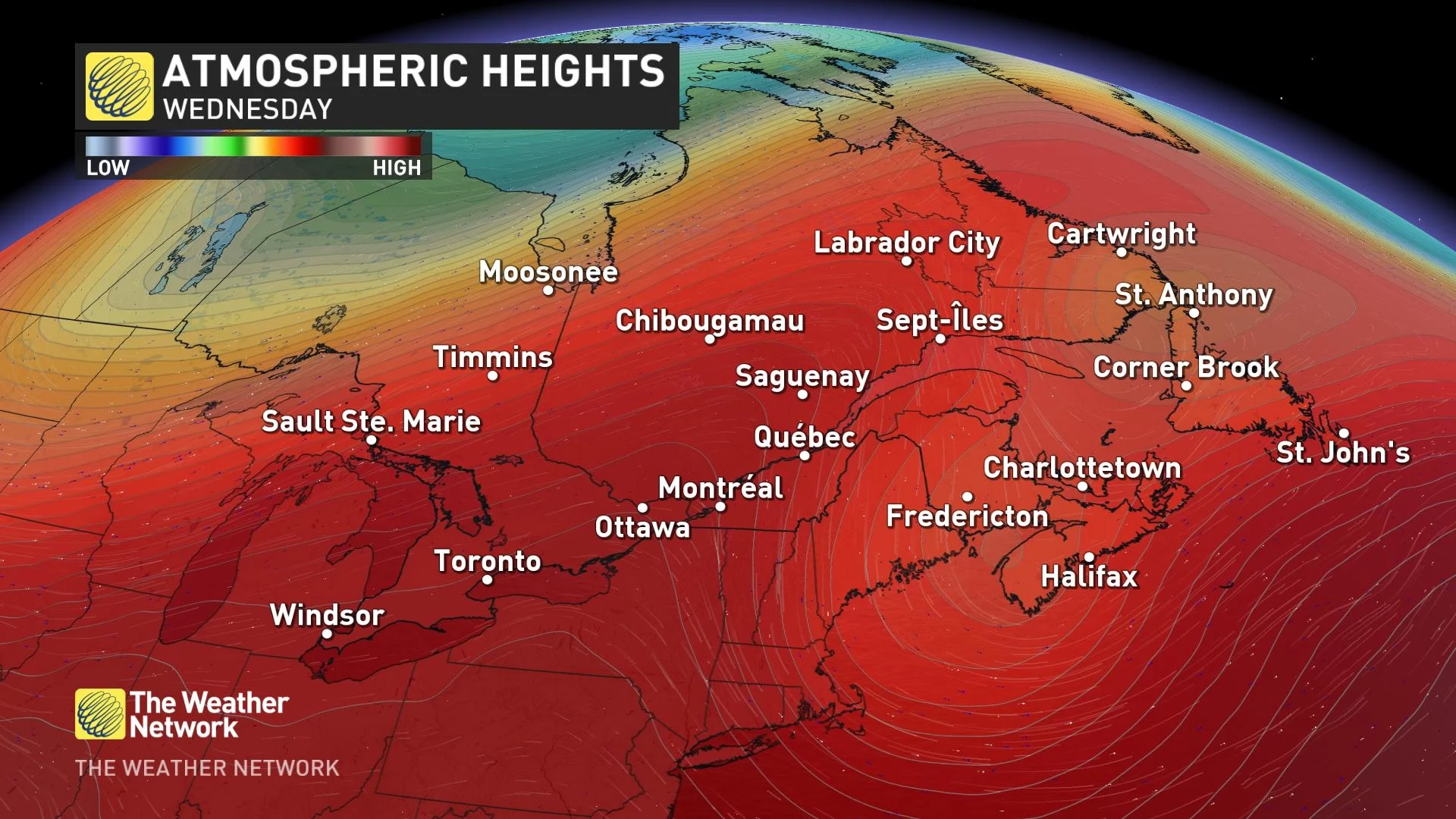
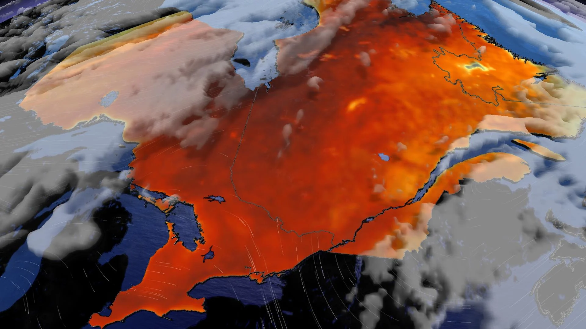
A volatile upper-level pattern building over North America will allow a sharp ridge of high pressure to build over Ontario and Quebec in the coming days, likely sticking around through the workweek.
Air tends to sink beneath an upper-level ridge, warming up as it descends toward the ground. This will turn up the heat for much of the region—possibly breaking all-time records across parts of the far north.

Kuujjuaq, Quebec, is a town of a few thousand in Quebec's Nunavik region, nestled along the Koksoak River a few dozen kilometres south of Ungava Bay.
The airport in Kuujjuaq typically records a temperature of about 16°C during the first few days of July.
Forecasters currently expect a toasty high temperature of 33°C on Tuesday, with a predicted humidex value of 35.
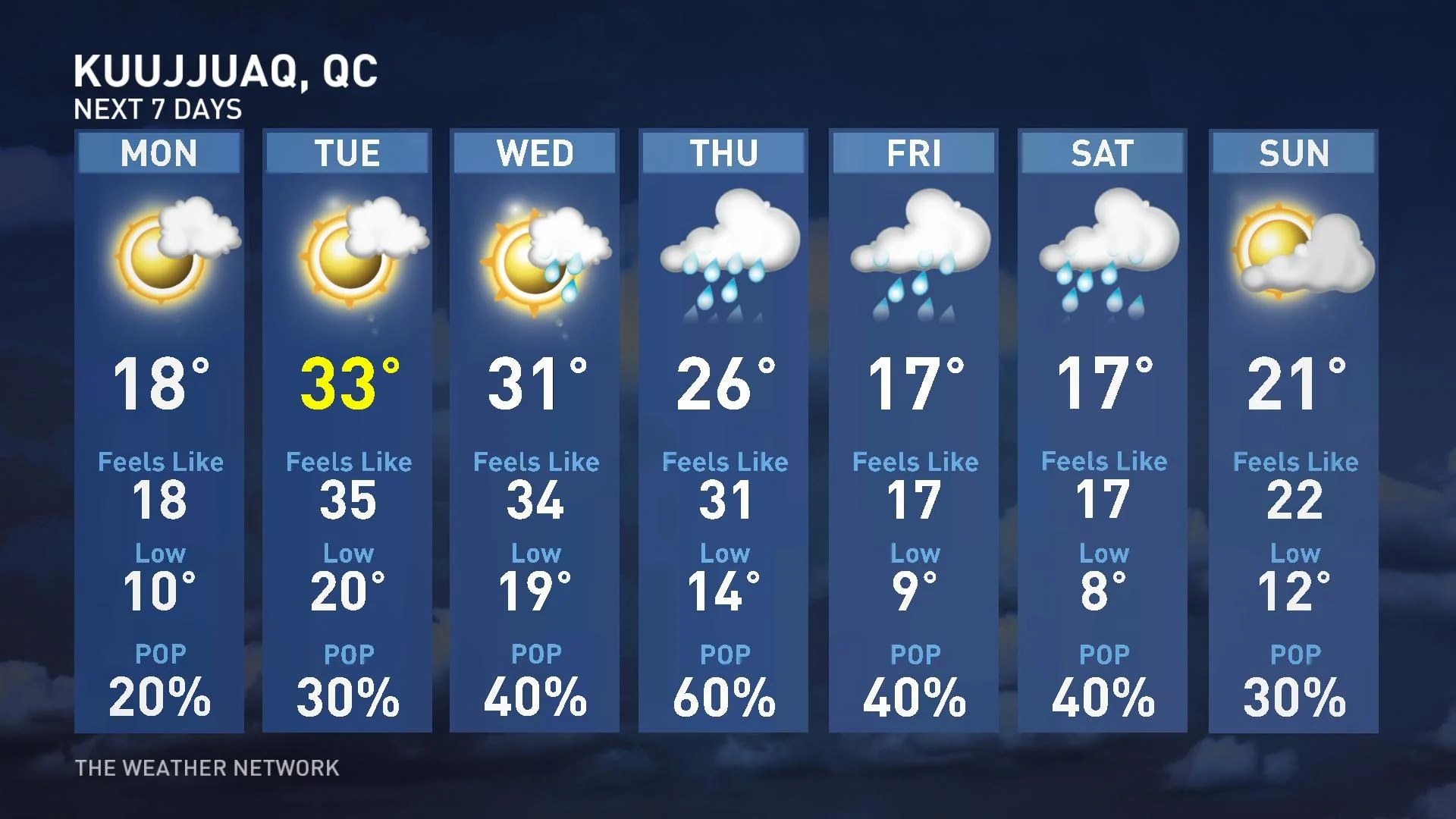
Such a remarkable temperature anomaly is on the higher end of heat we’ve recorded in northern Quebec. In fact, Kuujjuaq’s all-time high of 33.1°C on June 24, 1999, is at serious risk of falling if current forecasts pan out.
DON’T MISS: Newfoundland message in a bottle found in Norway 34 years later
The heat in Kuujjuaq will stick around for a couple of days, with a high in the lower 30s expected again on Wednesday before temperatures gradually fall closer to seasonal as unsettled conditions push in by the end of the week.
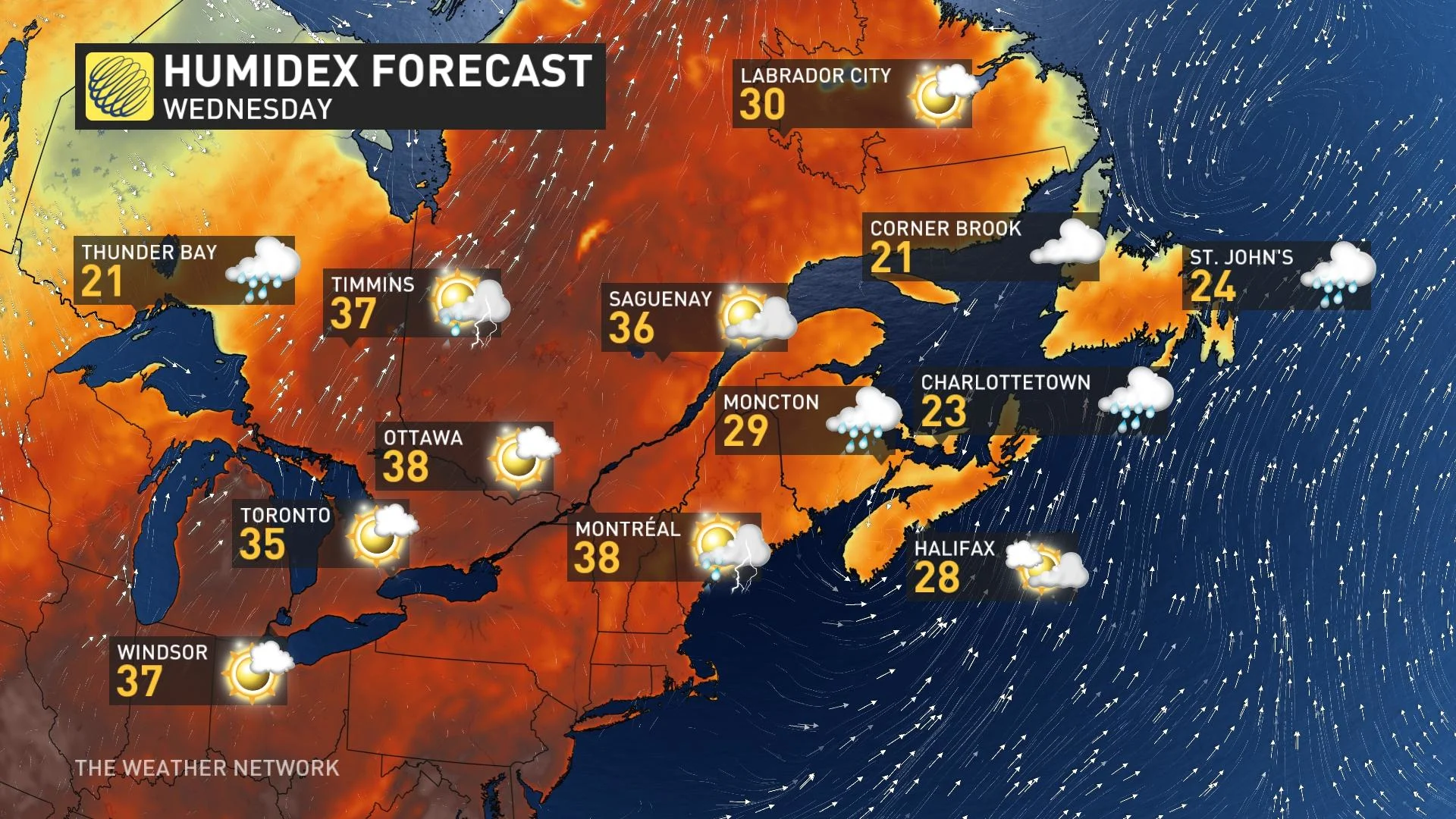
We’re not going to see temperature anomalies quite so extreme across more populous regions of Ontario and Quebec, but what the heat lacks in intensity it’ll more than make up for in mugginess.
That humidity will actually save us from extreme heat. Water has a high heat capacity, so moist air takes longer to warm up and cool off than drier air.
However, that won’t stop daytime highs in southern Ontario and southern Quebec from reaching the upper 20s to around 30°C over the next week. Daytime humidex values will easily climb into the upper 30s for many folks, possibly breaching 40 in southern Ontario.
MUST SEE: Microbursts can turn a gentle storm into a harrowing ordeal

The humidity will prevent nights from cooling off much, to boot. For much of the week, low temperatures will struggle to fall much below the 20-degree mark.
The compounding effects of steamy days with muggy nights may affect vulnerable individuals, especially those without adequate access to air conditioning. Make it a point to check on vulnerable folks over the next week to ensure that the heat isn’t taking a toll on their wellbeing.
A warm and humid airmass will also lead to a near-daily risk for pop-up thunderstorms throughout much of the region.
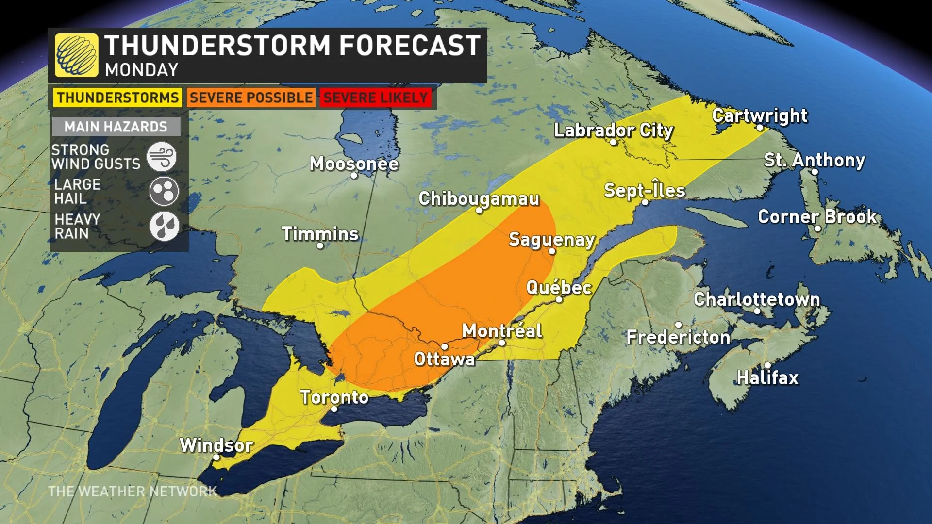
These pulse-like storms rise with the heat of the day and fizzle out in the evening. Some of them could reach severe limits in spots. Keep the umbrella handy and stay close to safe shelter in case one of these pop-up storms threatens in the coming days.