There goes Alpha: On to the Greek alphabet for Atlantic hurricanes

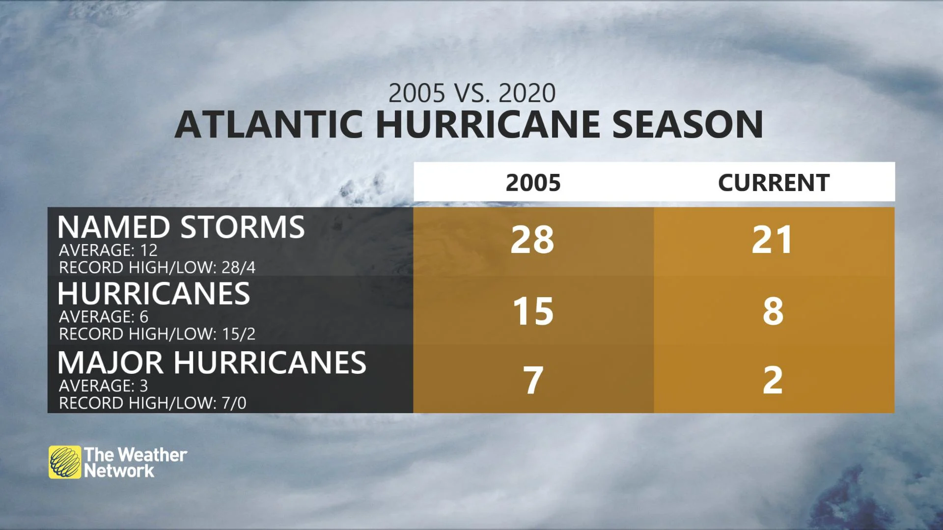
Considering what a record-setting year for storms it has been in the Atlantic basin, it was only a matter of time until we blew by the 21 names set aside to identify them.
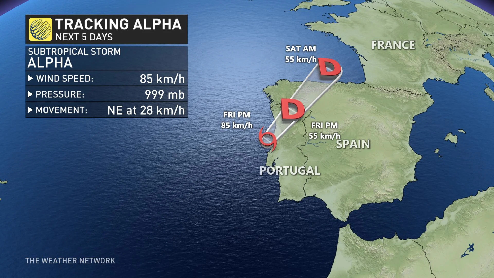
On Friday, Subtropical Storm Alpha formed near the coast of Portugal, marking the first of the Greek alphabet -- and the 22nd named storm of the Atlantic hurricane season.
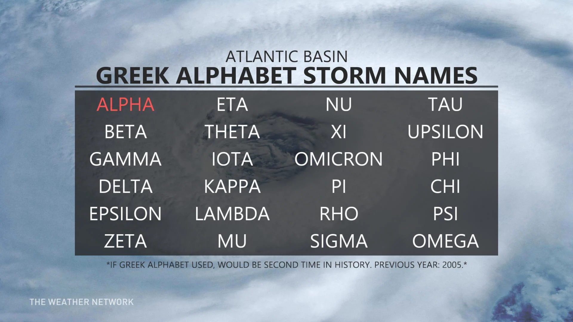
Atlantic hurricane names are alphabetical, starting with A every season. The letters Q, U, X, Y, and Z are omitted due low availability of Euro-centric names starting with those letters. Wilfred, which developed in the eastern Atlantic on September 18th, marked the last name on the World Meteorological Organization's (WMO) list.
The Greek alphabet has only been utilized once before, which was in 2005 when 28 storms churned up in the Atlantic.
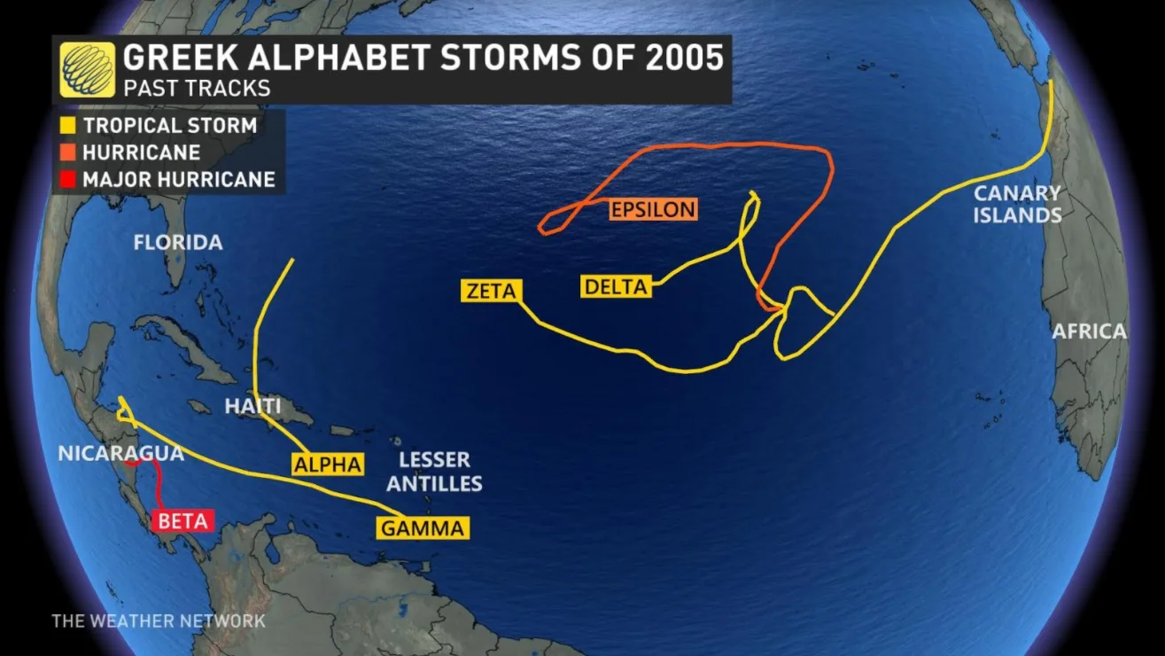
That year saw several strong hurricanes, including Katrina, Rita, and Wilma. In fact, that season ended up needing six names off the Greek list, with the final storm, Zeta, actually lingering into the early days of January 2006, long after the end of the "official" season on November 1st.
WHY STORMS GET NAMES
According to the WMO, the names designated to Atlantic storms are chosen years in advance.
The WMO selects the names to help with quick identification in warning messages. Human, gendered names are used because they are easier for the public to remember than numbers and technical terminology.
Sometimes, names are taken out of circulation. In 2019, for example, the names Florence and Michael were retired due to the widespread intensity and destruction caused by hurricanes Florence and Michael the previous year.
Non-retired names cycle through every six years.
ALPHA'S TRACK
While Alpha is forecast to be a short-lived storm, hurricane forecasters say that it could bring heavy rain and strong winds to Portugal over the coming days.
As of Friday afternoon, the center of Subtropical Storm Alpha was about 125 kilometres north of Lisbon, Portugal, and boasted maximum sustained winds near 85 km/h (with higher gusts), according to a weather advisory from the National Hurricane Center (NHC).

The storm was moving toward the northeast near 28 km/h, and this general motion was expected during the next day or so before dissipating, the agency added.
Alpha is forecast to move across the coast of west-central Portugal during the next couple of days.
“Little change in strength is expected before landfall, with rapid weakening over land through the weekend.”


