Arduous travel likely on the Prairies as another wintry dose comes through
A good portion of the Prairies will get another sneak preview of winter this week, with freezing rain, snow and gusty winds likely to disrupt commutes
Drivers on the Prairies are being urged to plan ahead and prepare for wintry weather once again this week.
MUST SEE: When should you switch to winter tires? Provincial breakdown, here
The wintry cocktail will see freezing rain, snow and blustery winds offered up to the Prairies, likely to lead to some hazardous travel conditions and perhaps road closures, as well.
Some areas could see 5-15 cm of snow by the time the system departs.
Alberta
Tuesday morning will feature a cold rain across Alberta, with periods of freezing rain developing in the south.
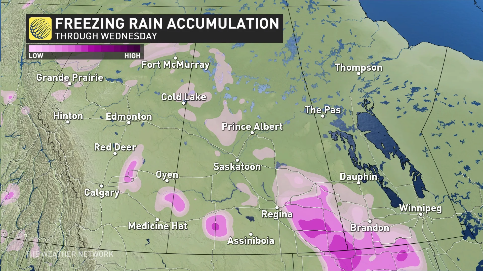
A quick shot of freezing rain forms east of Calgary, extending to the Saskatchewan border. A cold rain takes over and wraps up by the evening.
But farther north, an unsettled rain and snow mix, as well as breezy conditions, will follow. Bands of wet snow will develop in the northern foothills by Tuesday's commute home, and will spread across the QE2, impacting Edmonton and Red Deer throughout the evening.
RELATED: Here’s how early skiers lined up for elusive 'first chair' at Lake Louise
This quick burst of snow, coupled with winds ramping up over 40 km/h, could pose a brief period of tricky travel and possible whiteout conditions, before gradually clearing for Wednesday.

Saskatchewan and Manitoba
By the late morning hours on Tuesday and through the early afternoon, a period of freezing rain is possible in Saskatchewan near Moosomin, Weyburn and southeast along highways 13 and 9. Southeastern Manitoba may also see a brief period of the icy precipitation during the same timeframe, as well.
Slick driving is possible if the pool of cold air sticks around, though computer models show the cold and snowfall is likely to take over.

MUST SEE: Canada's November Outlook: A smooth transition or a free fall into winter?
Tuesday evening's commute home will feature accumulating snow building across southern Manitoba, including Winnipeg, with between 5-15 cm likely.
Conditions ease by Wednesday morning, but a trailing trough will brush flurries across Saskatchewan through the day as the system continues to push east.
Stay with The Weather Network for the latest on conditions across the Prairies.