Newfoundland: Additional snow will follow record-smashing storm

Eastern Newfoundland is all but at a standstill after bring buried in record-breaking snowfall
A historic snowstorm has smashed records -- and in one case, houses -- in Newfoundland. St. John's saw more than 75 cm of snow with the storm, and while the flakes tapered off early Saturday, the impacts will linger on for days. States of emergency have been declared for St. John's and other communities as a lengthy clean-up process begins. We take a look at what you need to know below.
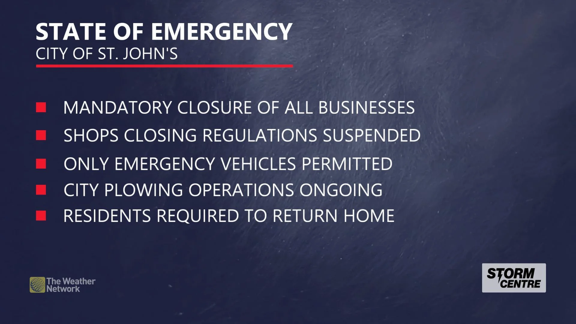
What is a State of Emergency and how it affects you, here
HIGHLIGHTS:
9 to 12 metre storm surge for parts of the northern coast through early afternoon
Another round of snow late Sunday/Monday; 5 to 15 cm expected for Maritimes
Stay aware of ALERTS in your area
SATURDAY AFTERNOON/EVENING: CONDITIONS IMPROVE -- FOR A WHILE
St. John's and other communinties in Newfoundland remain under a state of emergency after a historic snowstorm dumped closer to a metre of snow on parts of the province. St. John's recorded 76.2 cm of snow with the storm, crushing the single-day record for snowfall in the capital.
Winds will ease late Saturday afternoon and through the evening as the low pressure centre starts to slide away into the Atlantic, allowing residents and officials to tackle the tremendous drifts afflicting the region.
The record-breaking snowfall forced some in the Battery area of St. John's to evacuate after an avalanche hit the cliff-side community. Officials reported no one was injured, but the slide damaged one house.
SEE IT: Newfoundland starts to dig out after monster blizzard sets records
SUNDAY/MONDAY: NEXT STORM BRINGS ADDITIONAL SNOW
Unfortunately, there won't be much time to finish those cleanup operations before the next system rolls into the region, with the next round of snow set to arrive late Sunday afternoon.
While this won't be anything close to the epic blizzard we've seen to start the weekend, there is another 10 to 15 cm of snow in store for some of the hardest-hit areas with this next system.
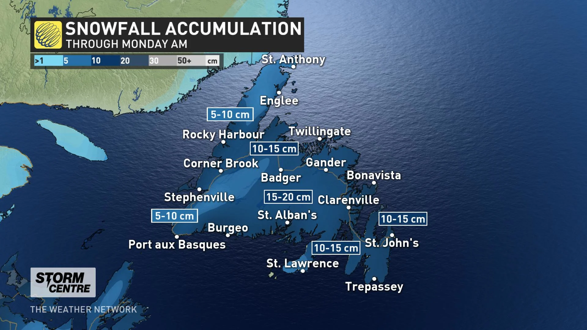
Much of the snow is expected to move through Sunday night, but gusty winds on Monday may spur some additional sea-effect flakes, along with drifting and blowing snow and shifting snowdrifts.
Stay with us here at The Weather Network for your forecast updates as we follow these systems throughout the week.