Damaging winds, snow blast parts of Atlantic Canada

Powerful winds will continue for parts of Atlantic Canada through Thursday, as a moisture-laden system slowly tracks across the region.
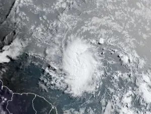
A powerful system barrelled across Atlantic Canada on Wednesday, bringing a wide variety of dangerous and damaging weather to the region. While conditions gradually improved in terms of precipitation for the Maritimes, strong winds continue to gust through Thursday with parts of Newfoundland and Labrador still battling heavy snow and blizzard-like conditions. We breakdown what's left of this system, plus a look at the next storm that follows quickly, below.
Visit our Complete Guide to Spring 2019 for an in-depth look at the Spring Forecast, tips to plan for it and much more
WEATHER HIGHLIGHTS:
Strong winds continue through parts of Atlantic Canada Thursday
Persistent sea-effect flurries over western Newfoundland through Friday with blizzard conditions over Labrador
Next system much weaker, but still brings a mix of rain and snow through Saturday
Check the latest ALERTS in your area
PRECIPITATION EASES ACROSS THE MARITIMES, BUT WIND GUSTS STILL A FACTOR
The intense system that brought a rare April snowfall to parts of the southern United States on Tuesday made its mark across the Maritimes on Wednesday, bringing snow, rain and strong winds to the region. Although the precipitation eased through the evening and overnight hours, some schools in northeastern New Brunswick faced another day of closures on Thursday as the province digs out from this latest healthy dose of spring snow.
Damaging winds were also widespread across the Maritimes with power outages and downed trees reported through Thursday morning.
WIND GUSTS UP TO 90 KM/H CONTINUE
As the system makes its way over Labrador, southwesterly winds gusting to 90 km/h will persist across the Maritimes on Thursday before gradually diminshing throughout the day on Friday.
"High winds may toss loose objects or cause tree branches to break," warns Environment Canada. "Be prepared to adjust your driving with changing road conditions due to high winds."
WATCH BELOW: WEATHER REPORTER SPENDS A STORMY DAY BRAVING PEGGY'S COVE WIND AND RAIN
STILL WINTRY ACROSS NEWFOUNDLAND AND LABRADOR
Strong winds began howling across Newofoundland Wednesday night with a persistent strength lasting through much of the day on Thursday. In some areas, the southwesterly wind gusts will reach between 100 to 120 km/h.
The combination of strong winds and sea-effect snow on the back side of this low are also making for some hazardous travel conditions. The squalls will become more intense as temperatures continue to fall amid the gusty and powerful winds. That could result in "intermittent blizzard-like conditions with poor visibility in blowing snow," warns Environment Canada.

RELATED: What Canadians can expect in April from 'tumultuous' spring
The heaviest snow is forecast over Labrador, where blizzard conditions are likely to last into Friday. Up to 40 cm of snow is possible by the time all is said and done along the northern shore and the higher terrain through the southern interior. As for the population centres, Labrador City and Happy Valley-Goose Bay are looking at 10-15 and 20-30 cm respectively.
SEE ALSO: Massive Atlantic Canada ice wall would be right at home in Game of Thrones
WEEKEND OUTLOOK: ANOTHER STORM ON THE HORIZON
Another system, although much weaker, will track across Atlantic Canada on Saturday with a mix of rain and snow expected for the Maritimes and primarily snow once again for Newfoundland.
"Conditions will remain cold for Sunday and Monday with yet another messy system arriving later Monday, bringing a period of snow and ice to much of the Maritimes before changing to rain across the region," says Weather Network meteorologist Dr. Doug Gillham. "That colder than seasonal weather will also dominate next week."
Be sure to check back for your latest forecast updates.