'Classic' fall pattern in B.C. will deliver heavy rain on the weekend

The rainy, windy and even snowy week for B.C. continues as an atmospheric river feeds in ample moisture from the Pacific.
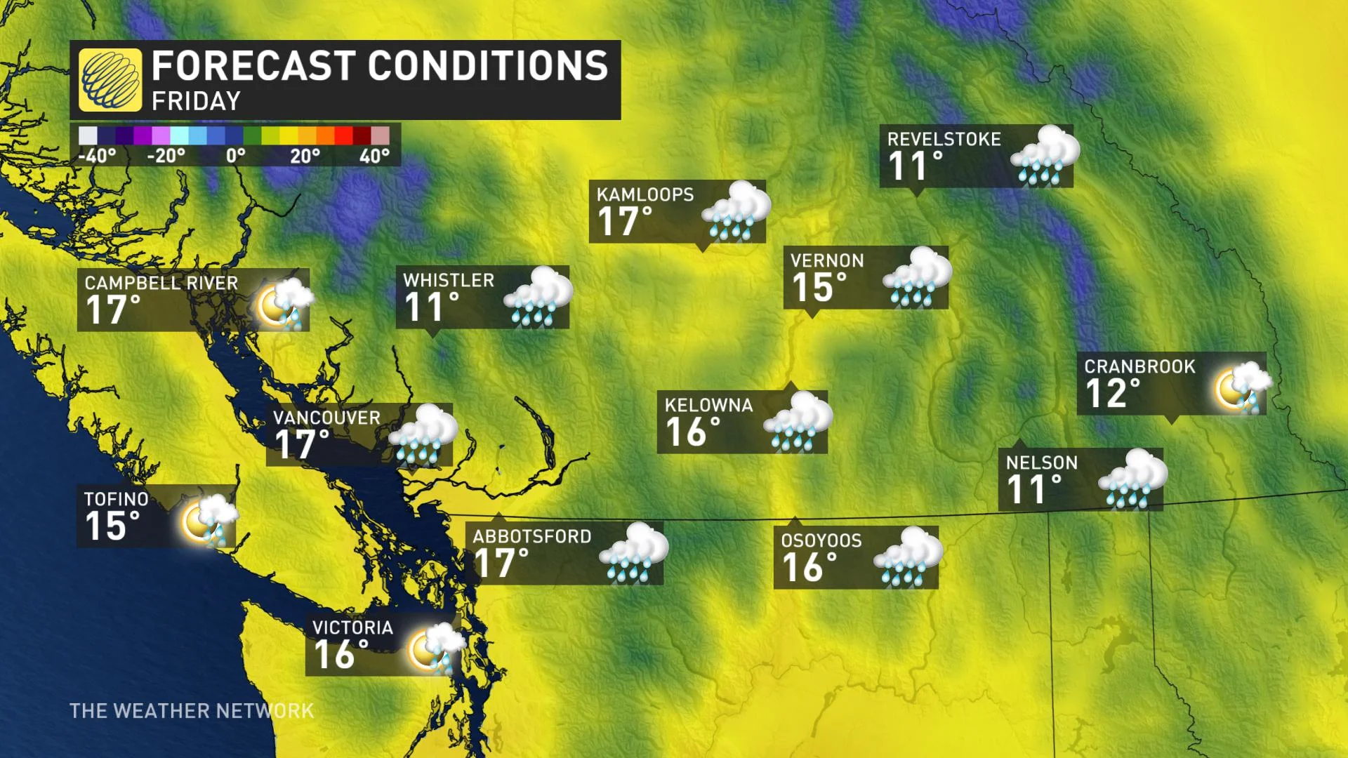
The 'classic' fall pattern that is currently in place will continue to bring rain across B.C. This is all thanks to an upper trough and an atmospheric river, which is ushering in moisture from the Pacific. Friday will see the steady rains taper off to showers, but then another low will bring in an additional round of downpours Saturday morning. High-elevation snow is also expected to persist through Sunday. Details and timing, below.
WEATHER HIGHLIGHTS
Brief break from downpours Friday, but another round of soaking rains, gusty winds Saturday
Pattern reversal next week, with extended period of warmer, drier weather
POWERFUL WIND GUSTS, HEAVY RAIN
A low pressure system that is quickly tracking through part of B.C. through Thursday night will bring powerful wind gusts to coastal regions of Vancouver Island and the Sunshine Coast. Gusts up to 70 km/h are possible near the Strait of Georgia through early Friday morning.
“High winds may toss loose objects or cause tree branches to break. Avoid wooded areas to prevent injury from falling trees or branches. Campers should move to sturdy shelters,” warns Environment Canada.
RELATED: The cost of atmospheric rivers are on the rise as they get bigger
Environment Canada has issued a rainfall warning for Howe Sound, which says that 40 to 50 mm of rain could accumulate by Friday morning. Flash flooding and pooling water on roads could occur from the heavy downpours and caution is recommended near rivers, creeks and culverts.
LOOK AHEAD: CLASSIC FALL PATTERN THROUGH WEEKEND
There won't be much relief for the province any time soon, as a 'classic' fall pattern locks in through the weekend, with multiple systems moving in.
While heavy rain tapers off to showers Friday afternoon, another low associated with the upper trough will move in Saturday morning, bringing an additional round of downpours.
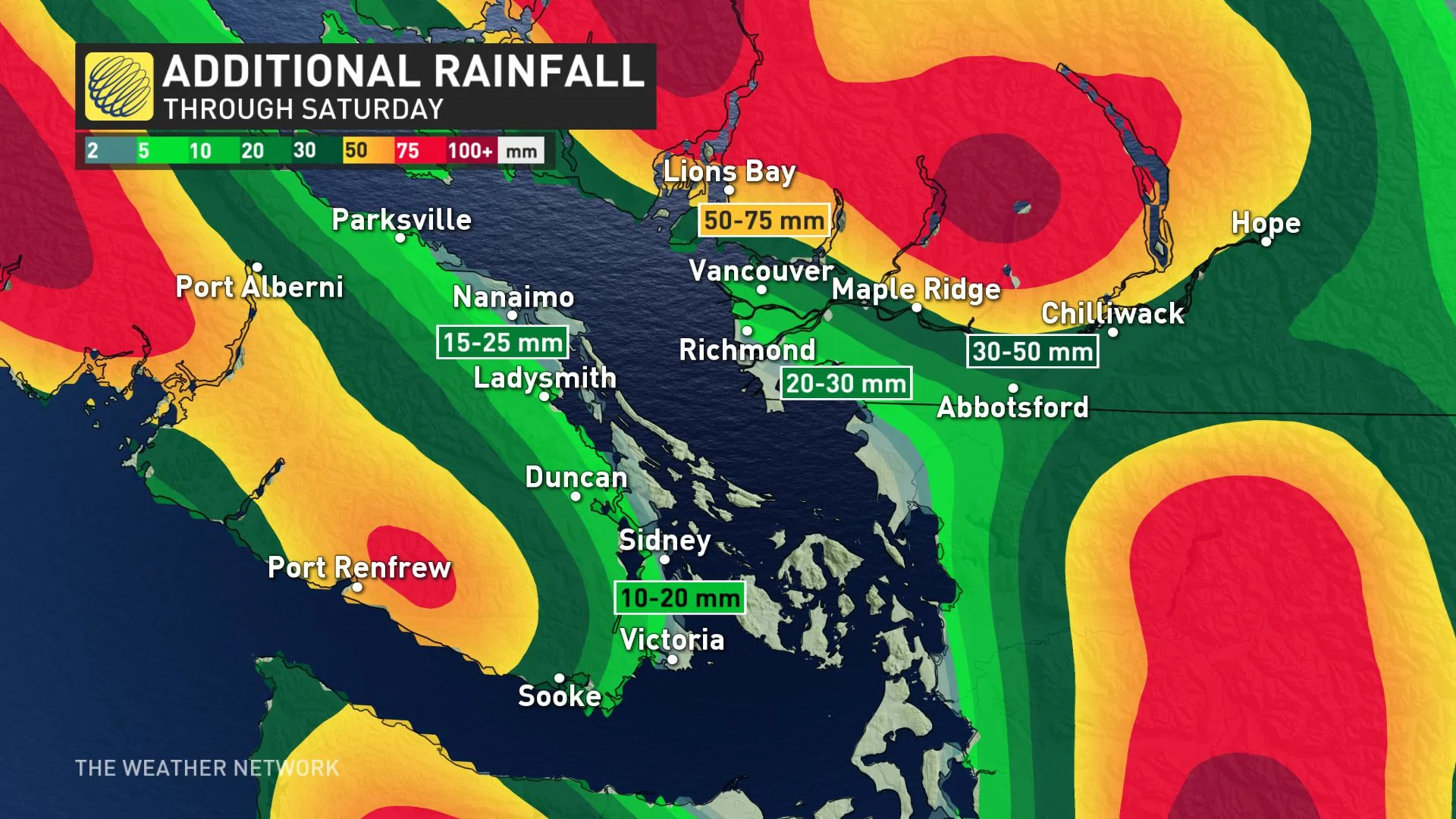
While earlier forecast models indicated a wet Sunday for the South Coast, the system is now trending further north, so a drier day is expected for the region, while heavy rain continues to fall along the central coast.
Snow will continue to fall in the alpine regions of the coastal mountains, as well as the Rockies, through the weekend, before tapering off Sunday night. Freezing levels are currently at 2500 metres.
Beyond the weekend, another pattern reversal will bring a return to late-summer-like weather next week, continuing through the first week of October. Temperatures will climb into the mid- to upper-20s, which may break records in some locales.
Check back regularly for updates as we continue to monitor the forecast.