August outlook: Summer extremes finally relax in Canada

As we head towards the second week of August, the extreme temperature contrasts will slowly break down and we will also start to see a shift in the pattern.
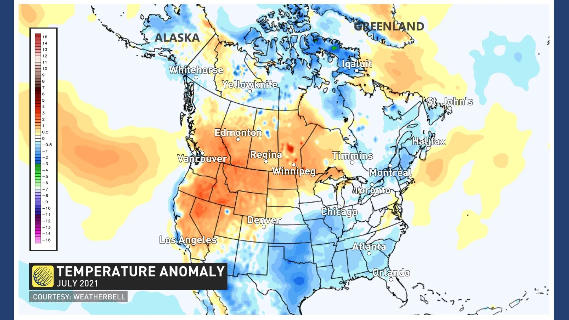
July featured a sharp contrast in temperatures across Canada with extreme heat and drought dominating from B.C. to western Ontario, while much cooler and stormy weather dominated from southern Ontario to Atlantic Canada.
Here is a look back at temperature anomalies for the month of July, with the various shades of orange and red highlighting the above normal temperatures. The various shades of blue highlight the regions that were cooler than normal during July.
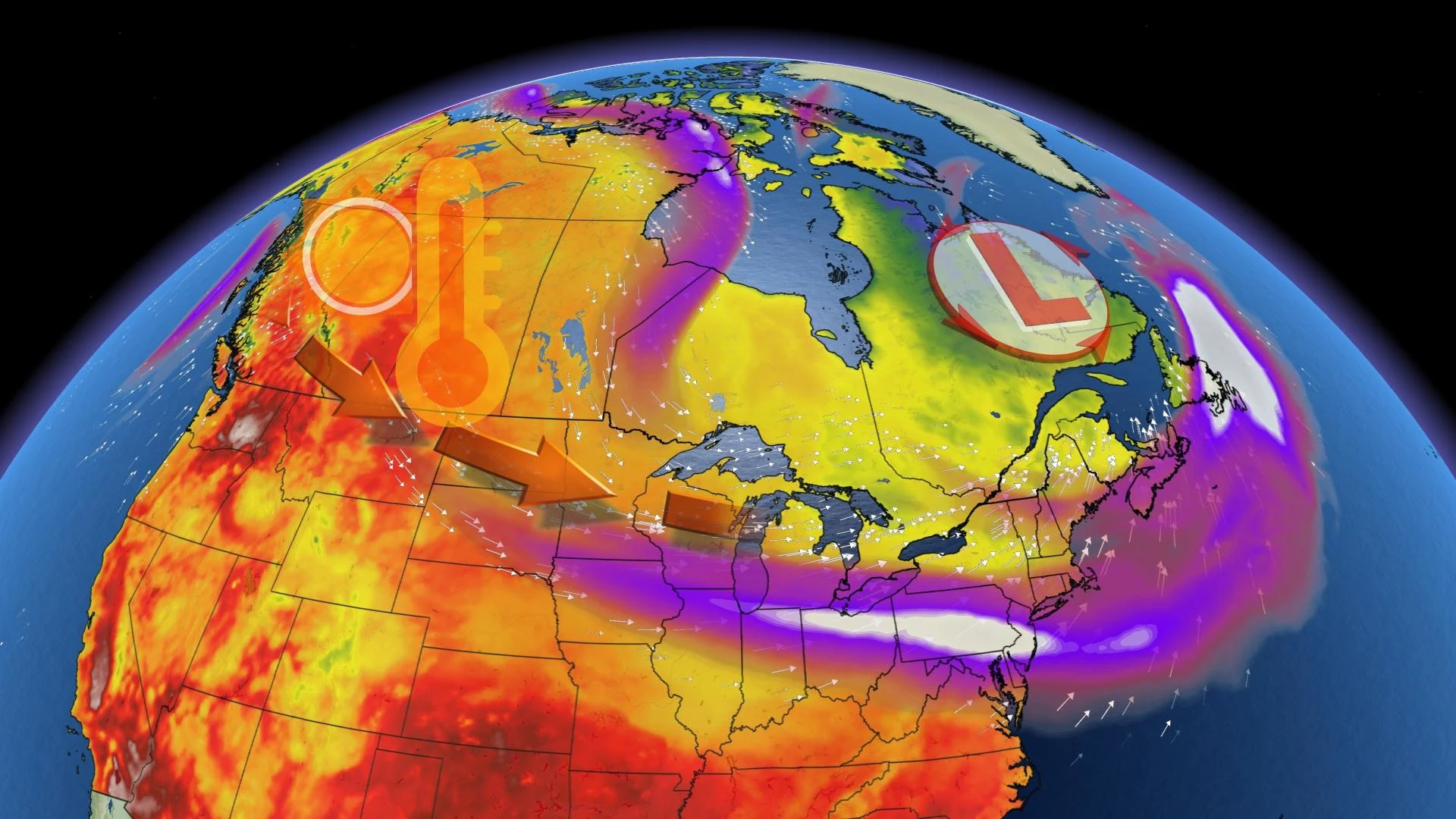
Early August will look a lot like July with hot weather continuing to dominate across the western half of the country, with cooler than seasonal temperatures will continue for most areas east of the Great Lakes.
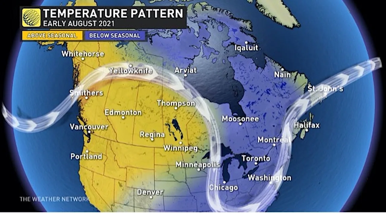
However, as we head towards the second week of August, the extreme temperature contrasts will slowly break down and we will also start to see a shift in the pattern.
Across Western Canada, the extreme heat will relax, and we will finally see some much needed rain across B.C. Meanwhile, warmer weather will spread into Eastern Canada. This will finally bring more consistent warm, and at times hot, weather to areas that did not see and consistent heat during July, including southern Ontario, southern Quebec and into Atlantic Canada.
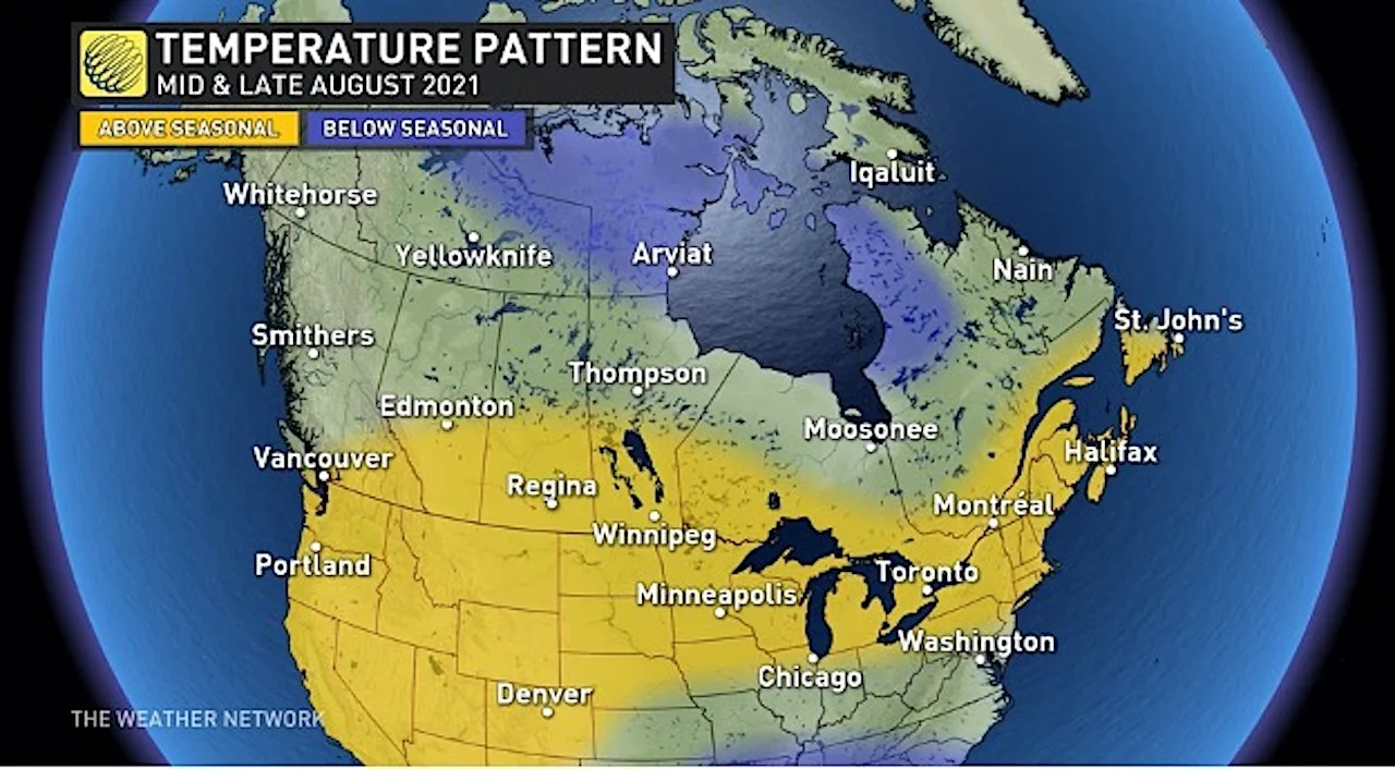
Here is a closer look at what the shift in the pattern means for different parts of Canada during mid- and late-August.
BRITISH COLUMBIA
Southern B.C. should still tip to the warm side of normal during mid- and late-August, but temperatures will not be nearly as hot as what we saw during July. Central and northern areas should see near normal temperatures.
We should also see near normal and locally above normal rainfall. While any rainfall will be welcome across this region, it is important to keep in mind that August is normally a dry month. Since we already have severe drought conditions in place across the region, it will take more than just normal August rainfall to bring meaningful relief from the wildfires across the region. However, conditions will be less hostile for the crews that are working so hard to bring the fires under control.
PRAIRIES AND NORTHWESTERN ONTARIO
Overall, August will be a hot and dry month, especially across southern areas. However, the extreme heat will finally relax and give way to a more seasonal pattern at times, and the focus of the hottest weather will shift east from southern Alberta to southern Saskatchewan and southern Manitoba.
SEE ALSO: Why are we seeing so many record-shattering weather events right now?
SOUTHERN ONTARIO AND QUEBEC
After a cool and wet July, summer should finish strong across this region. While the first week of August will still be cooler than normal, warm weather will be more consistent during mid- and late-August, and even some hot weather is expected. The weather pattern will continue to be stormy at times, but we should finally see some stretches of dry weather that last for more than just one to two days.
NORTHERN CANADA
While August will begin with very warm weather stretching from Whitehorse to Yellowknife, a cooler pattern is expected to quickly return, with near normal temperatures expected to dominate during mid- and late-August.
ATLANTIC CANADA
After a cool July, August will be noticeably warmer across the region. However, we will have to keep a close eye on the tropics as the pattern during mid- and late-August will support a rather active period for tropical storms and hurricanes.