Hurricane warnings issued as Beryl swirls toward Texas
A stretch of the Texas coast is now under a hurricane warning as Beryl is expected to strengthen in the Gulf of Mexico

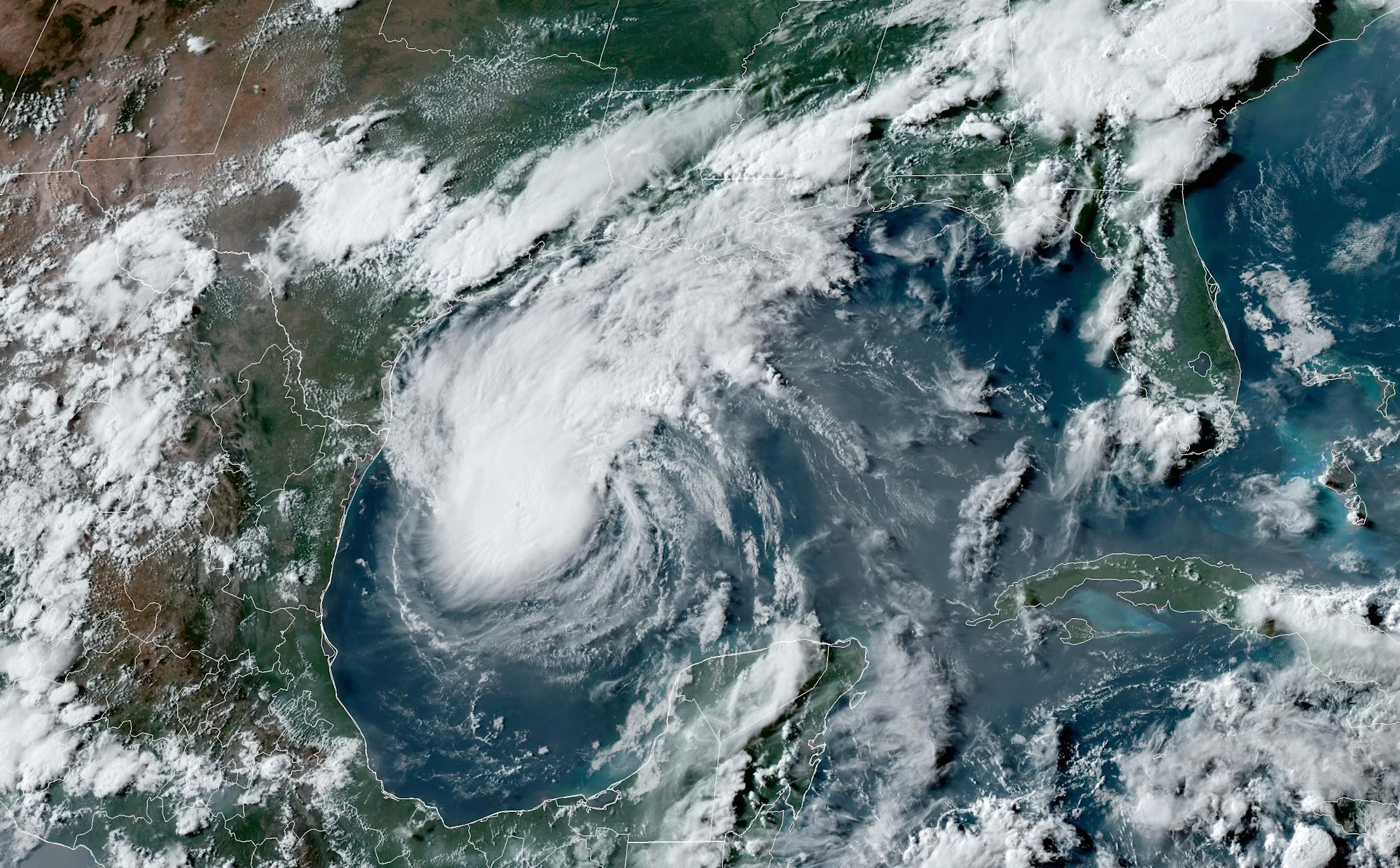
Forecasters issued hurricane warnings on Saturday as Tropical Storm Beryl continues churning in the Gulf of Mexico.
The storm is fighting to recover from its tangle with Mexico’s Yucatan Peninsula on Friday. Dry air and wind shear are preventing the storm from reorganizing itself too quickly.
Despite its current struggle, the U.S. National Hurricane Center (NHC) expects Beryl to regain hurricane strength before making landfall south of Houston on Monday.
DON’T MISS: Canadian Red Cross launches appeal to help people impacted by Hurricane Beryl
Very warm waters in the Gulf will likely allow the system to regain some strength and organization on the weekend before it reaches the Texas coast.
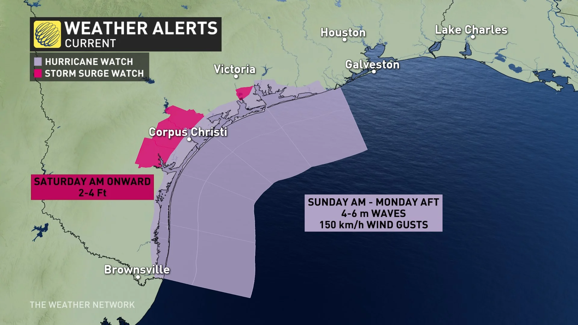
A hurricane warning and a storm surge warning are both in effect for the Texas coast from Baffin Bay northward to Sargent. This includes the city of Corpus Christi. A tropical storm warning is in effect farther north, including the cities of Houston and Galveston.
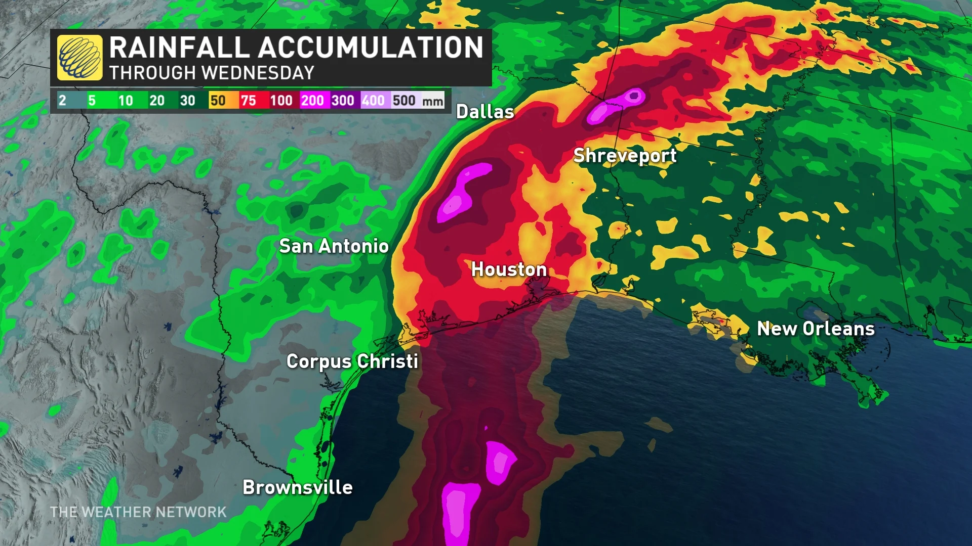
Damaging winds, flooding rain on the order of 200+ mm, and life-threatening storm surge flooding along the coast are possible as Beryl moves inland early this week. Tornadoes are also possible around the Houston metropolitan area as the storm makes landfall.
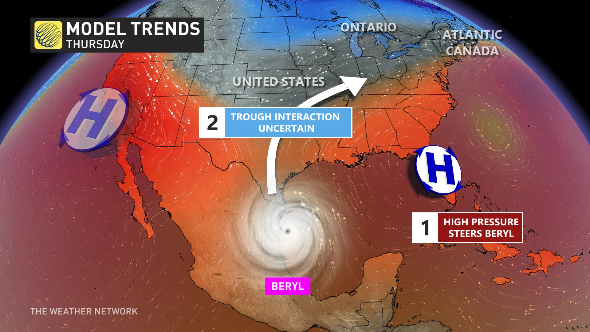
After landfall, it’s likely that the heat dome over the southeastern U.S. will steer Beryl’s remnants over the region.
It’s tough to say what, if any, impacts the storm’s remnants could have on Canada since the potential is more than a week out. However, the remnants could potentially delay the arrival of cooler and less humid conditions, or modify the effects.
Beryl’s historic run
Beryl is a historic storm. Over the past couple of days, the system has set records for:
the earliest Category 5 hurricane on record, beating 2005’s Hurricane Emily
the earliest Category 4 hurricane on record, beating 2005’s Hurricane Dennis
the earliest hurricane so far east in the tropical Atlantic on record
This is also the first time since 1966 we’ve seen a major hurricane before the July 4th holiday.

Experts largely agree that we’re in for a very active Atlantic hurricane season in the weeks and months to come. Sea surface temperatures throughout the Atlantic are running several degrees hotter than normal, closer to what you’d expect in September than the end of June.
MUST SEE: El Niño is over—but La Niña may arrive during peak hurricane season
These abnormally hot waters will combine with the lower wind shear brought on by a developing La Niña in the eastern Pacific to foster extremely favourable conditions for tropical cyclone development through the peak of the season this fall.
The latest seasonal outlooks call for as many as two-dozen named storms, which is far more than the 14 tropical storms we’d see during a typical Atlantic hurricane season.
Thumbnail courtesy of NOAA.
Stay with The Weather Network for all the latest on this busy hurricane season.