Heavy, blowing snow continues blasting Newfoundland Friday evening
Winter storm warnings cover Newfoundland's Avalon Peninsula with dangerous blizzard conditions set to continue into Friday night
The Avalon Peninsula resembled a well-shaken snow globe as the sun set on Friday and a heavy, wind-whipped snow continued across the region.
Strong northerly winds, falling temperatures, and heavy snow will allow dangerous blizzard conditions to persist through Friday evening.
MUST SEE: Winter to finally show up in January as El Niño bested by polar vortex
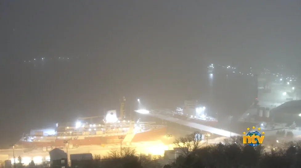
A screen capture of the St. John's Sky Cam around 5:00 p.m. local time on Friday. (Courtesy of NTV News.)
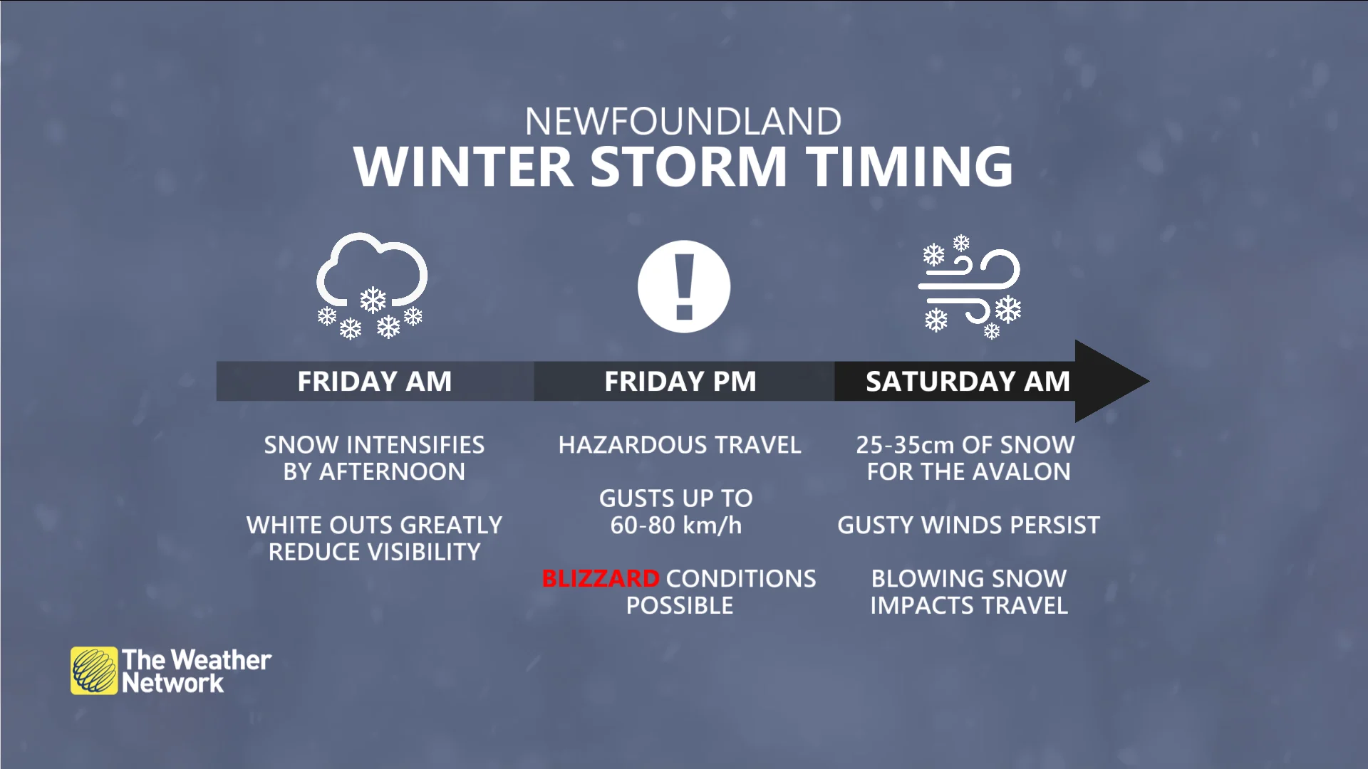
The Avalon Peninsula will take the brunt of this winter storm, where snowfall totals of 25-35 cm are on tap alongside gusty winds of 60-80+ km/h. This includes the city of St. John’s.
A webcam overlooking St. John's operated by NTV News revealed extremely low visibility amid the heavy, blowing snow plastering the region early Friday evening.
Road conditions will be extremely difficult, if not near impossible at times, so drivers are being urged to avoid any non-essential travel until things improve. While the snow will wind down by Saturday morning, some blowing snow will persist amid gusty winds.
Dangerous blizzard conditions by Friday afternoon
A low-pressure system trekking by Newfoundland is bringing the region its largest snowfall of the season so far—a low bar given that we’ve had a pretty mild start to the winter.
Heavy snowfall rates and gusty winds will continue through Friday night and into early Saturday.
STAY SAFE: Be aware of your heart while shovelling heavy snow

Blizzard conditions are possible through the evening hours as snowfall rates approach 5 cm/h accompanied by wind gusts of 60-80+ km/h. Rapidly accumulating snow and whiteout conditions will make travel extremely dangerous or virtually impossible at the height of the storm, which will last through the evening commute.
Avoid travel if at all possible, and plan ahead if you have to venture out during the wind-driven snow. Ensure you have emergency supplies in your vehicle in case you get stuck.
The snow will gradually draw to an end by Saturday morning, though wind gusts of 70 km/h through the day will lead to reduced visibility as the freshly fallen snow continues blowing around.
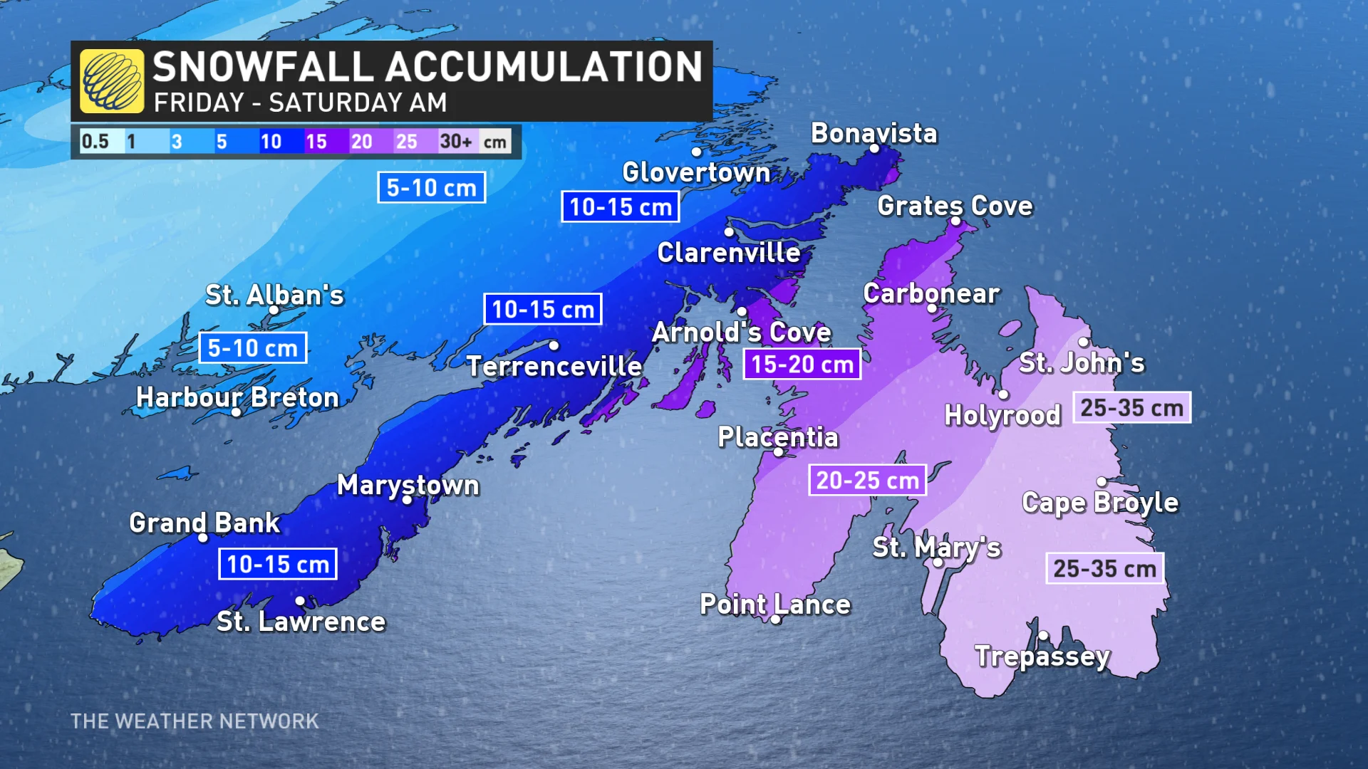
We're on track to see widespread totals of 25-35 cm across the Avalon, including in St. John’s. Totals will steadily drop farther west, with 15-25 cm expected on the Burin Peninsula and only 5-10 cm of snow around Gander on the western edge of the system.
Farther south, folks in parts of Nova Scotia and Prince Edward Island could see a touch of sea-effect snow behind this system.
Another round of snow is on the way for the Maritimes this weekend as a powerful, moisture-rich storm arrives from New England.
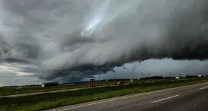
Header image courtesy of Colin Lane in St. John's, Newfoundland.