Trajectory for 'very large' Hurricane Lee takes shape as it heads north

'Very large' Hurricane Lee will begin its trek northward along the Atlantic coast Wednesday, with Atlantic Canada expected to see some widespread impacts from the potent storm
Visit The Weather Network's hurricane hub to keep up with the latest on tropical developments in Canada and around the world
Lee, still a Category 3 hurricane, will begin making its trek northward along the Atlantic coast Wednesday as a trough sets up over the eastern United States and disrupts the high-pressure ridge that has been driving the storm thus far.
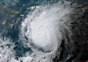
As expected, Lee is expanding in size and will soon begin to weaken as it pushes through cooler waters. Lee is considered to be a "very large hurricane," says the U.S. National Hurricane Center (NHC). Hurricane-force winds extend outward up to 205 kilometres from the centre, and tropical storm-force winds extend outward up to 390 kilometres.

Lee will weaken a bit as it climbs north and grows in size
Despite being a major hurricane now, Lee is chugging into an area of cooler waters and a less-than-favourable environment for further strengthening. In fact, Lee will begin to gradually lose strength over the course of the week as it makes its way north.
DON'T MISS: A world first, every tropical ocean saw a Category 5 storm in 2023
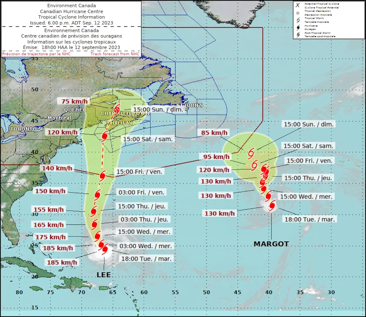
The latest forecast from the NHC on Tuesday evening states Lee's current sustained winds are at 185 km/h, putting it at the lower end of its Category 3 status. Some slow weakening is forecast during the next 48 hours, though the wind field is to remain large.

However, tropical systems do tend to grow in size as they curve toward the north, spreading their energy over a wider area rather than focusing all their power on a relatively tiny part of the storm.
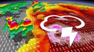
The fact that Hurricane Lee’s footprint will slowly grow in size despite losing its strength is important for any communities in the eventual path of the storm. A threat for heavy rains, high winds, and coastal flooding could extend hundreds of kilometres from the centre of the storm. The biggest concerns will be high tide, dangerous surf, and coastal flooding.
Information statement issued by the Canadian Hurricane Centre
The Canadian Hurricane Centre (CHC) issued a tropical cyclone information statement for the Maritime provinces.
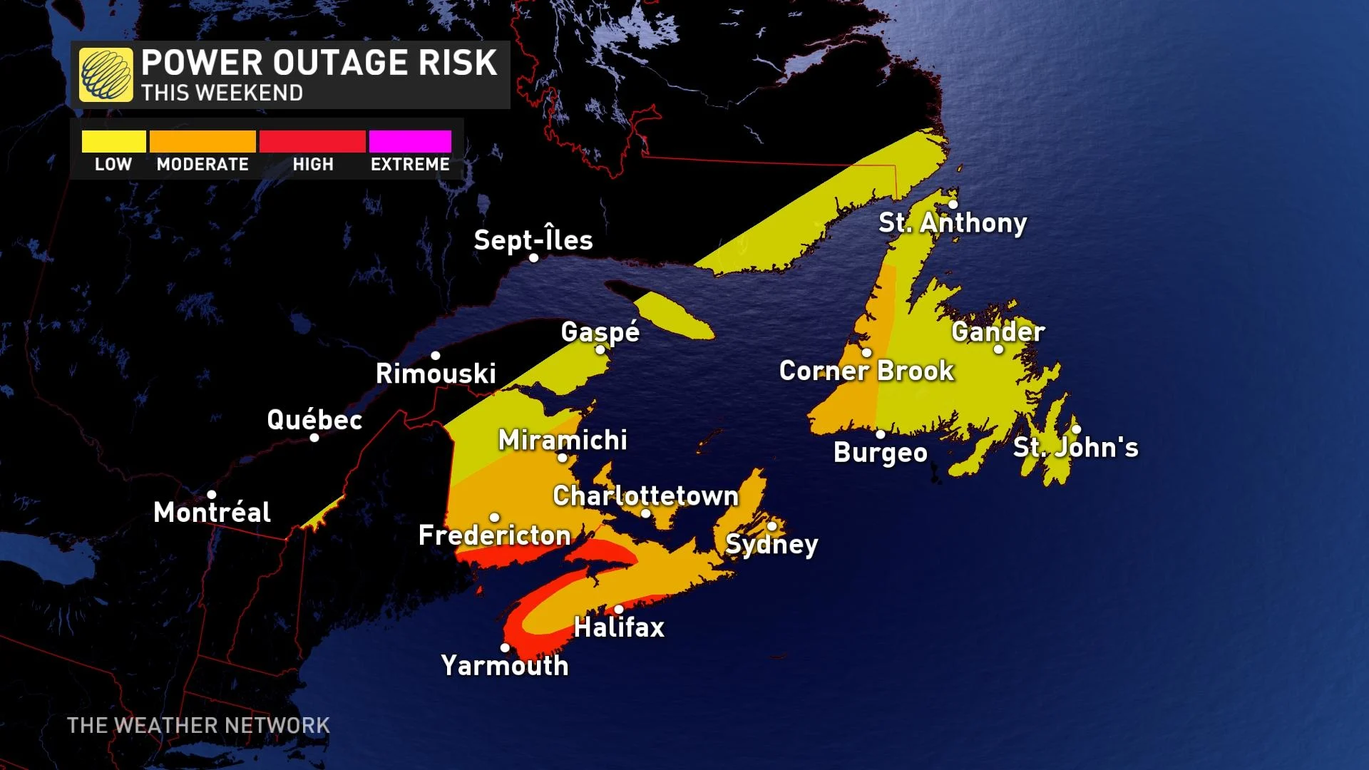
While the exact location of Lee’s landfall is still up in the air, the importance of it decreases as the system becomes larger and the greatest impacts aren’t centred at the core of the storm. The confidence is especially growing for the Maritime provinces and Bay of Fundy region. Residents in these areas, especially closer to the coast, should begin preparing for widespread power outages over the weekend.
A ridge of high pressure over the Atlantic is responsible for steering Lee toward the northwest right now. Hurricane Lee will start moving on a more northward direction Wednesday, further enhancing the tropical air mass over Atlantic Canada.
The CHC expects Lee's circulation to broaden significantly as it moves north and anticipates it to move into the Canadian marine district as a Category 1 hurricane. It is looking likely that the forward motion of the storm could slow, and while doing so, winds would start to decrease.
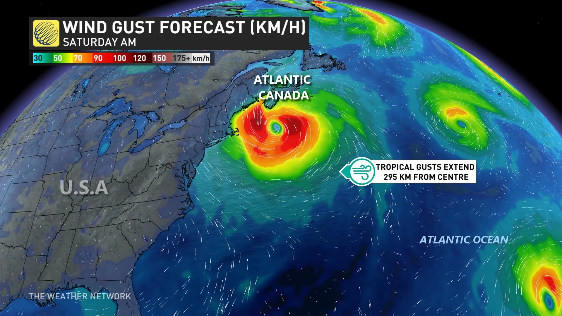
As Lee tracks into Atlantic Canada, it will quickly weaken, reducing the impacts from the storm. That being said, there will still be some impacts to the Maritimes. As Lee approaches, rain will start, potentially accumulating to 60-100 mm totals in the southern Maritimes over the weekend.
(Canadian Hurricane Centre)
At the same time, wind gusts will pick up late Friday and will peak Saturday into Sunday with a widespread 70-100 km/h. The strongest winds can be expected along coastal sections while quickly decreasing inland.
The greatest threats are the waves and surge immediately along the coast. Waves of upwards to 6-7 metres are possible out to sea.
Folks across the region are understandably weary about tropical systems after the impacts of Dorian in 2019 and Fiona in 2022.
It’s likely that Hurricane Lee would not be as strong as either of those two systems if it was to hit the region. However, residents do need to stay on high alert for flooding, power outages, tree damage and coastal flooding.
WATCH: The best time to prepare for a hurricane is long before one threatens. Here's how
Stay prepared
We’re now in the climatological peak of hurricane season across the Atlantic basin. Anyone along or near the East Coast should prepare for hazards like power outages and flooding regardless of this one storm’s progress.
Ensure you’ve got non-perishable food, water, personal hygiene supplies, flashlights, and batteries to last for several days without electricity or water. Prepare an emergency plan in case of flooding or evacuations.
STAY SAFE: What you need in your hurricane preparedness kit
Anxiety is normal when there’s a big storm out there, and even more so when the storm’s future is uncertain. Preparing for a storm now -- long before one ever draws near -- ensures you’ll be ready to go if anything looms on the horizon in the weeks and months ahead.
Stay with The Weather Network for the duration of this storm as we closely monitor this hurricane and its developments.