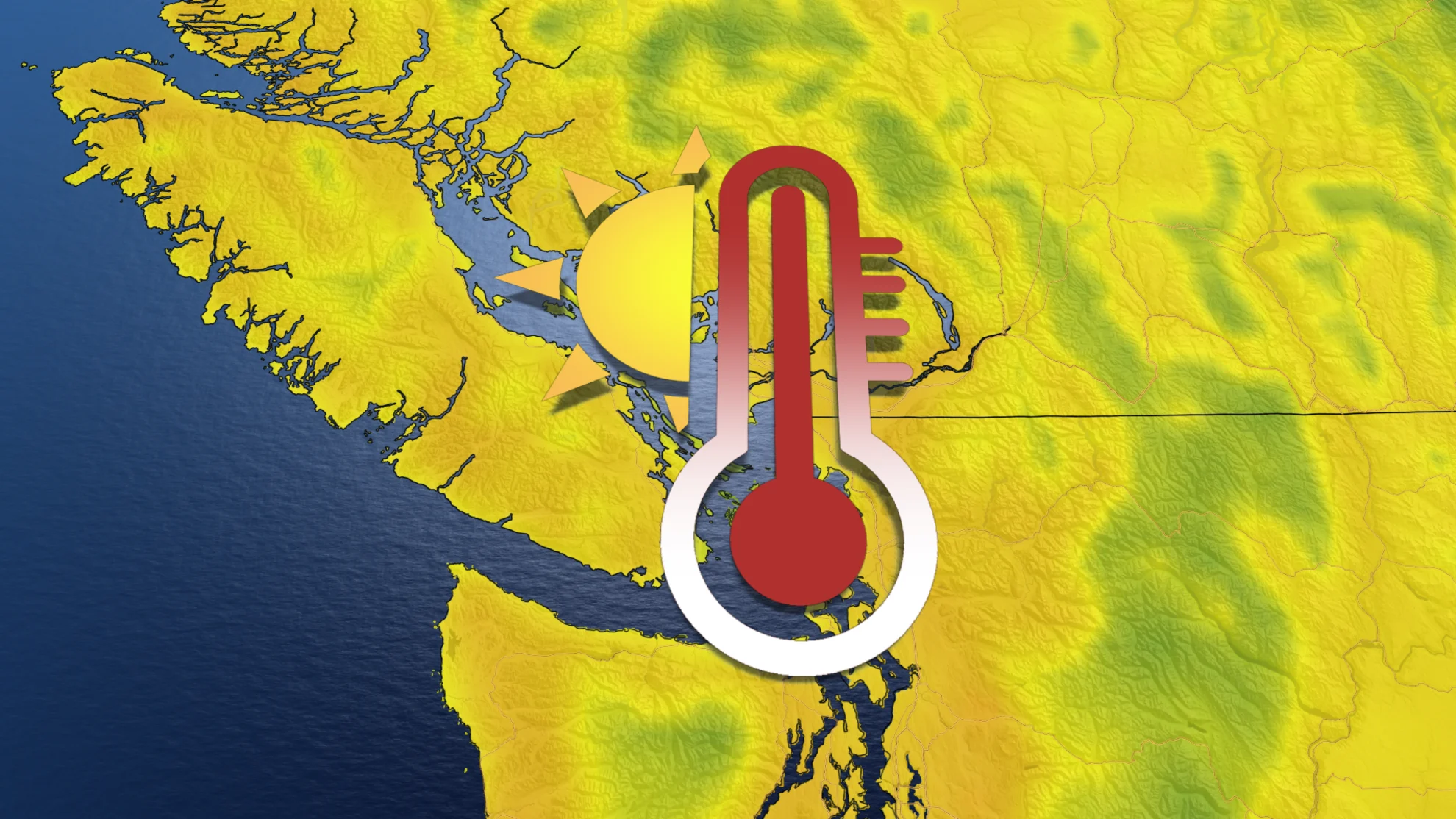
B.C.'s winter ends with 20-degree temperatures this weekend
Get ready for some gorgeous late spring-like weather across British Columbia as temperatures soar well into the 20s to kick off the March break
Winter was very much an on-again, off-again season this year in B.C., but if you can believe it, we have already reached the final full weekend of the season now. Spring officially arrives on Tuesday, March 19, perfectly aligned with the timing of March break set to kick off across much of the province.
The weather conditions will also perfectly align for the arrival of the spring break and the new season, with gorgeous late spring-like, and even early summer-like, feels at times over the coming days. Don't be too quick to pack away all the winter gear however, as the tables will turn once again as we close out the month of March with a countrywide cooldown.
SPRING 2024: Get an in-depth look at the Spring Forecast, tips to plan for it, and much more!
Temperatures sky rocket to kick off March Break
Temperatures are set to soar well into the upper teens and lower 20s for the South Coast region both Saturday and Sunday, all part of a major pattern reversal underway across the country.
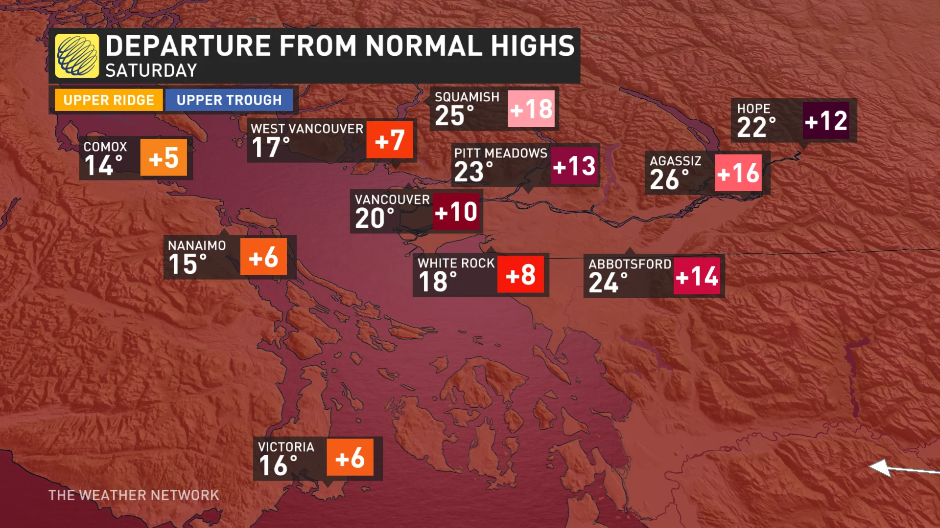
Some locations inland may even reach 23-25°C, a first of the year if we get past the 20-degree mark.
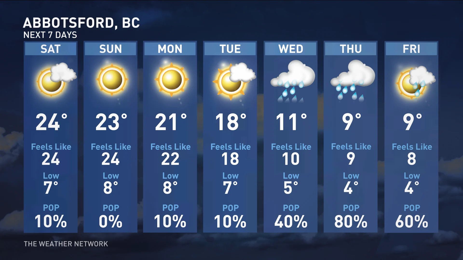
Daytime highs in Abbotsford are forecast to hit 23 and 24°C, and if we reach or surpass 23°C, it'll be the earliest occurrence for a high of 23°C or greater ever recorded in history for the city.
Temperatures later this weekend look to peak through the Interior, well into the upper teens for Kamloops, Kelowna and the Okanagan, as well.
Abundant sunshine will accompany the warming temperatures, making things feel like anything but winter across most of the region.
High avalanche danger with major weekend warm-up
While residents will be using every excuse to get outside and enjoy the weather, freezing levels will be quite high, triggering a high avalanche danger rating until Saturday at least.
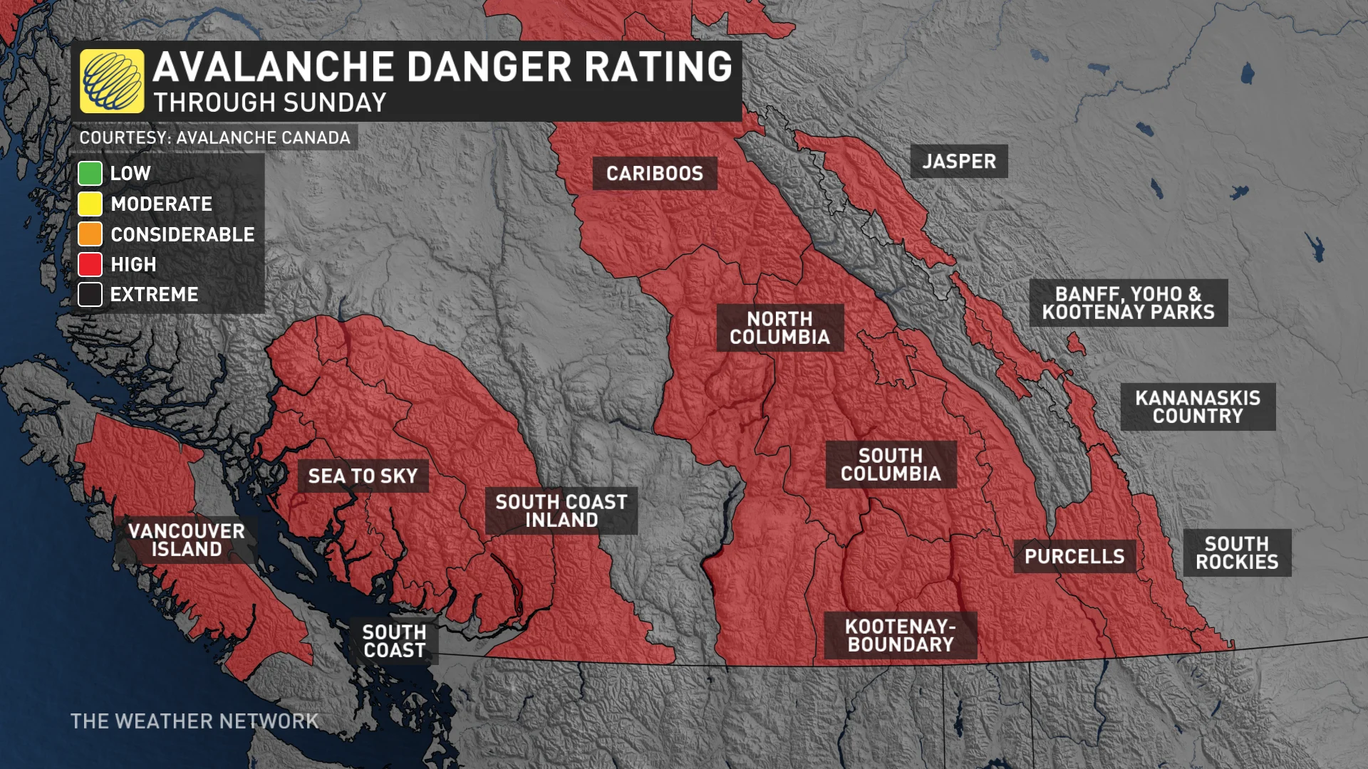
"There is a significant warm-up forecast for this weekend. It's likely that this will increase the reactivity of the persistent weak layer," says Avalanche Canada in the warning. "Smaller, wet, loose avalanches are likely and could also trigger this layer. Continue to make conservative terrain choices."
SEE ALSO: Woman survives being buried by avalanche for almost 20 minutes
The ski hills will certainly lose some snowpack with this pattern change, but there are signs to finish the month with more accumulating snowfall on higher terrain.
Countrywide cooldown closes out the month of March
Conditions will turn much colder once again by late next week, also becoming more unsettled, with a mid-week system expected. This will bring heavy snow to the central and southern Rockies and Kootenays, with significant snow also expected for the South Coast mountains, with rather low snow levels on tap.
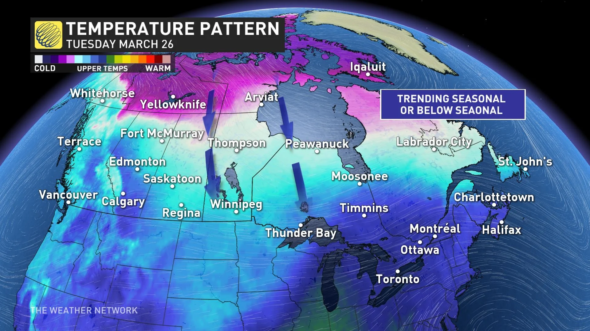
The unsettled and cooler pattern will hold strong through during the final week of March, as well, with the widespread cool down spanning much of the country.
WATCH: Surviving a tree well: The hidden danger on ski hills
Stay tuned to The Weather Network for the latest forecast updates for B.C.