Canada's permafrost line shifted 120 km north, here's why

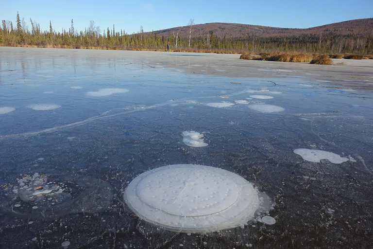
Permafrost, a layer of soil, rock, and any other subsurface Earth material that exists at or below 0 °C for two or more consecutive years is migrating.
The vast majority of this underground ice is located in high latitudes around the Arctic and Antarctic regions, but it can also be found at lower latitudes hidden in high alpine terrain.
Visit our Complete Guide to Spring 2019 for an in depth look at the Spring Forecast, tips to plan for it and much more
Permafrost accounts for 0.022% of total water on Earth and exists in 24% of exposed land in the Northern Hemisphere. As the earth warms, dramatic changes in the distribution of the subsurface ice occurs, especially in the Arctic region where temperatures are rising twice as fast as the global average.
Normally the ground would remain frozen all year, but as the average freezing lines (0oC) shift north towards the pole, so does the line marking the permafrost boundary. According to Kevin Schafer, a permafrost expert from the U.S: National Snow and Ice Data Center, the two go hand in hand, and as freezing temperatures shift north so does the frozen ground.
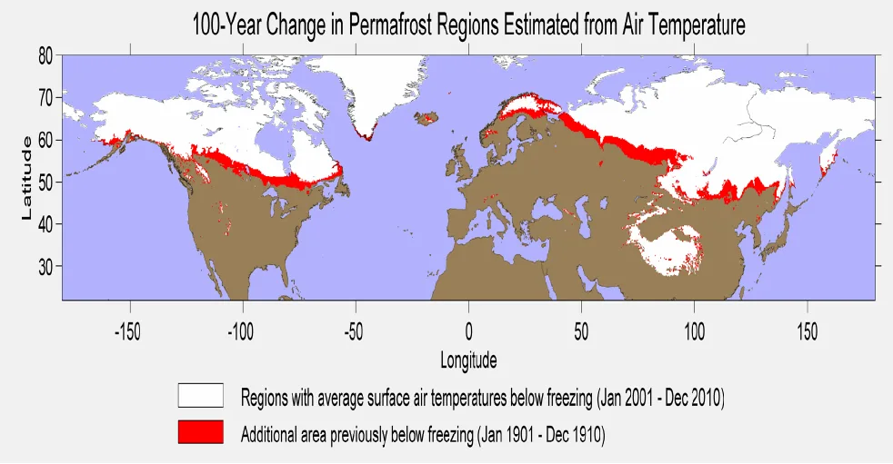
Graphic: Permafrost melt since 1900. Regions where the annual air temperature averaged 0C or below for the 1901-1910 time period are colored in red, while those areas that were 0C or lower during the 2001-2010 period are colored in white. (Courtesy: Berkeley Earth)
While ice surface change is well monitored by satellites, what happens under the surface is not so, and permafrost variations are only sparsely measured with meteorological stations. What's this means is that regions being researched for other environmental reasons are well documented when it comes to permafrost data, but others have no data at all.
A study conducted in James Bay (northern Canada) showed that over a period of 50 years, the permafrost had retreated 120 kilometers north. Schafer has studied underground temperatures in boreholes, finding striking results. Twenty metres below the surface, temperatures are increasing 1 to 2° C per decade, which according to him, is extremely rapid heating.
This trend is expected to continue and even accelerate with time. In fact, a recent study by National Center for Atmospheric Research (NCAR) scientists predicts, that by 2100, the area covered by permafrost will most likely shrink from nearly 10 million to 1 million square kilometers. This means most of Alaska and southern edge of Greenland would be permafrost free.
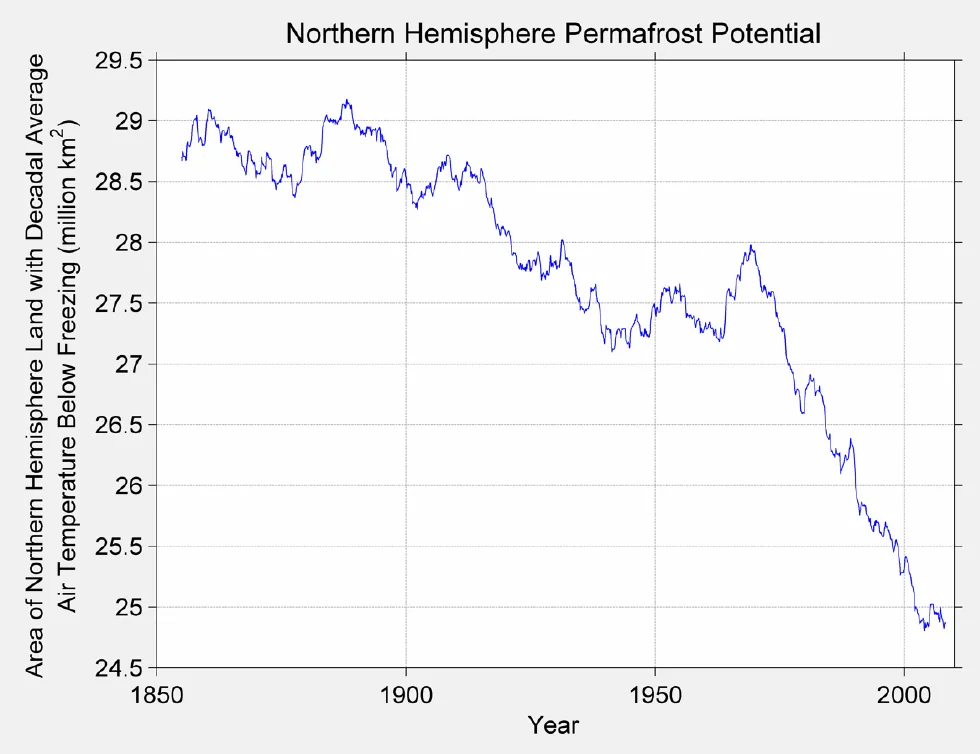
Graphic: This figure shows the decline in permafrost potential over the 1850 to 2013 time period. The permafrost potential is defined by the decadal air temperature. If the annual average temperature over a 10-year period was 0C or below, then that area was regarded as permafrost. Over the 1900-to-present time span, roughly 4.5 million sq. km of potential permafrost area has been lost. (Courtesy: Berkeley Earth)
SEE ALSO: Rare mega-storm could wash away portions of California
Changes in the permafrost layer will have local, regional and even global impacts on climate and ecosystems. Permafrost acts as a cemented surface, keeping the ground firm and water resistant.
As it thaws, however, structures begin to turn, twist and collapse. This has been observed in northern areas of Russia like Norilsk, where numerous buildings have been compromised by melting permafrost. The same has been occurring in areas of Alaska, where roads are buckling and homes collapsing.
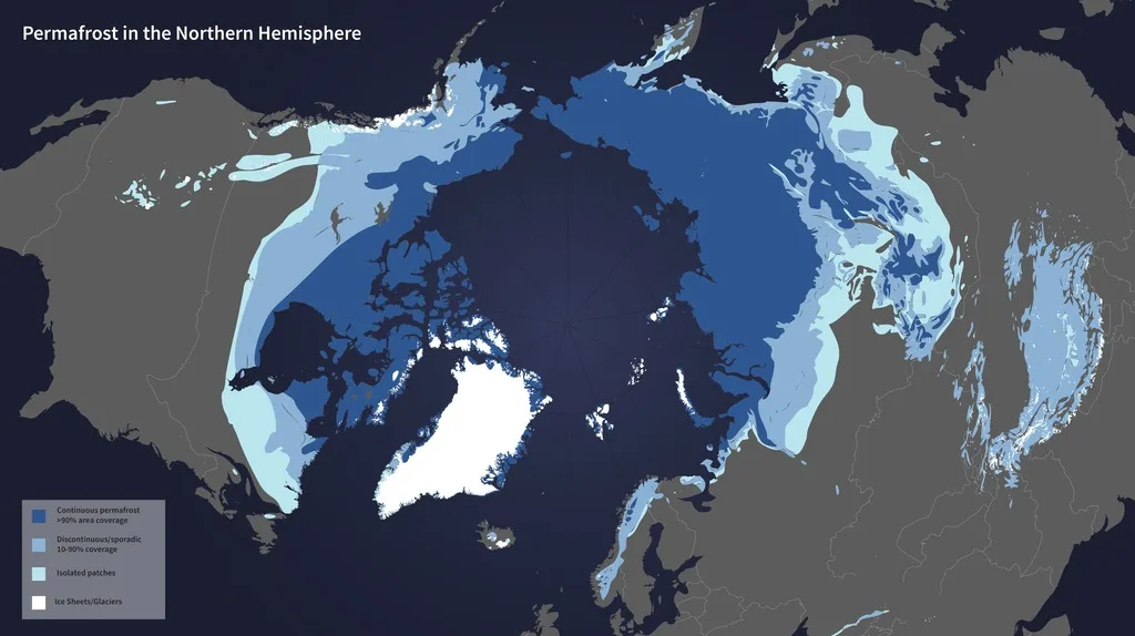
Image: NASA
On the ecosystem side of things, the thawing of large extensions of underground ice will also cause many of the thousands of lakes in the region to drain away. The new scenario would also include a tremendous amount of methane release from the now ice free subsurface, one of the main greenhouse gases that contributes to global warming.
WATCH BELOW: 'DOOMSDAY' SEED VAULT BREACHED BY MELTING PERMAFROST
Thumbnail image courtesy of NASA


