B.C.: After days of intense rain, low-elevation snow ahead

The worst of the atmospheric river will be mostly behind us by Sunday morning, but some of its effects will linger, and plunging freezing levels put snow back on the menu for parts of the Lower Mainland starting on Sunday, with a potentially larger dose next week. We break down what you need to know below.
WEATHER HIGHLIGHTS
Cold front dropping into region early Sunday brings low elevation snow risk
Very low freezing levels, falling temperatures continue into early part of next week
Keep up on weather alerts in your area.
SUNDAY: COLDER WEATHER FOR THE SOUTH COAST, SNOW LEVELS NEAR SEA LEVEL
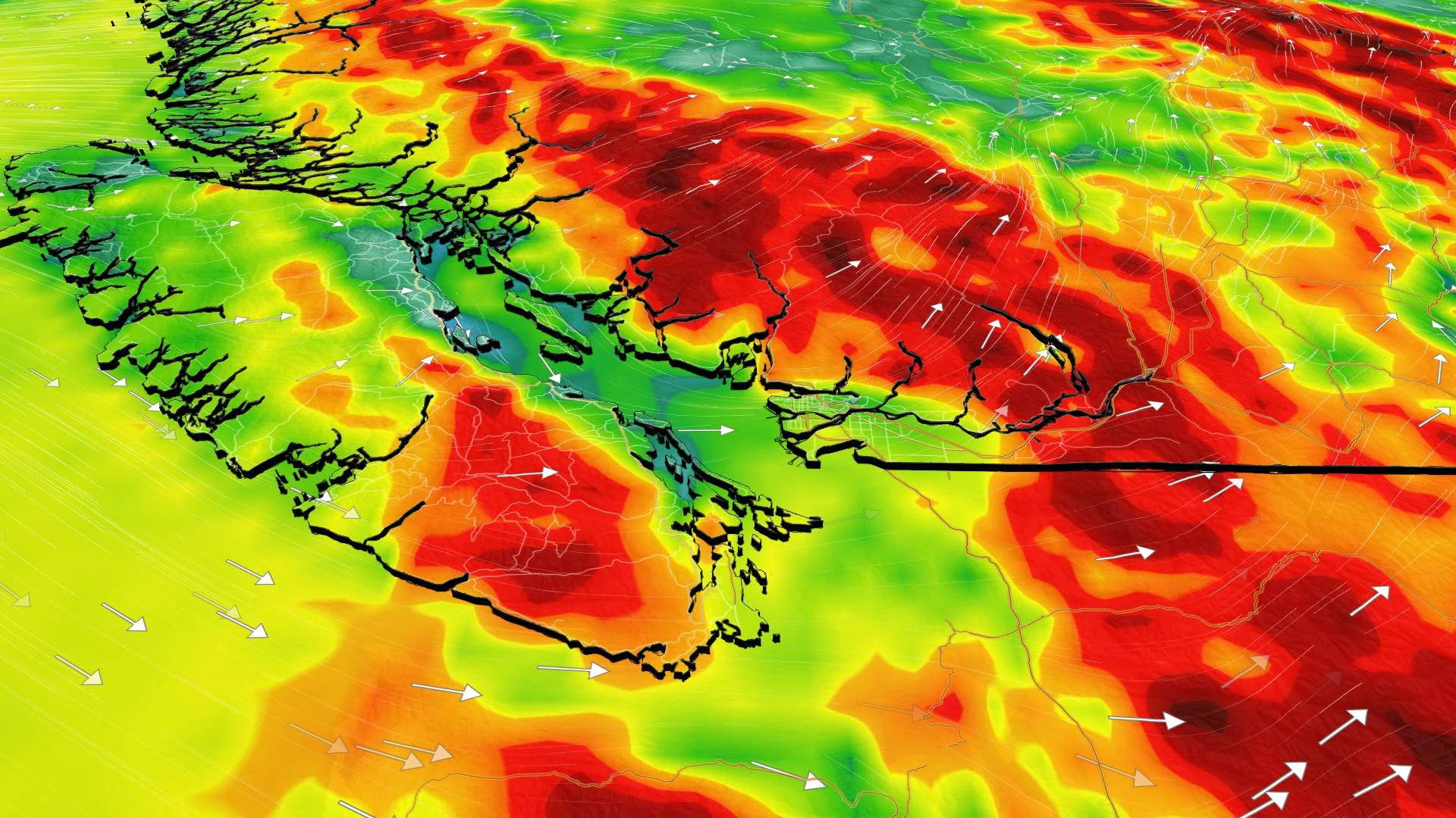
After the intense rains of the last few days, B.C. mostly gets a break Sunday, though some passing showers will linger somewhat into Sunday.
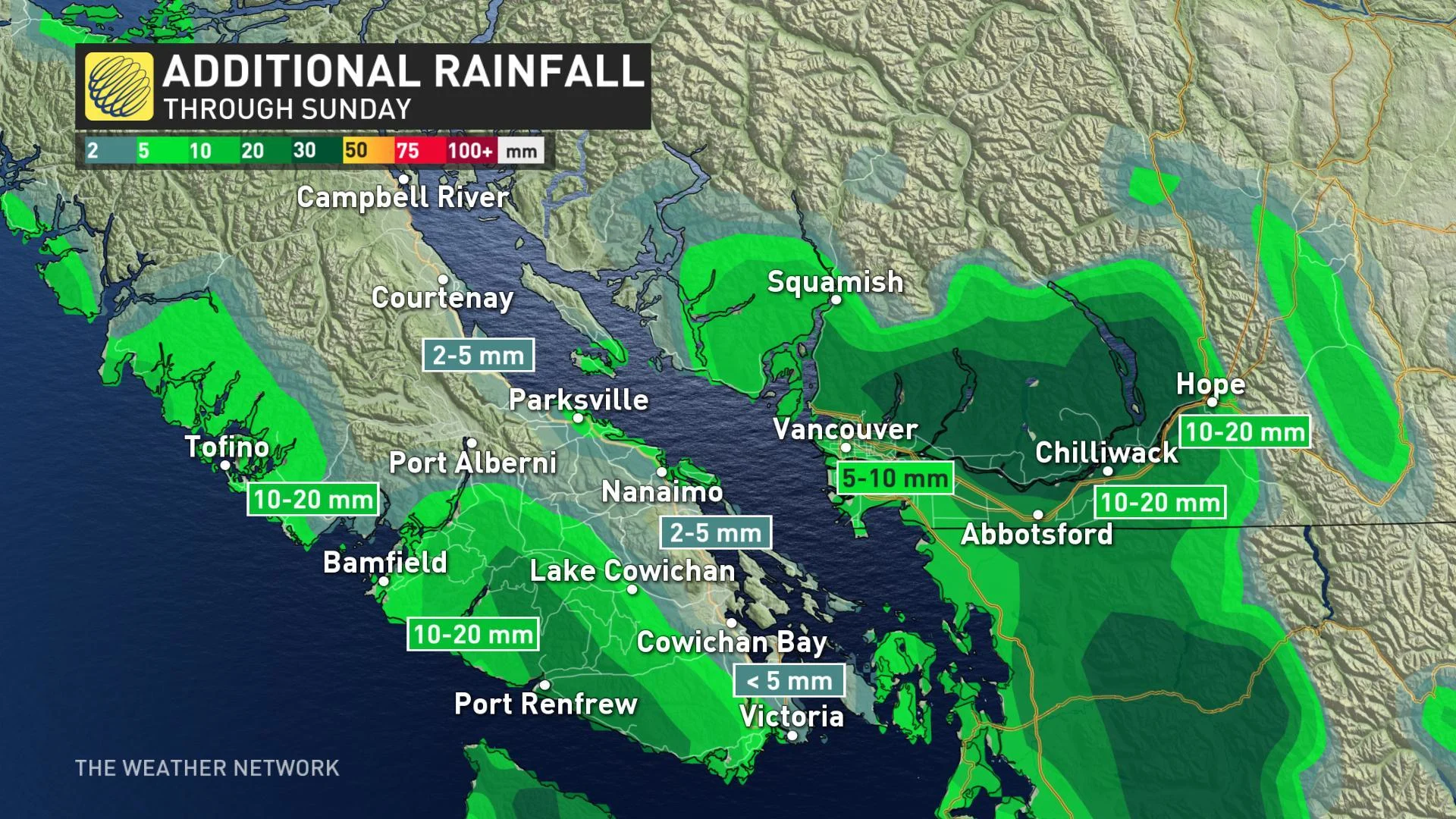
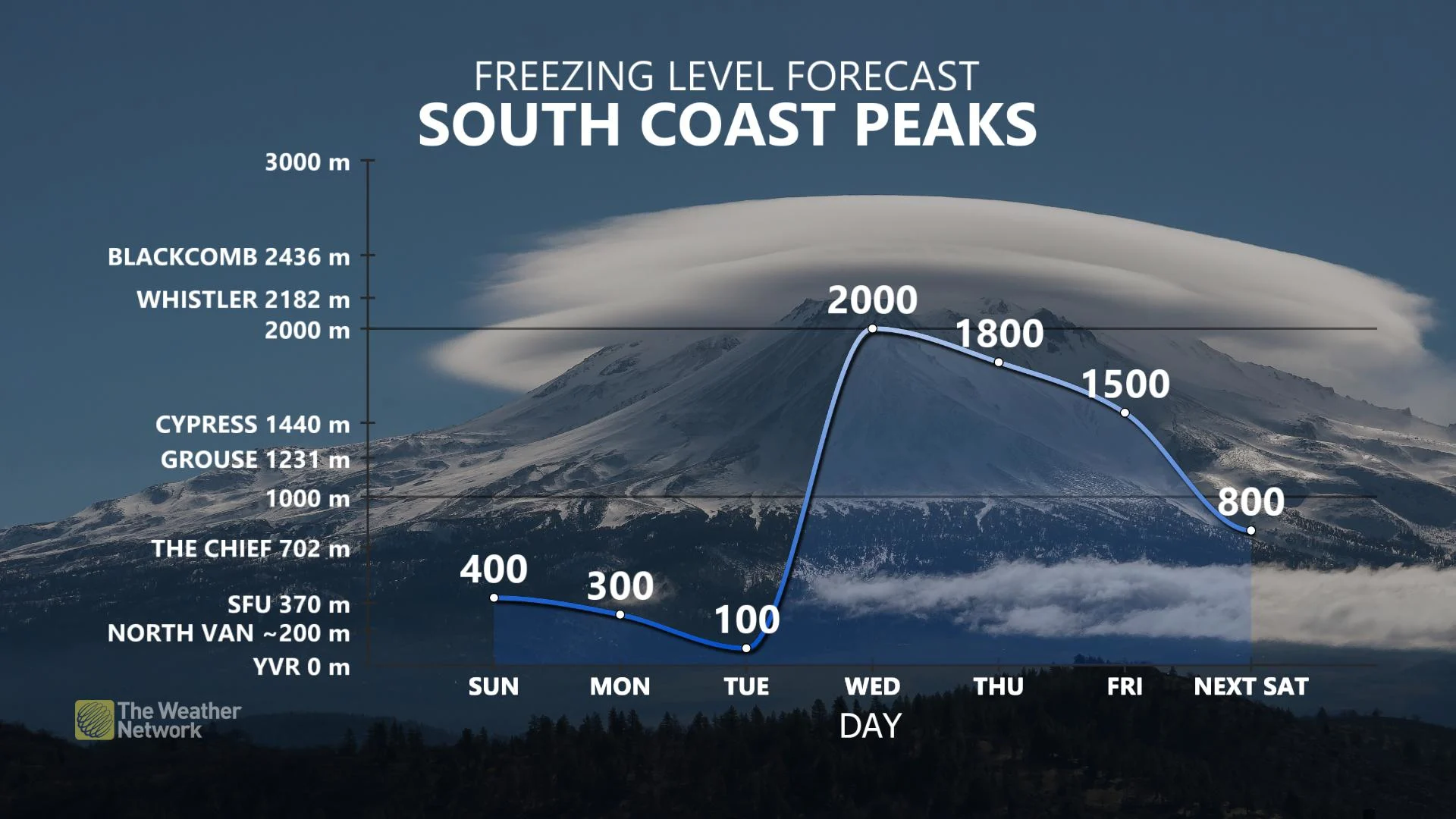
Freezing levels, meanwhile plummetted from over 2,000 metres near the end of last week down to just a few hundred metres by Sunday, making for a chance of a wet rain/snow mix for parts of the Lower Mainland as another pulse of moisture moves through early Sunday morning.
North Vancouver and higher terrain north of the Fraser River are the most likely to see a mix, but a few wet flurries aren't out of the question into places like Burnaby and Coquitlam.
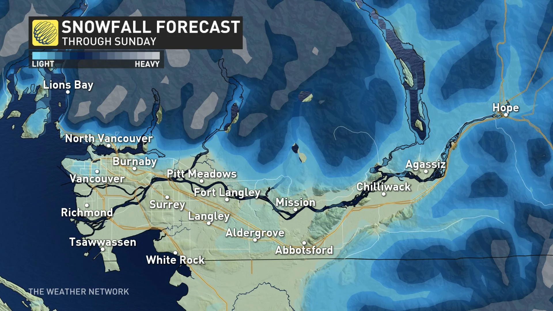
LOOK AHEAD: LOWER MAINLAND SNOW RISK RISES INTO EARLY NEXT WEEK
Freezing levels will fall even further into early next week, raising the risk of some accumulating snow across the Lower Mainland, aided somewhat by temperatures that will be just a few degrees above zero.
Snow totals in our forecast will be conservative until confidence increases, but this will be a trend to watch for Monday and Tuesday.