Chance for severe storms and heavy rain in Ontario to kick off long weekend
The start to the Canada Day long weekend won't be to the liking of Ontarians wanting to head outdoors, with a bout of steady rainfall and the risk of thunderstorms pushing through on Saturday.
The much-anticipated Canada Day long weekend has arrived, and it could kick off in a stormy fashion in many parts of Ontario.
A low-pressure system that brought widespread, heavy rain and some flooding to the Prairies will track through Ontario Saturday, bringing similar conditions.
SEE IT HERE: Your Canada Day weekend forecast holds a mix of gloom and fantastic days
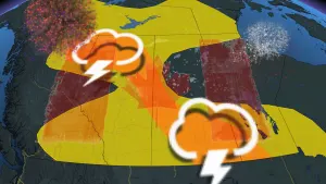
The focus will be on the rainfall, but there will be a far-reaching threat for thunderstorms, with pockets of severe possible peppered in different parts of Ontario on Saturday.
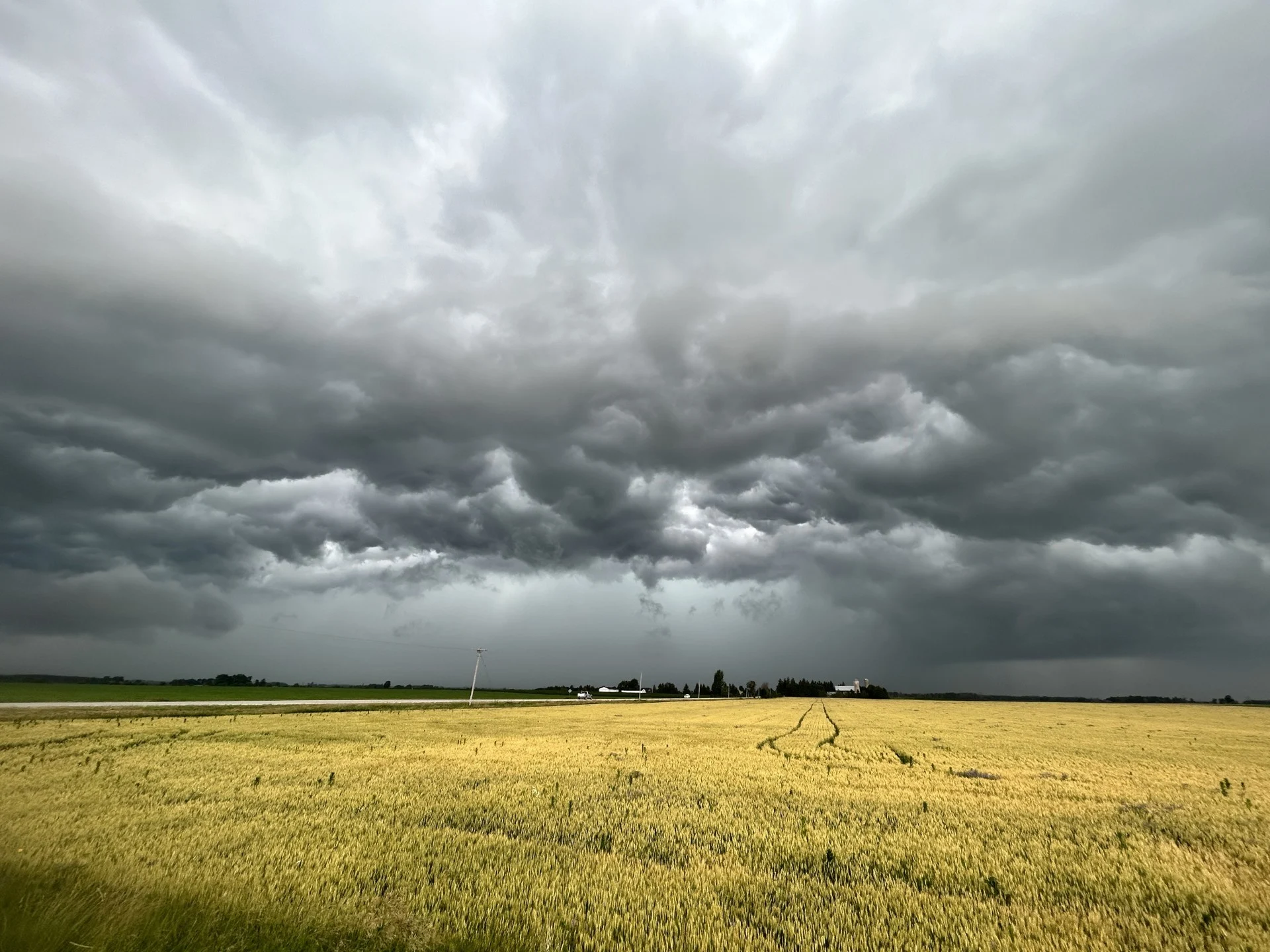
Multiple rounds of rain could soak Saturday plans
A widespread slug of steady rain washed over southwestern Ontario on Saturday morning. Multiple rounds of showers and thunderstorms will track i behind the morning’s initial rainfall.

Rounds of rain will reach the Greater Toronto Area (GTA) by midday and push into eastern Ontario toward Ottawa by the afternoon hours.
We’ll see the greatest rainfall totals along and south of the 401 corridor, where 20-40 mm of rain is expected by Sunday. This includes London and Niagara Falls. Steady rain could cause pooling on the major highway and reduce visibility at times. Be sure to exercise caution when travelling and drive accordingly.
DON'T MISS: Here's why you'll want to ditch the lake floatie this summer

Moving farther north into cottage country, rain totals will begin to taper off, with just 10-20 mm expected through the weekend.
While most of the thunderstorms tracking behind the rain should remain non-severe, there’s a chance for stronger storms to develop in northeastern Ontario, thanks to daytime heating resulting from some breaks in the cloud cover, as well as southwestern areas of the province.
These storms could produce strong wind gusts and hail.

Some weather models are highlighting the risk for a line of storms developing later in the day along the cold front near Lake Erie. However, it’ll be tough for these storms to turn severe given limited instability over the region.
Sunday will see drier weather across southwestern Ontario and the GTA, although showers will linger a bit longer in the east. We’re looking forward to more tranquil conditions in time for Canada Day celebrations on Monday.
Stay with The Weather Network for the latest on your forecast across Ontario.