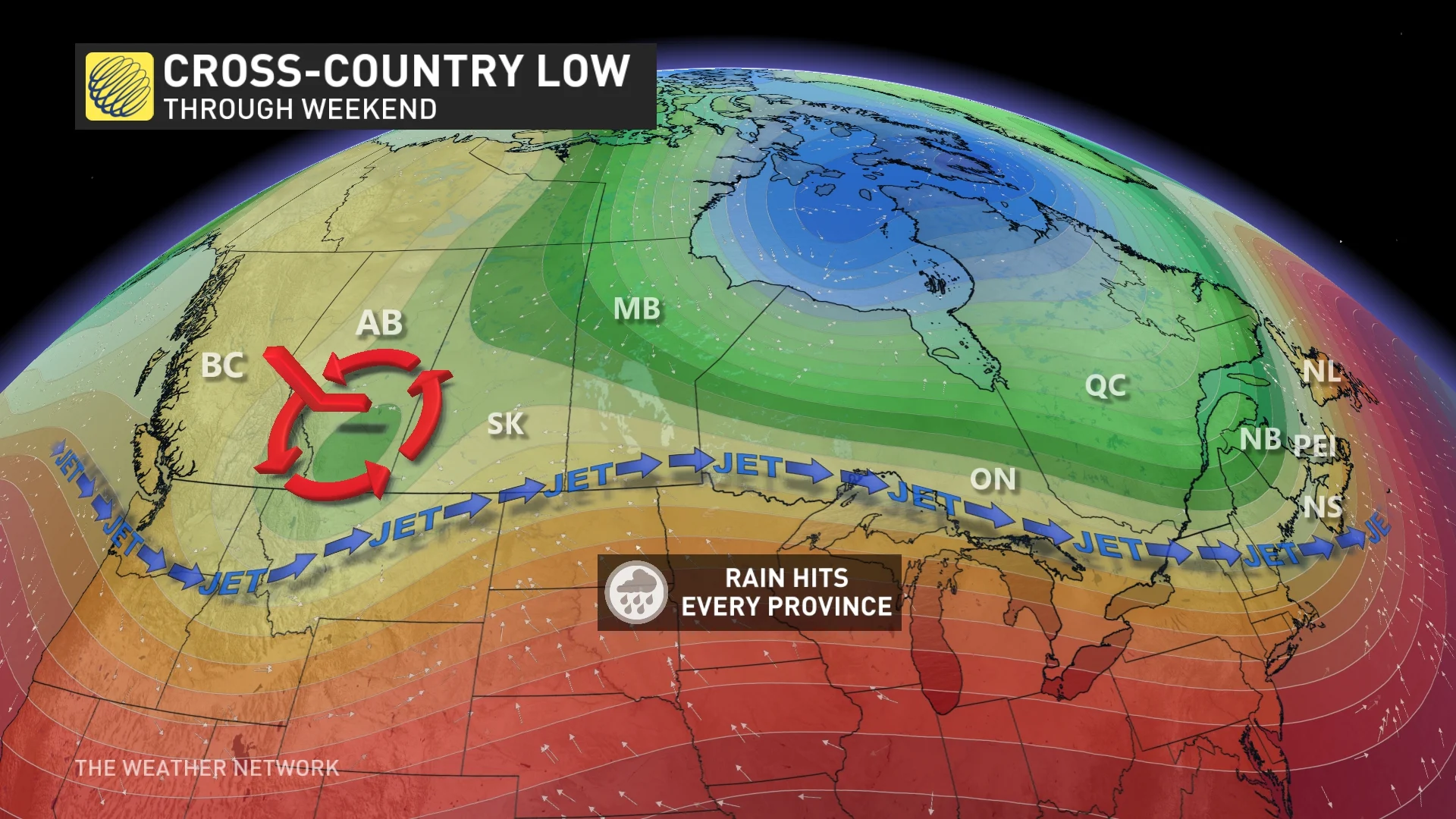
Cross-country low rains on all provinces ahead of Canada Day long weekend
Tracking the risk of rain, thunderstorms, and even snow as a low travels across the country through the weekend, and leading into Canada Day
Just as Canada gets ready to celebrate the first official long weekend of the summer, all eyes are the forecast with an overall active pattern taking hold of this final week of June.
Temperatures will also sit near, or slightly below, seasonal as we head into the Canada Day long weekend, with no consistent or extreme heat in sight through the first week of July, as well. Quite the contrast from the heat wave that scorched of much of Eastern Canada just last week.
MUST SEE: Your changeable Canada Day forecast may turn into a game of musical chairs
Several back-to-back systems will make for an active pattern for this time of year, with the risk of thunderstorms and locally heavy rain taking aim at some regions into the weekend. If your long weekend plans involve any outdoor activities, you'll likely want to continue to keep an eye on the skies for the chance of stormy conditions at times in your area.
Here's a closer look at how the week plays out.
This week: June ends with changeable conditions, and a lack of consistent heat heading into the long weekend
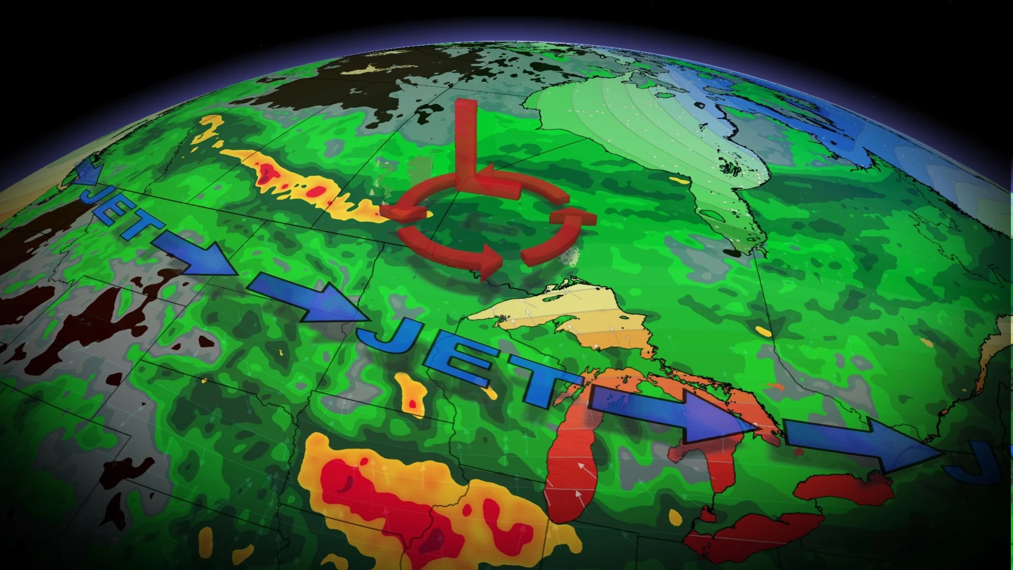
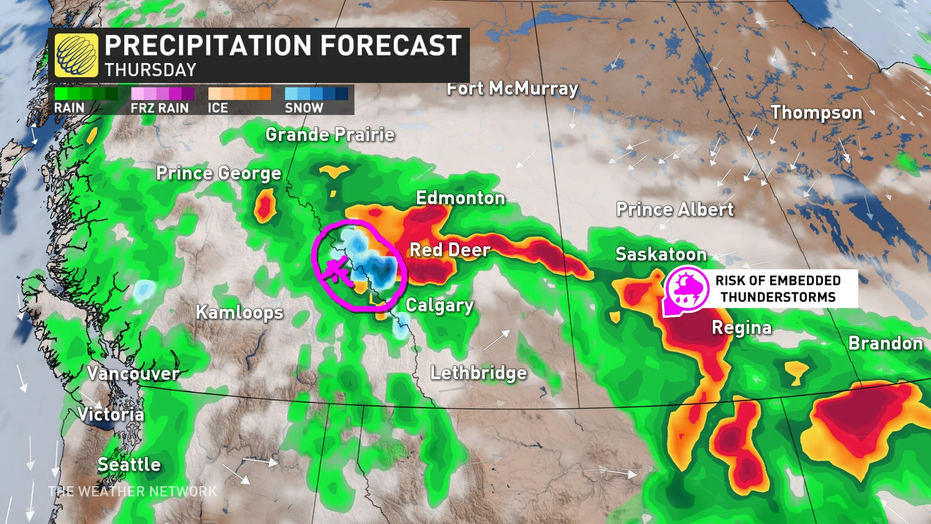
An upper trough will track into British Columbia on Wednesday, pushing east through the Prairies Thursday and Friday, where the heaviest rain is expected.
Snow will also fall in the higher elevations of the Rockies, and while not completely uncommon for late June flakes to fly, likely something you were hoping to be done with by Canada Day.
By Saturday, it's Ontario and Quebec's turn for some wet weather, reaching the Maritimes by Sunday, and ending its cross-country journey in Newfoundland on Canada Day Monday.
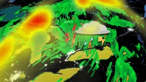
This trough will develop a low-pressure system that will bring widespread rain to all of the Canadian provinces throughout the week. It also has the potential to bring thunderstorm chances embedded within the rain to some areas.
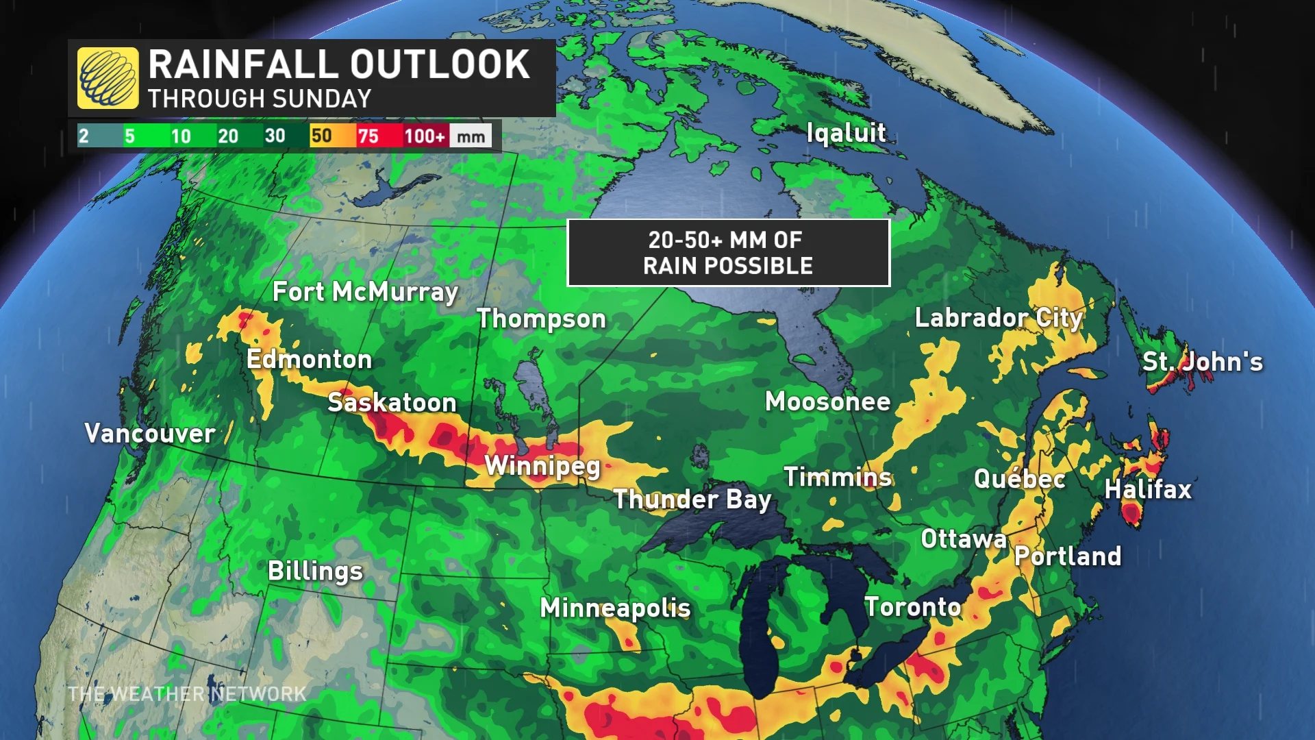
The heaviest rain is expected to fall across parts of the Prairies, with widespread totals of 30-60 mm likely. Localized totals, however, could reach 60-100+ mm for some, elevating the risk for flooding.
The persistent rain will reduce drought conditions even further in the West, but unfortunately, northern areas will remain mostly dry.
Timing wise, Ontario and Quebec will likely see a soggy Saturday, putting a damper on any early Canada Day festivities or firework displays. The same will be the case for Newfoundland, as the remainder of the rain hits the island on the actual holiday Monday.

RELATED: Here's how to plan for an amazing Canada Day fireworks display
The low will not be super strong, however, which is why wind gusts associated with it will only reach 40-60 km/h as it tracks across the country.
WATCH: The weather conditions that can make or break a firework show
Be sure to check back as the week progresses for an updated Canada Day long weekend national forecast