Storm risk hangs on over the Prairies, as totals add up with steady rain
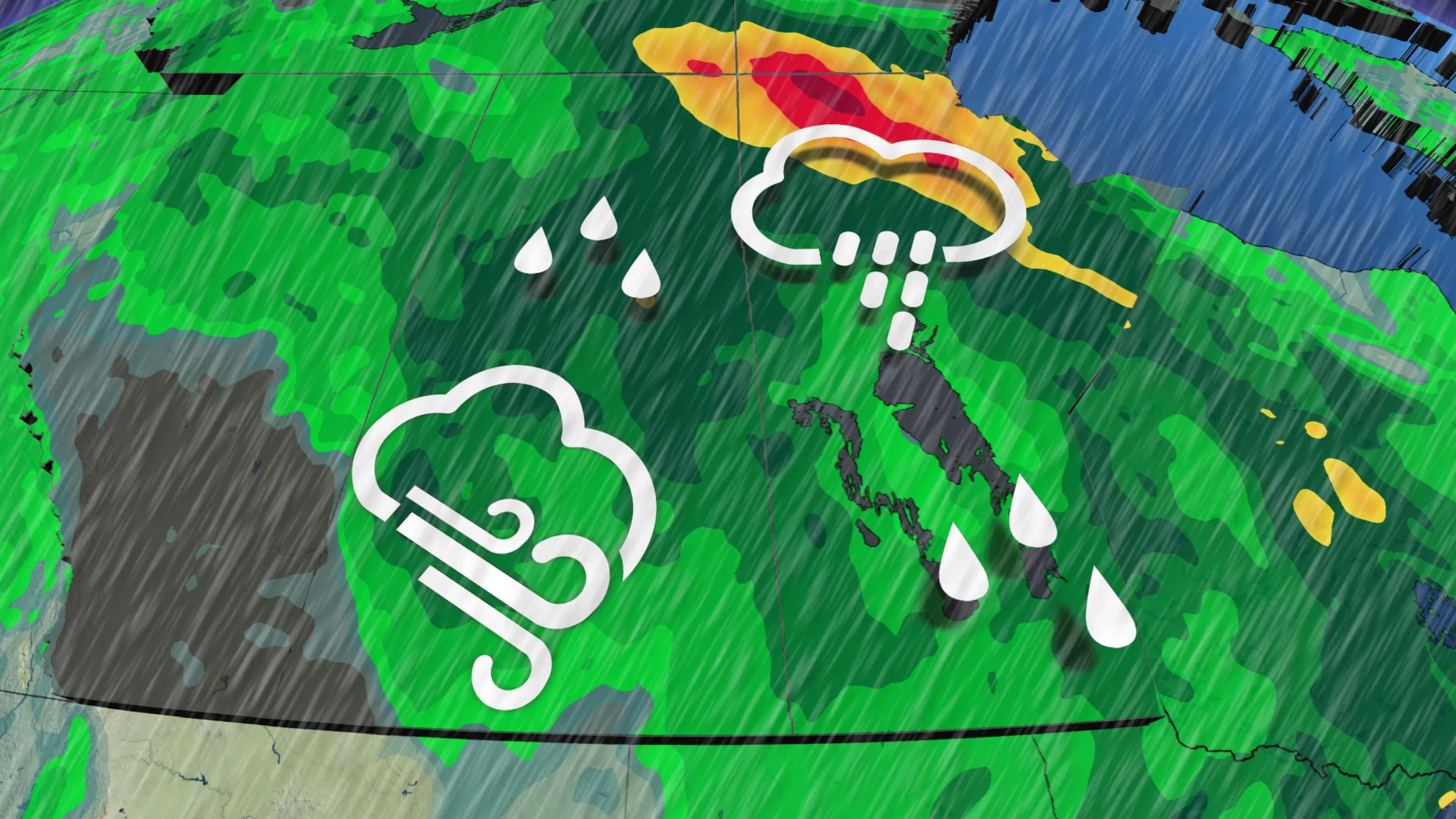
Rainfall totals continue to add up across the Prairies, as an unsettled pattern takes hold for this first week of June. The risk of thunderstorms persists into Tuesday, as well
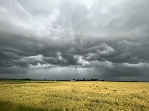
Windy, chilly, and wet weather kicks off this first week of June across the Prairies, as a large, low-pressure system brings days of rain and a lingering thunderstorm threat.
The steady rain is certainly welcome even after a soggy May, continuing to quell the wildfire threat and some of the dry conditions still ongoing in parts of the region. Some areas could see up to 60 mm of rainfall through mid-week.
SUMMER 2024: Get an in-depth look at the Summer Forecast, tips to plan for it, and much more!
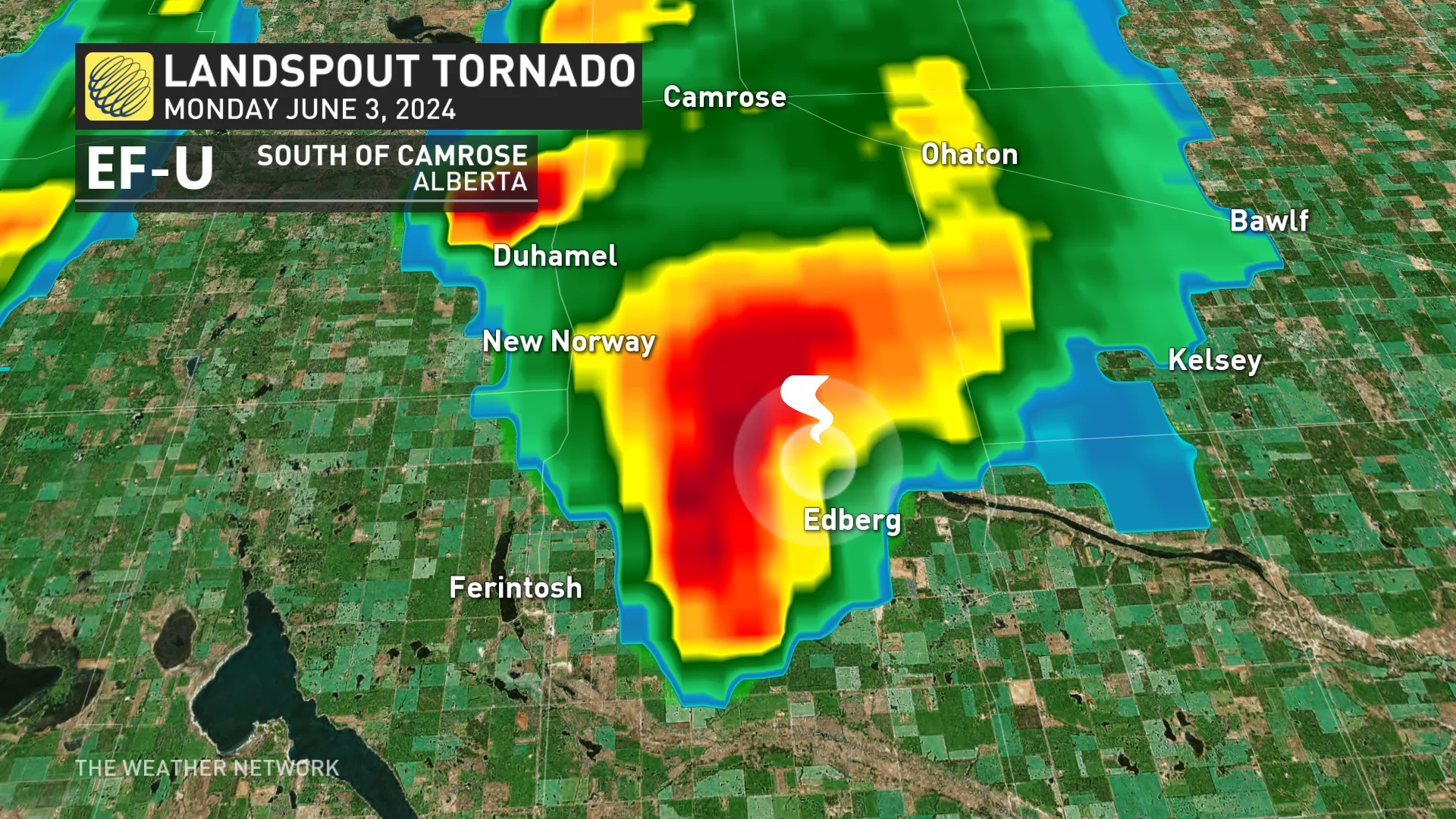
Amid the unsettled pattern, a landspout tornado was reported near the community of Edberg, Alta., south of Camrose, with some unverified reports of damage. That prompted Environment and Climate Change Canada (ECCC) to issue tornado watches for parts of the province at the time. This is the fourth tornado of the season to touch down in the province.
Tuesday should be a less active day in terms of severe storms, but there will still be a risk across sections of the eastern Prairies.
Tuesday through Wednesday: Steady rain continues as the low crawls eastwards
As the low slows down and continues to crawl eastward, the risk for thunderstorms continues across Saskatchewan and Manitoba.
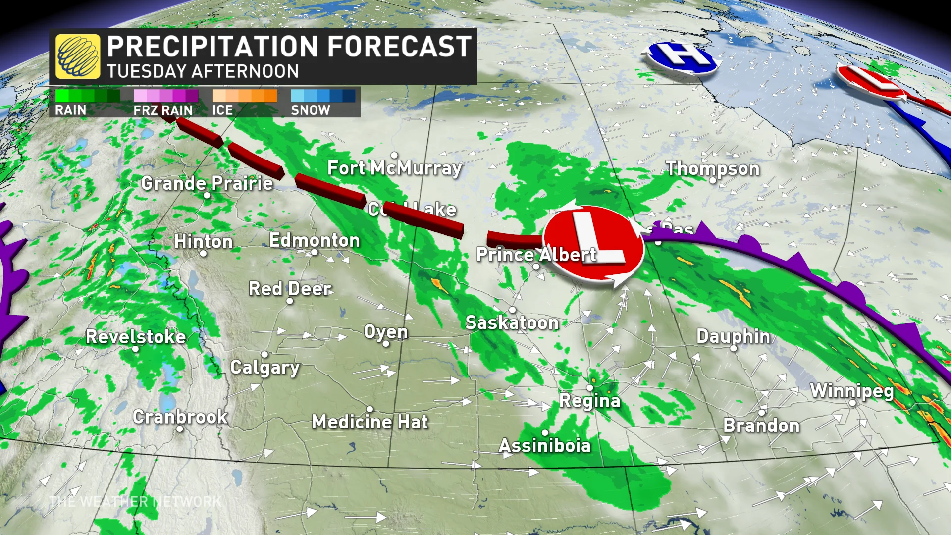
The bigger story will be the heavy rainfall on the central Prairies. The slow movement of the low, combined with a steady flow of Gulf moisture from the south, will fuel steady rainfall for the central Prairies.
Between 40-60 mm of rain is possible in central and northern Saskatchewan, while 10-30 mm is anticipated in areas along the Yellowhead Highway and locales south of it.
Highly unusual rainfall totals will spread across Churchill, Man., with a chance of a rare, all-time record being set as a result of the forecast that calls for 50-60 mm through Wednesday.
The previous rainiest day in June for the community is only 36.4 mm of rainfall, recorded on June 23, 1982. Its wettest day on record occurred on Sept. 3, 1983 with 62.3 mm observed.
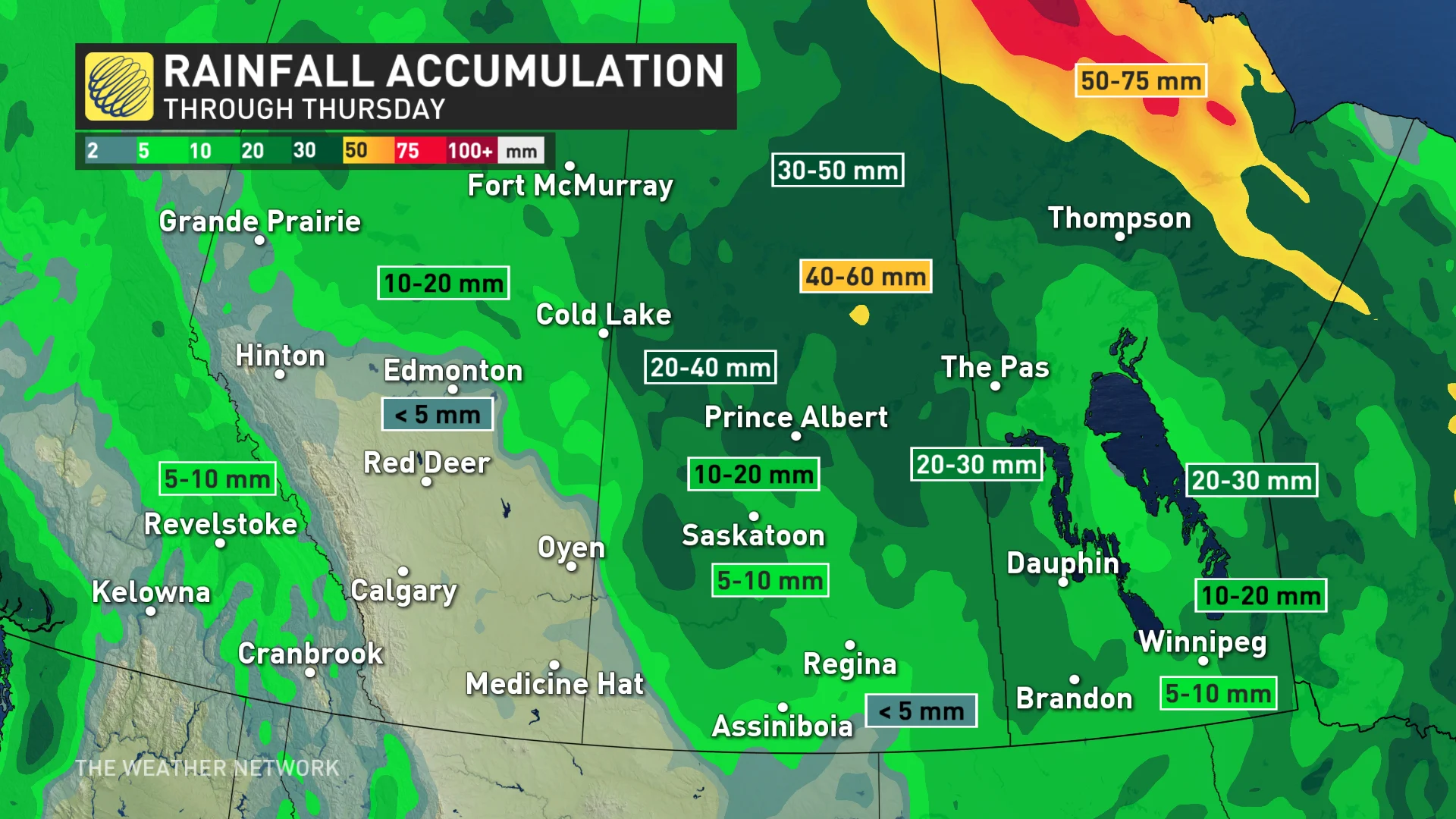
On average, 42 mm typically falls for the entire month of June in the region.
DON’T MISS: How a U.S. heat dome could bring severe summer storms to Canada
Southern Alberta should be mainly dry, and the stretch of dry weather will continue into the weekend and beyond across the region.
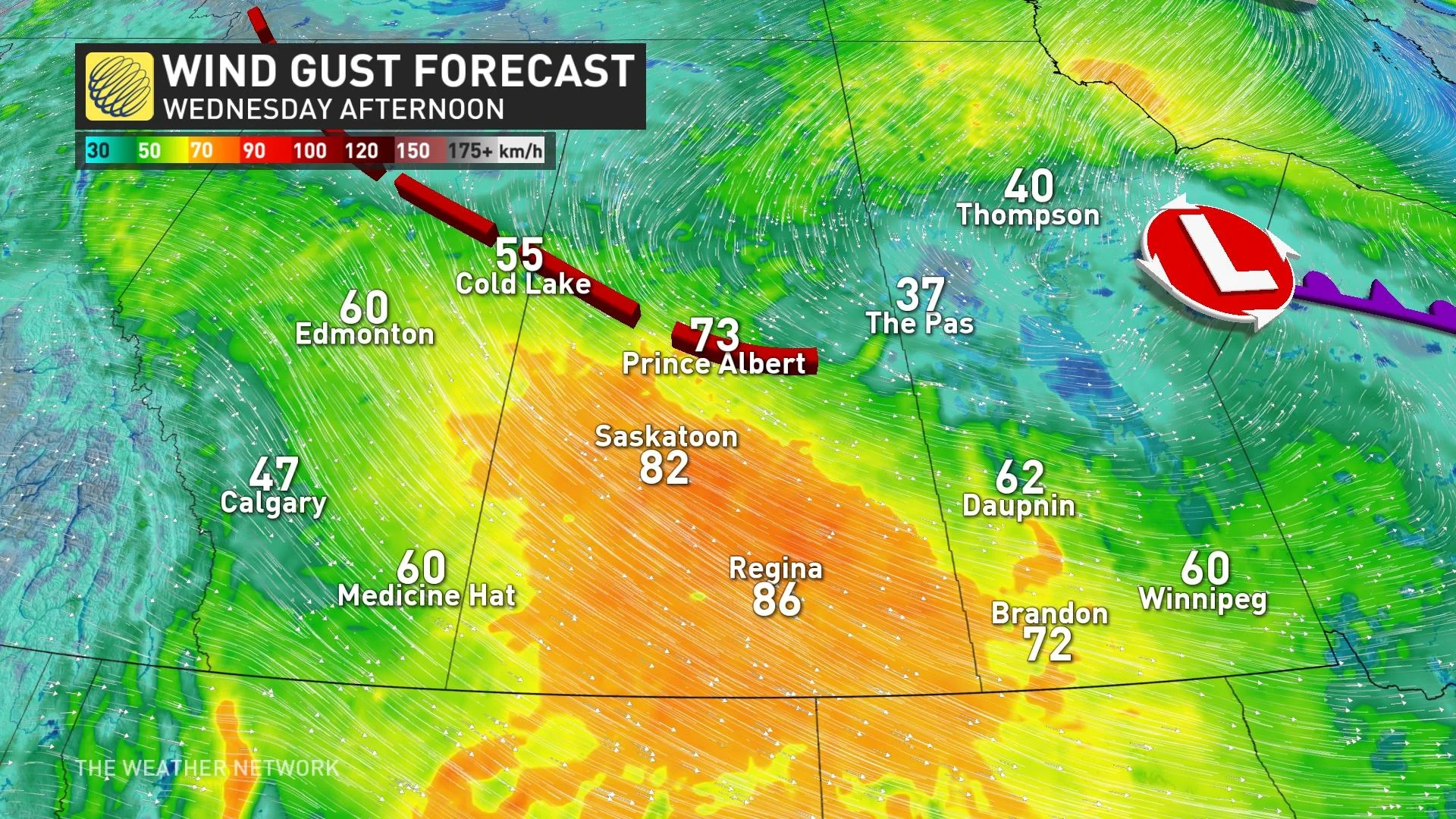
By late Tuesday, and into Wednesday, winds become a concern across the southern Prairies, with potential gusts up to 80 km/h from the northwest.
Most of the Prairies have seen wetter-than-normal conditions over the past month. This rainfall will serve to pad the totals, bringing good news for wildfire prevention and the agricultural growing season.
A drier and somewhat warmer pattern is expected this weekend and most of next week, but a low-pressure system and some more wet weather is possible early next week for the southern Prairies.
Check back for all the latest on your forecast across the Prairies.