Slick roads likely as weekend system brings Prairies snow, ice
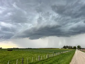
Some communities on the Prairies will face slick roads this weekend as a developing clipper promises snow and ice across the region
We’re watching the progress of a clipper that’ll threaten hazardous travel across parts of the Prairies as we begin the first weekend of November.
This developing system is associated with the same disturbance that brought plenty of rain and frozen precipitation to British Columbia earlier in the week.
We’re looking at the potential for a little bit of everything as a clipper sweeps the region. Rain, snow, and freezing rain are all on tap from Alberta to Manitoba, with some communities facing the potential for slick travel at times.
MUST SEE: Canada's November Outlook: A smooth transition or a free fall into winter?

A trough swinging across the Rockies will give rise to an Alberta clipper during the day Saturday.
This system will tap into Pacific moisture that’s following the trough over the mountains, producing a swath of rain, snow, and even some ice across the region through the weekend and into Monday.
READ ALSO: Canada’s strong jet stream creates a bomb cyclone that will hit the UK, France
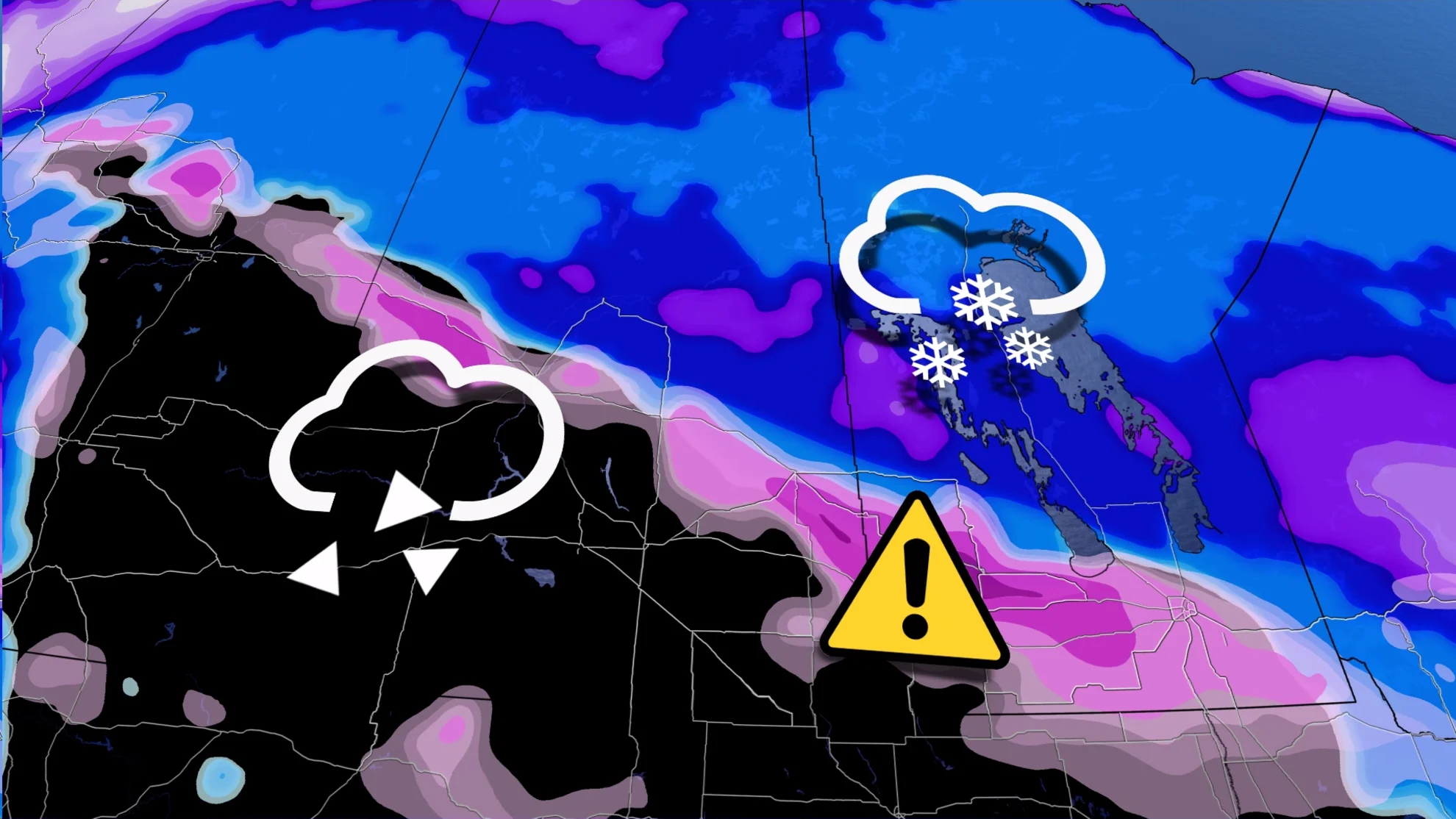
We’ll watch the clipper slide southeast out of Alberta and into Saskatchewan and Manitoba through Sunday.
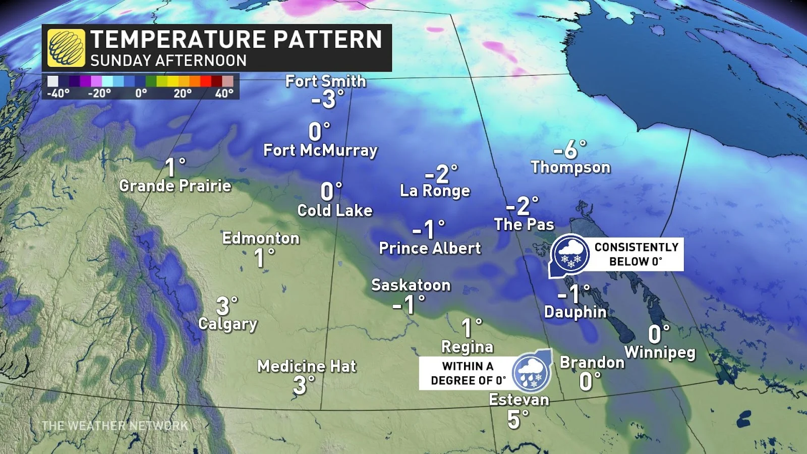
Cool air along the north side of the clipper will keep precipitation mostly snow, while communities along and south of the system’s centre will see temperatures warm enough for mixed precipitation or plain old rain.
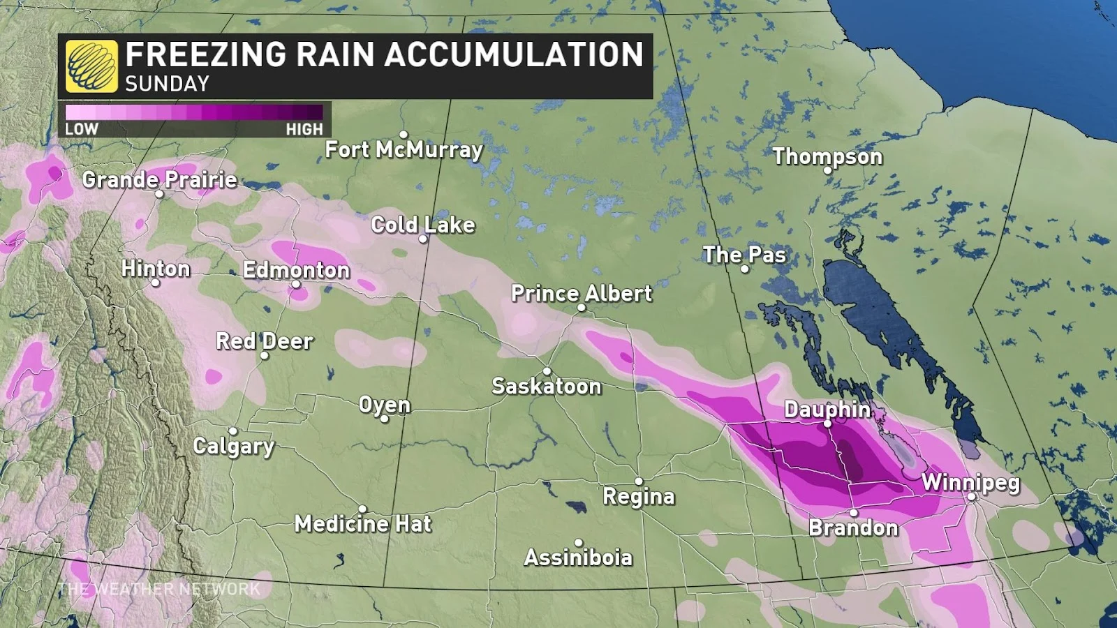
A bit of good news for travellers along the Yellowhead and Highway 1 on Sunday is that the clipper’s track has shifted east a bit. As such, Regina and Saskatoon will avoid any significant accumulation, and freezing rain should be short-lived before temperatures rise.
The greatest threat for travel impacts from snow will occur along the Yellowhead from Yorkton to Portage, and the risk for slick roads from freezing rain will be found across southwestern Manitoba.
The bulk of our clipper will move into Manitoba during the day Sunday, where we'll see a risk for enhanced snowfall totals across the Interlake region. Conditions will improve as the system pulls east into northwestern Ontario by Monday morning.
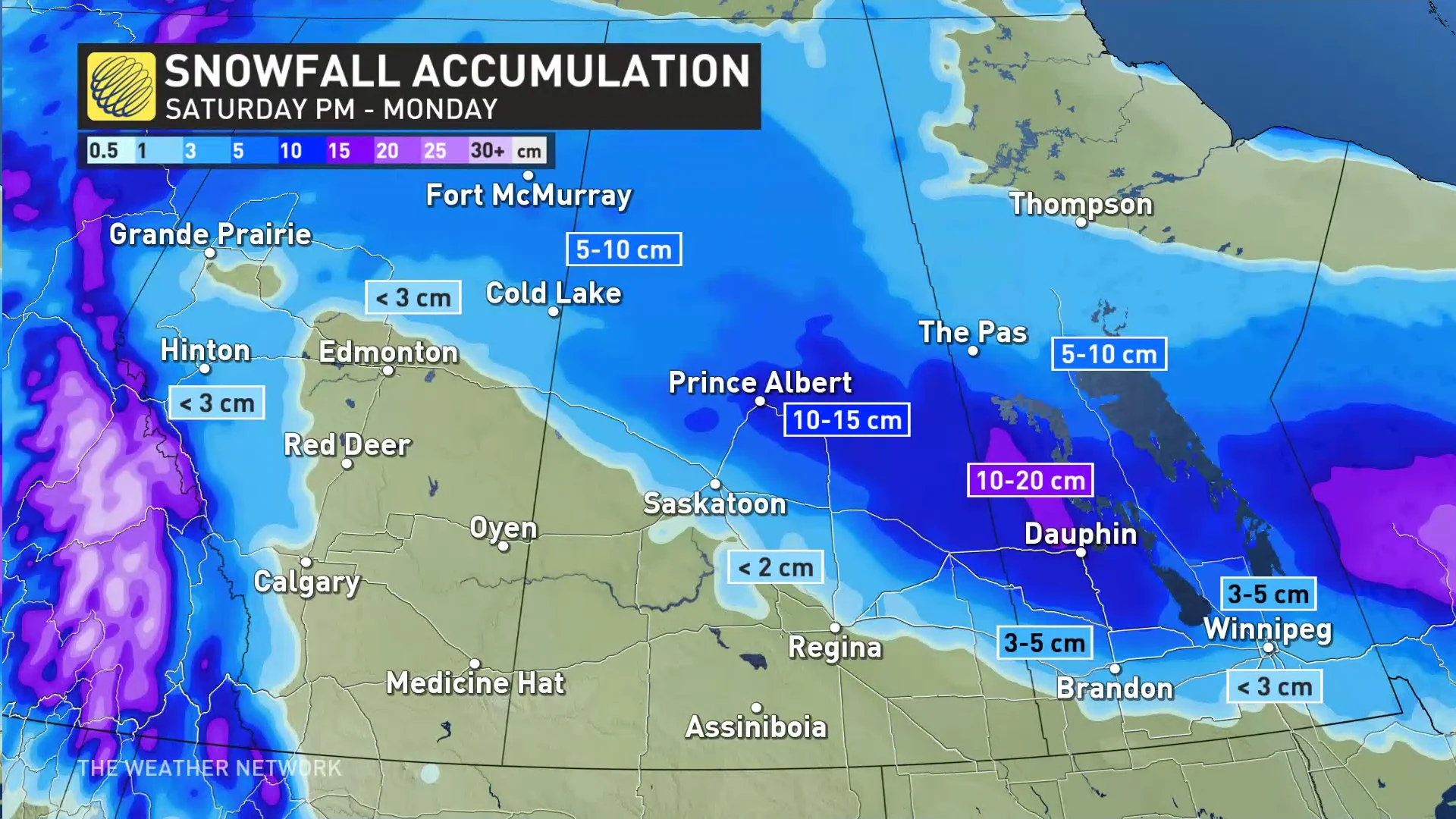
Modest snowfall totals of about 5-10 cm are likely throughout northern Alberta and Saskatchewan. Higher totals are possible across parts of central and eastern Saskatchewan and southern Manitoba. Prince Albert could see 10-15 cm of snow by the time precipitation wraps up late Sunday, while communities like Dauphin could see 10-20 cm of snow by Monday morning.
Breezy conditions are likely behind the clipper, as well, which could reduce visibility at times in areas experiencing snowfall. However, with gusts in the 30-50 km/h range, the winds shouldn’t create whiteout conditions.
Stay with The Weather Network for your latest forecasts across the Prairies.