
Potent system eyes Quebec with 15-35 cm of snow, difficult travel expected

Widespread, heavy snow will impact southern Quebec on Monday which will complicate travel throughout the day. Far-reaching totals of 15-35 cm of snow is expected, including in Montreal. Winter storm warnings and special weather statements are in place. More on timing, amounts, and what to expect through the rest of the week, below.
MONDAY: SIGNIFICANT SNOW MOVES IN FROM THE SOUTH
A low-pressure system that has been developing for days stateside will track south of the St. Lawrence River, bringing significant snowfall to the region for Monday. Winter storm warnings and special weather statements are in effect.
DON’T MISS: Why those wild weather maps you see on social media are probably bogus
Heavy snow will develop into early Monday morning over southern Quebec, including Montreal, spreading up the St. Lawrence Valley as the day progresses.
A touch of warmer air aloft over the Eastern Townships could allow for mixed precipitation at times. The intrusions of freezing rain or ice pellets will knock down snowfall totals in that area, where we generally expect to see 5-15 cm of snow.
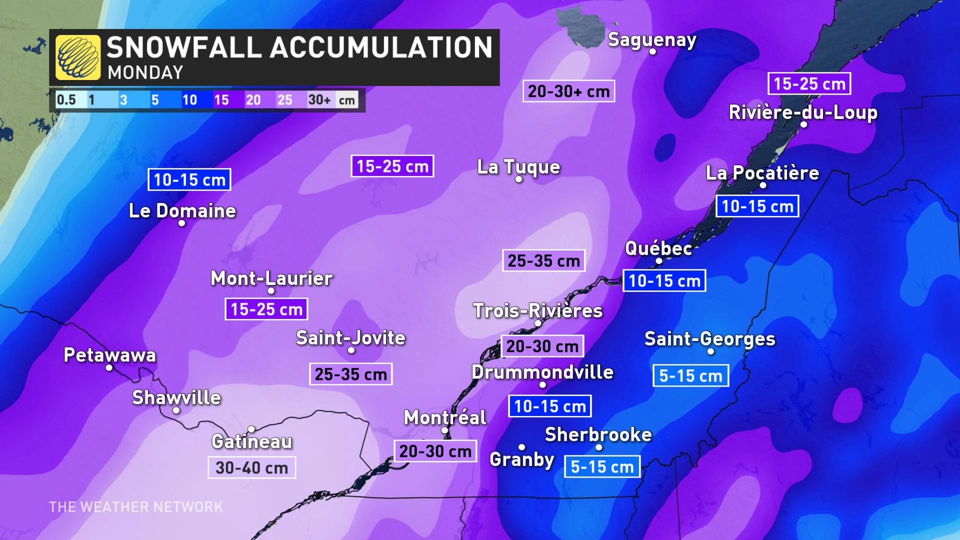
Widespread storm totals of 15-35 cm are expected across the rest of southern Quebec, including Metro Montreal. However, a tight gradient in snowfall totals will set up near the city, with a quick cutoff between bountiful snow and more modest accumulations just east of it.
Expect significant travel disruptions in urban areas during the morning and evening commutes, with snow-covered roads making travel difficult if not impossible, especially in communities expecting significant snowfall totals.
Blustery winds combined with heavy snowfall may significantly reduce visibility at times, further endangering travel across the region. Consider postponing non-essential travel.
Snow will continue through the day before easing in the overnight hours for most communities in Quebec.
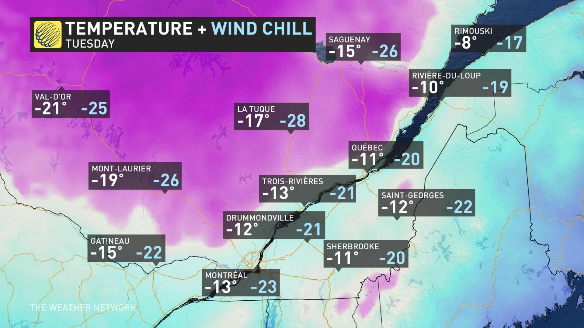
TUESDAY AND BEYOND: TEMPERATURES FLUCTUATE, BUT REMAIN COLD
Beyond this winter storm, temperatures will fluctuate a bit throughout the week across southern Quebec. By Tuesday, a northwesterly flow returns and temperatures drop well below seasonal once again.
A brief warm-up will arrive on Wednesday, bringing high temperatures into the single-digits below zero. Colder air will filter in toward the end of the week, returning daytime highs to the double-digits below zero—significantly below seasonal for the middle of January.
A clipper system could bring another opportunity for light snow to the region on Wednesday. Another chance for snow will approach in time for the weekend.
Stay tuned to The Weather Network for the latest forecast for Quebec.