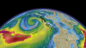
Closely eyeing Hurricane Earl's impacts over Canadian waters

Hurricane Earl will grow into a powerhouse of a storm over the next couple of days as it feasts on the warm waters of the western Atlantic Ocean.
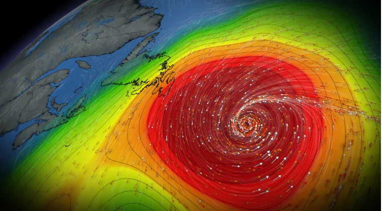
Hurricane Earl is on track to become the first major hurricane of the season as it churns in the western Atlantic Ocean. While the storm is expected to pass far to the southeast of both the Maritimes and Newfoundland, the region could still feel some effects of the growing storm as it swirls over the coming days.
Earl strengthened into a Category 2 hurricane on Thursday, ending the day with maximum sustained winds of 160 km/h, according to the U.S. National Hurricane Center (NHC).

The centre of Earl will pass very close to Bermuda on Thursday night. The hurricane’s close approach will subject the island to several hours of tropical storm conditions, with gusty winds, heavy rain, and rough seas likely during the height of the storm.
PREPARE FOR PEAK SEASON: Everyone needs a home emergency kit. Here's what to stock yours with
A tropical storm warning and a hurricane watch are both in effect for Bermuda as Earl passes close to the island. A small westward shift in the storm’s track could bring hurricane conditions over Bermuda on Thursday night.
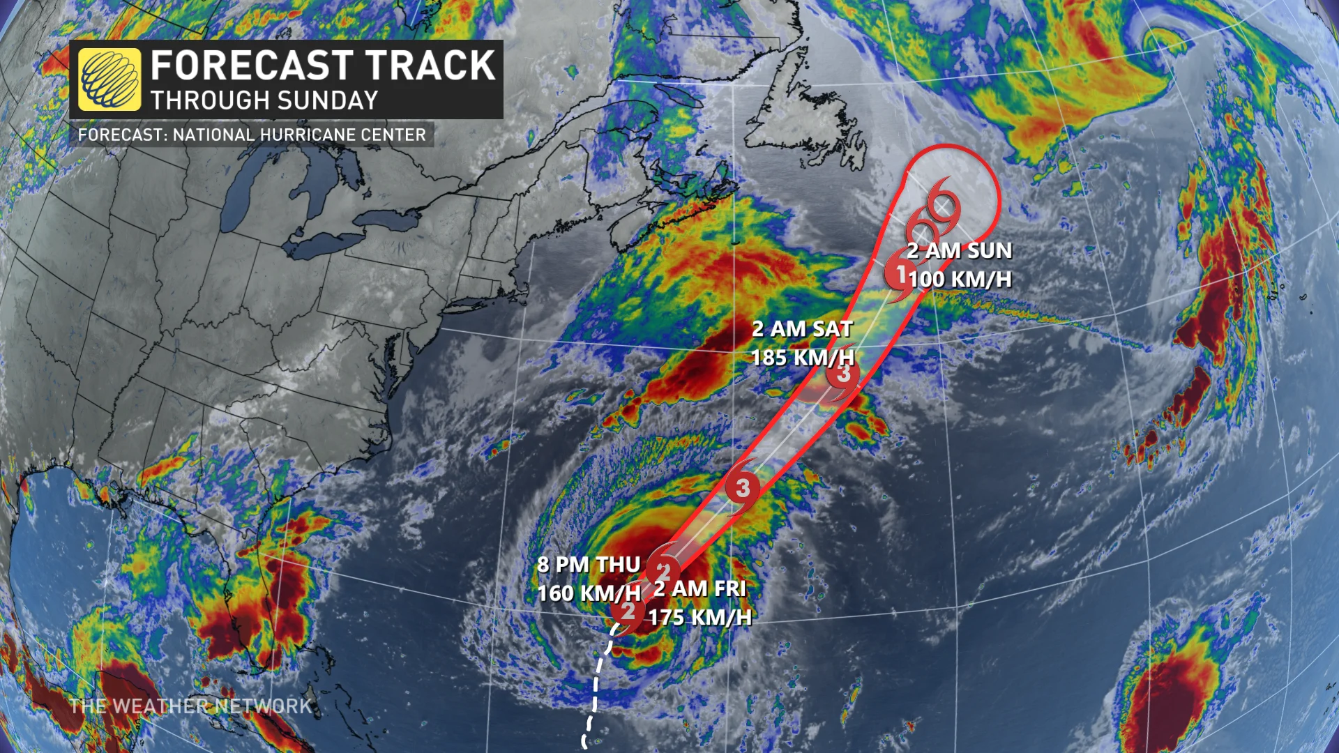
Forecasters expect Earl to grow into a major hurricane by the end of the week as the storm encounters favourable conditions across the western Atlantic Ocean. After peaking on Friday, the hurricane will slowly begin to weaken and lose tropical characteristics as it slows down offshore from Newfoundland.
Closely eyeing Canadian impacts
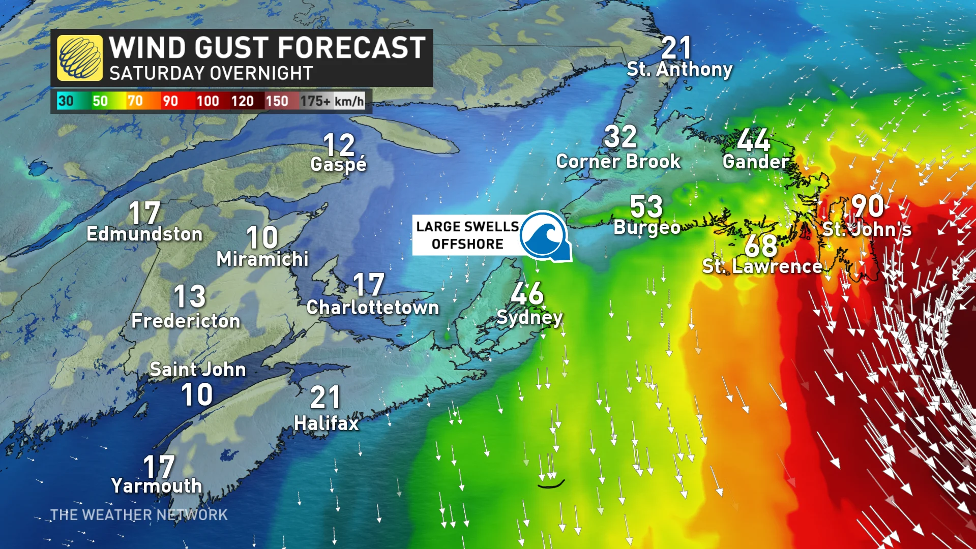
Environment and Climate Change Canada (ECCC) issued a tropical cyclone statement for the Avalon Peninsula as they monitor the hurricane’s progress.
"Ocean swells from the storm, regardless of track, will generate higher than normal surf along the Atlantic coast of Nova Scotia and southern Newfoundland this weekend," ECCC said in its statement on Wednesday.
Earl isn’t the only system we’re tracking in the Atlantic either.
The remnants of Hurricane Danielle will continue tracking east over the next few days, likely bringing a spell of foul weather to parts of the Iberian Peninsula by early next week.
The NHC also outlined two disturbances in the tropical Atlantic for potential development over the next five days. These systems remain far from land and there’s plenty of time to watch their potential development and tracks.
Stay with The Weather Network for the latest forecasts throughout hurricane season.