El Niño reshapes winter landscape: Low ice coverage in Hudson Bay

Hudson Bay takes an unusual turn with surprisingly low ice coverage
This El Niño winter is keeping us all on our toes. December has thrown all sorts of surprises. This month has featured many record breaking statistics including above average rainfall, extreme temperature records and now a lack of ice coverage in an area that normally would be frozen over. The mighty Hudson Bay.
SEE ALSO: Where did December go? Canada's winter wonderland turned upside down
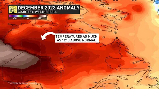
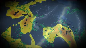
The lack of ice comes as no surprise once you look at the temperature anomaly map, showing temperatures soaring up to 12°C above normal. The prolonged warmth in this area is quite alarming, especially considering how far north it has extended this season.

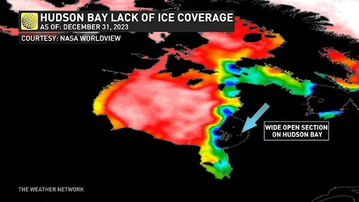
The ratio of ice coverage on Hudson Bay should usually be at 9:10 coverage according to data from Environment Canada. In many areas in the south east part of Hudson Bay there is zero ice coverage.
El Niño winters typically bring a strong warm signal to the models, resulting in reduced snowfall across most of Canada. Meanwhile, the U.S. contends with a more active jet stream in the deep south.
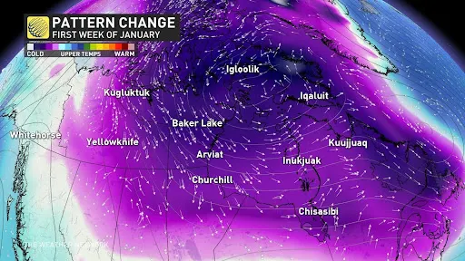
Despite being under the influence of an El Niño pattern, a substantial shift is anticipated in early 2024. Cold Arctic air will sweep across western and central Canada, triggering the reformation of ice on Hudson Bay. Expect wind chills plunging into the minus 40s, with below-seasonal temperatures making a comeback for a portion of the month.