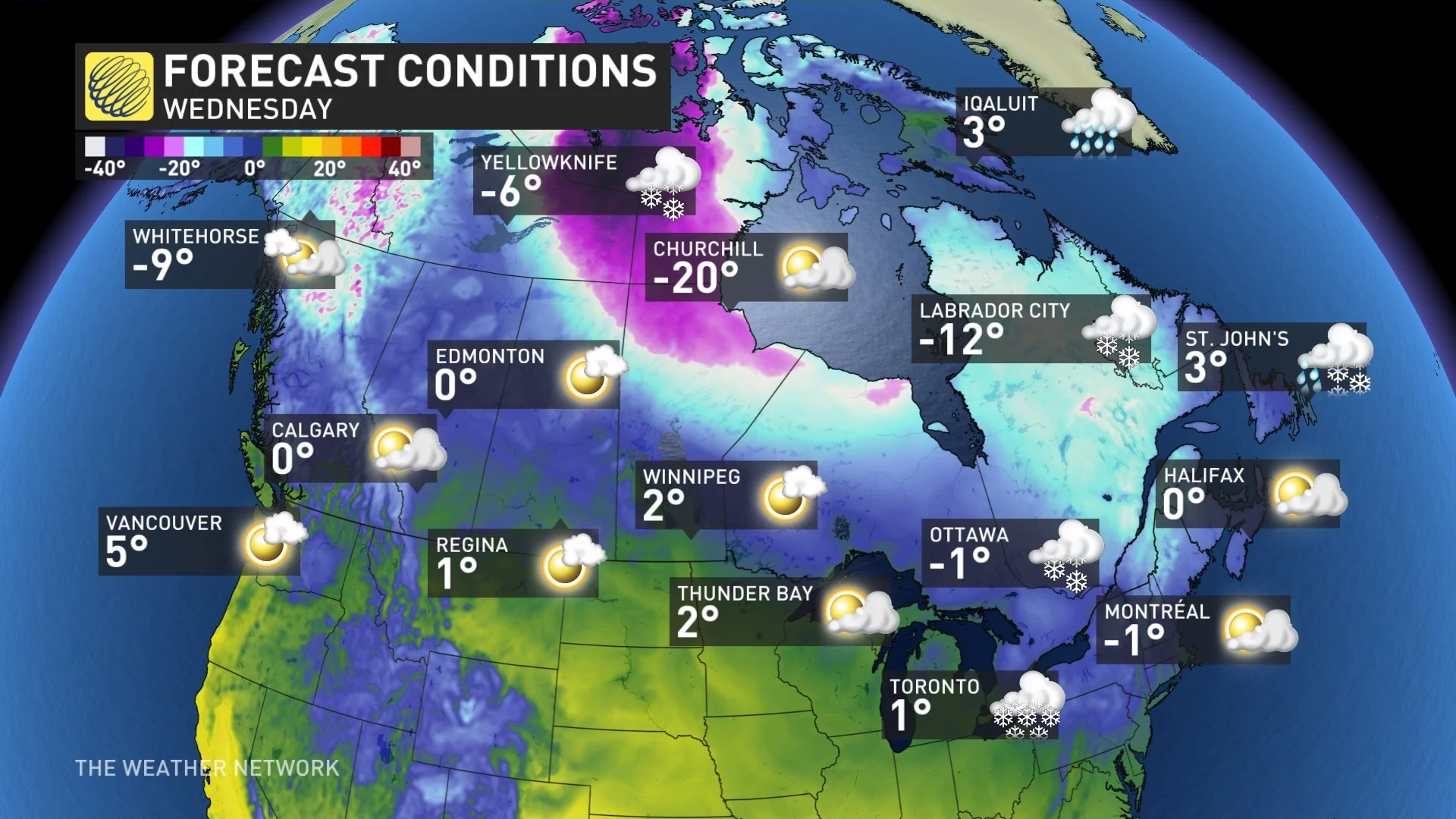
Far North city will be warmer than most of Canada and New York City

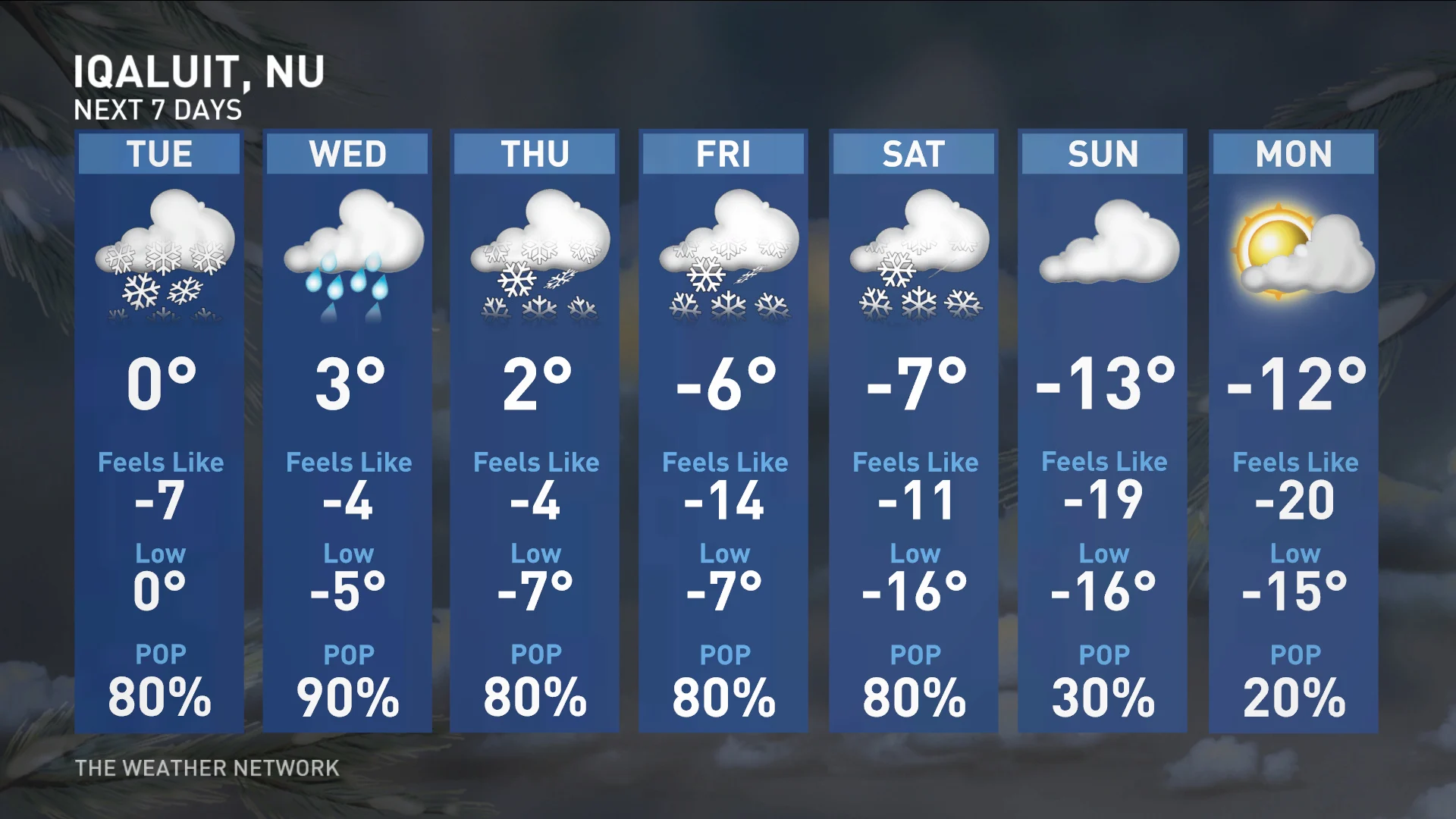
Believe it or not, Iqaluit, Nvt., will see warmer temperatures than much of Canada this week, even surpassing New York City, N.Y., with a daytime high of 3°C on Wednesday.
This week is a testament to how much of an impact the Arctic can have on regions as far south as the United States.
While it does happen from time to time, it's not often that Iqaluit, Nvt., is forecast to be warmer than most of Canada, and even some places south of the border, including New York City, N.Y., but that's what will happen on Wednesday.
DON'T MISS: Canada’s first -40°C reading a harbinger of a frigid week to come
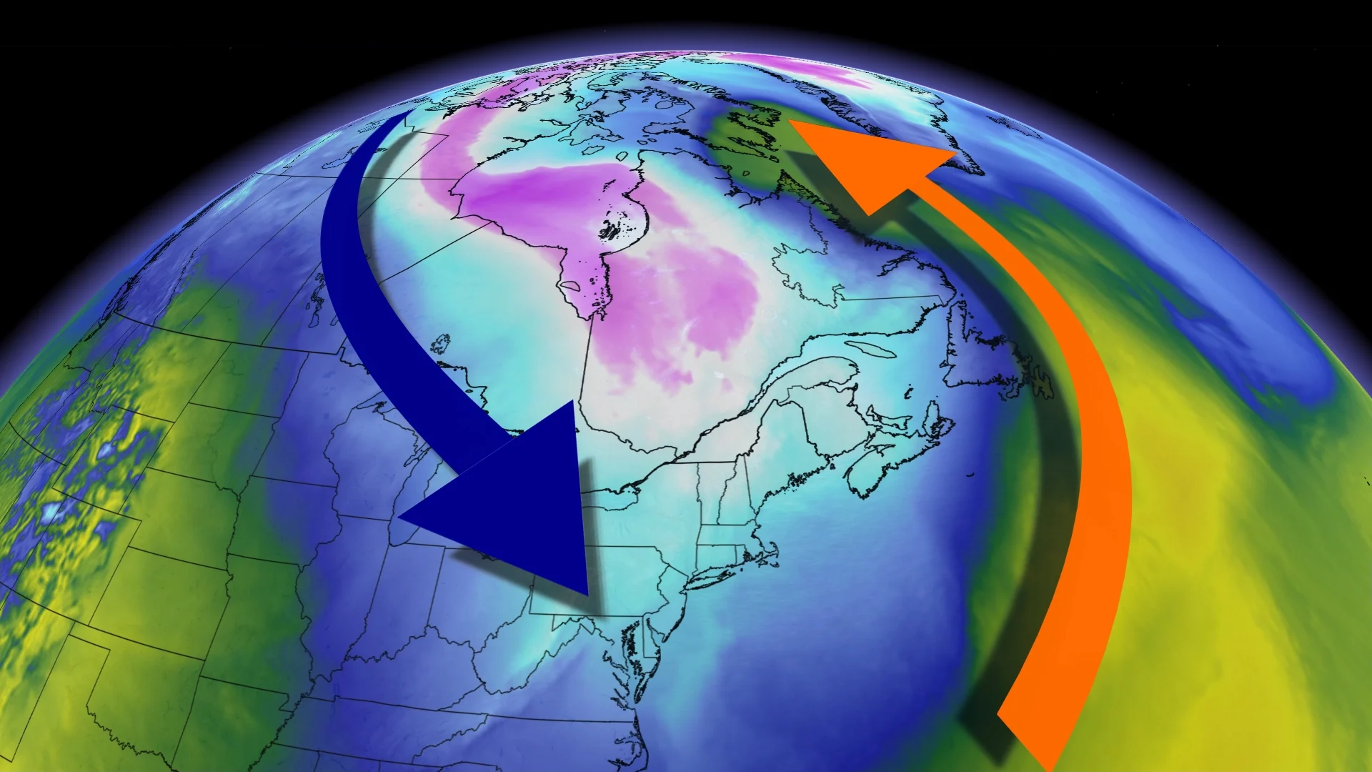
The cause is from a trough over top of Eastern Canada that is bringing the cold air to southern Ontario and New York, while also responsible for the above-seasonal temperatures in Iqaluit. Northwesterly winds are bringing some of the coldest air of the season to southern Ontario and New York, with both geographic locations sitting approximately two degrees below normal.
This same trough is what is ushering cooler temperatures to the Prairies, also be colder than Iqaluit. That isn't as abnormal since the Prairies' average temperatures for this time of year are closer to -5°C.
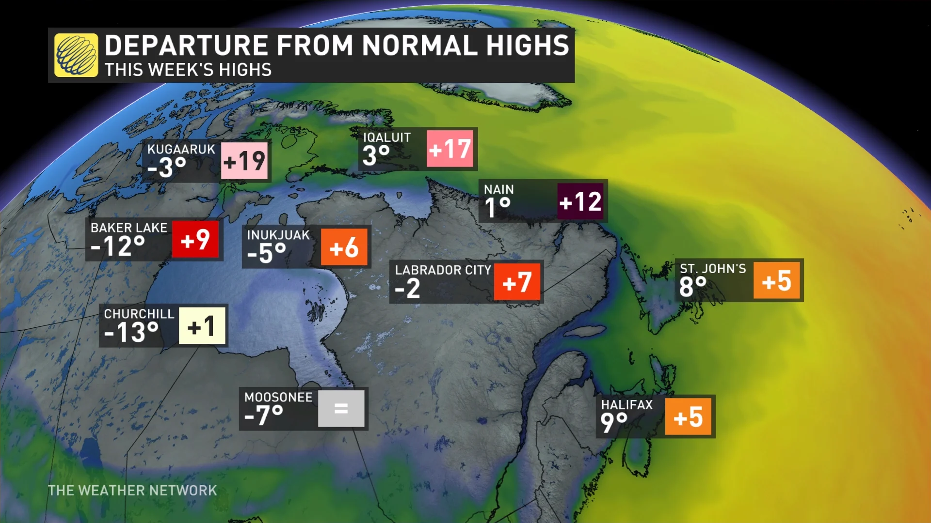
What is more interesting and important is the temperature anomaly for Iqaluit –– 17°C above normal –– at this time of year. The average temperature is -14°C. These warmest temperatures are caused by southerly winds, allowing for warmer air to filter in.
On Wednesday, Toronto is forecast to 1°C, New York City is anticipated to reach 2°C and Iqaluit is expected to top out at 3°C.
Once the trough moves to the east and the winds shift to the northwest, temperatures in Iqaluit will drop back down closer to seasonal this weekend as daytime highs in southern Ontario warm up a bit.
With files from Matthew Grinter, a meteorologist at The Weather Network, and Nathan Howes, a digital reporter at The Weather Network.