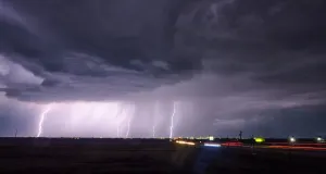
Flood concerns grow as Florida deluge threatens 200+ mm of rain
Drenching rains are likely across the southern half of Florida this week
A slow-moving, unnamed tropical disturbance will wring out a vast reserve of deep moisture over the Sunshine State this week, threatening parts of Florida with triple-digit rainfall totals by the weekend.
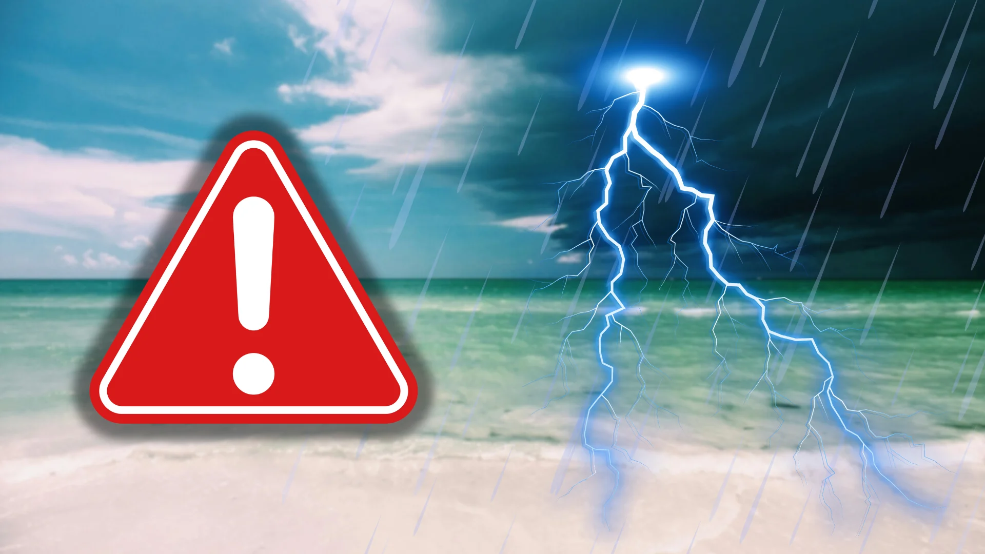
Localized flooding is likely throughout southern Florida as waves of heavy rain wash over the region. A severe drought across some of the affected areas may exacerbate flooding in spots.
DON'T MISS: The Atlantic Ocean’s high fever could fuel an ugly hurricane season
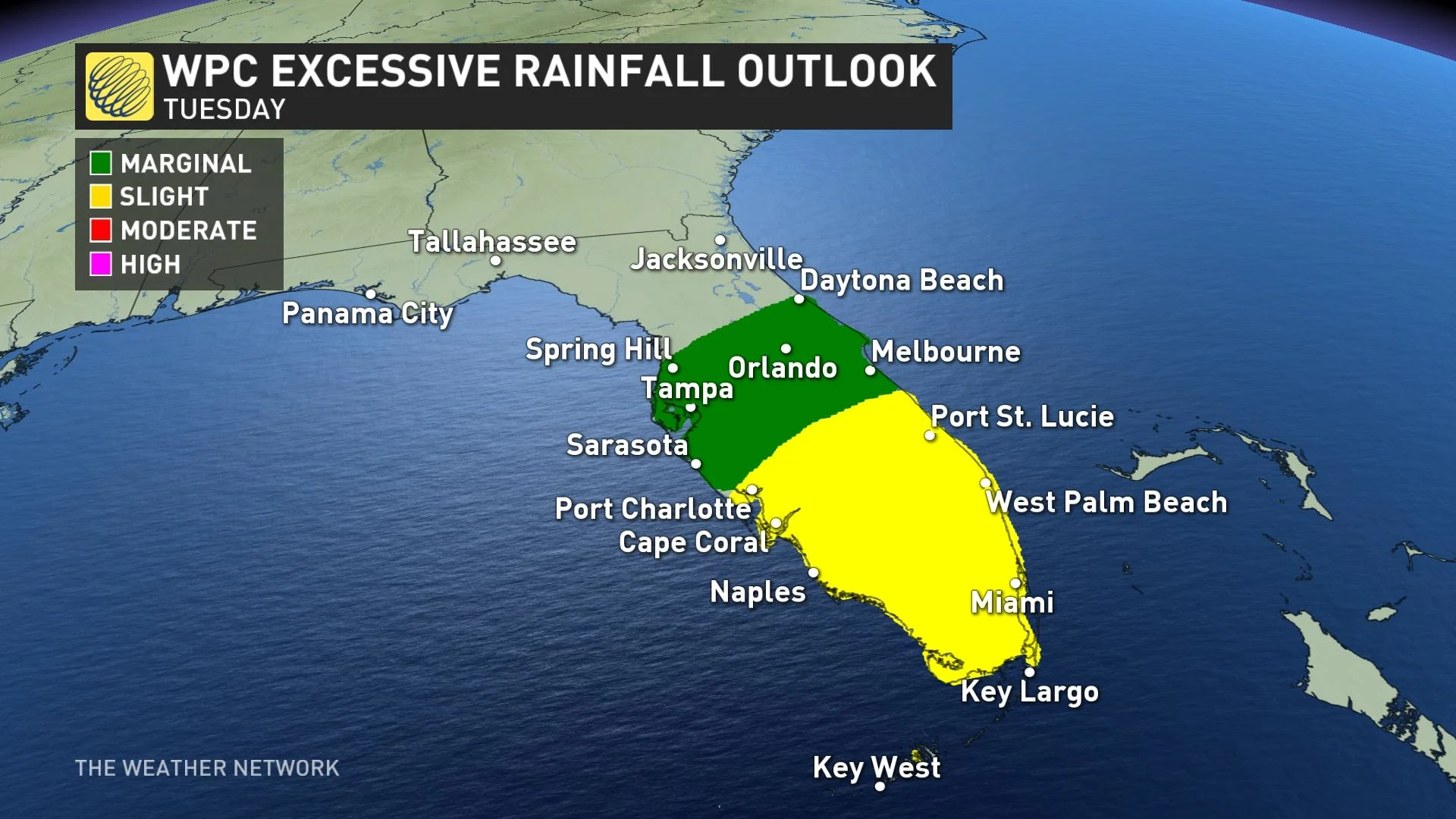
High pressure, bringing warm weather back into Ontario, will help to stall a stationary front over Florida beginning Tuesday. This will result in slow moving thunderstorms with high rainfall rates.
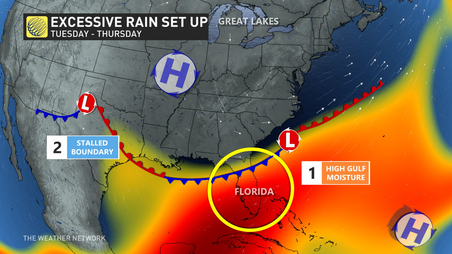
Forecasters are monitoring the risk for very heavy rainfall over the week as a tropical disturbance moseys into the eastern Gulf of Mexico.
This system, which the U.S. National Hurricane Center currently doesn’t expect to develop into a full-blown tropical cyclone, will have access to copious amounts of tropical moisture as it lingers over the region.
The U.S. National Weather Service office in Miami said on Saturday that moisture values over southern Florida will approach the highest values ever recorded around this time of year.
Any showers or thunderstorms that develop in this environment will have a deep reservoir to tap into and produce drenching rains in short order.
RELATED: Tropical systems don’t need a name to trigger devastating floods
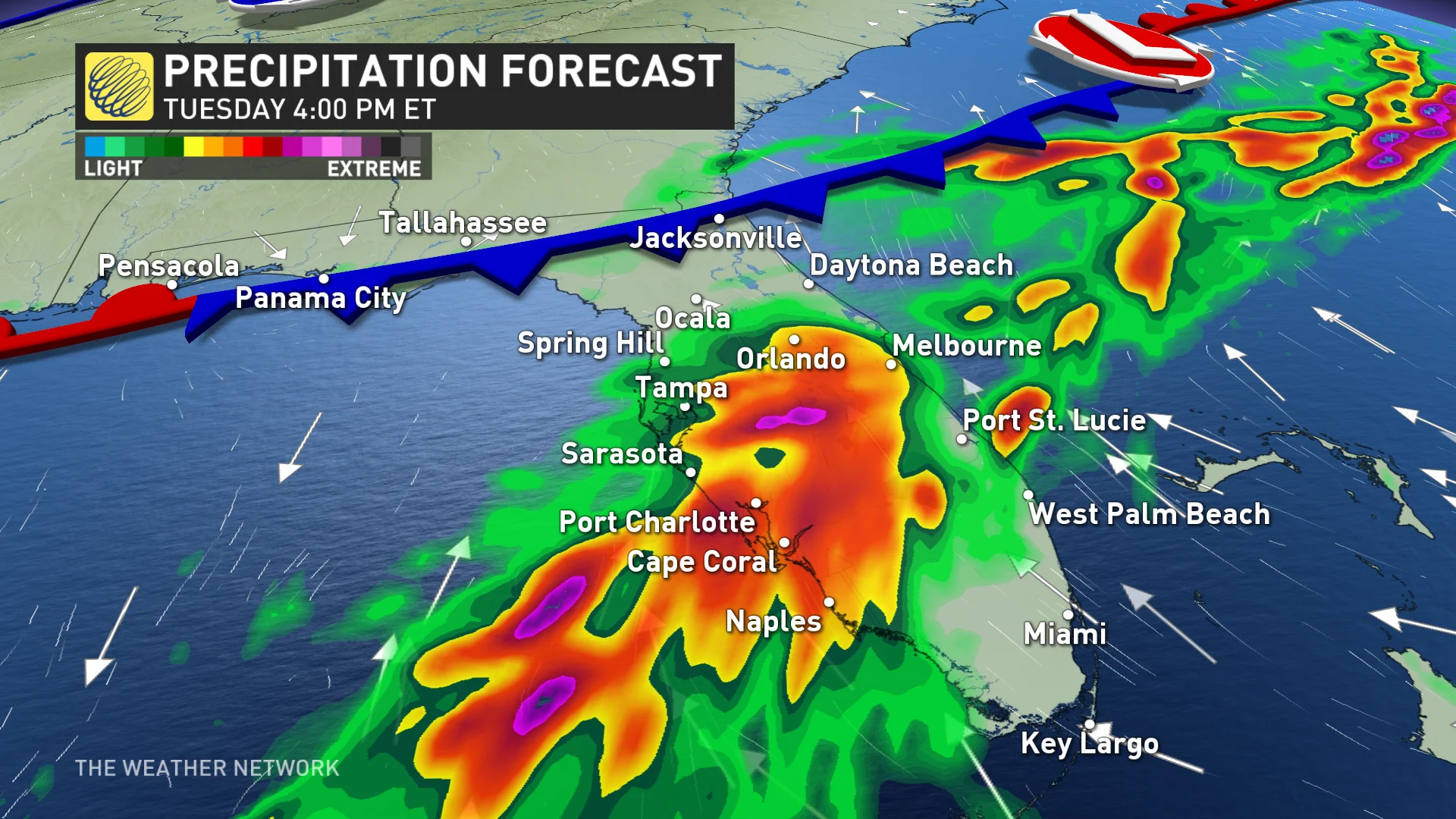
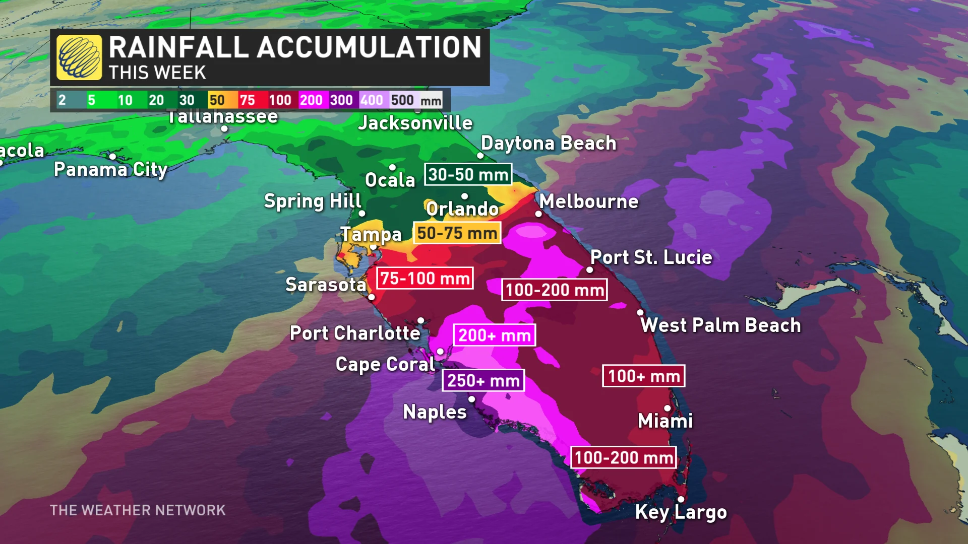
Torrential downpours are likely across the Florida Keys, Ft. Myers, Miami, West Palm Beach, and Fort Lauderdale areas. Heavy rain is likely into Tampa, Orlando, and north toward Jacksonville, as well.
Forecasters expect widespread triple-digit rainfall totals through the end of next week, with maximum values of 200+ mm possible along Florida’s southwestern coast. It's possible some areas see more than 300 mm of rain by next weekend.
This much heavy rain on its own can cause major flooding issues in vulnerable areas. But soils are saturated from heavy rain over the past couple of days, and the region has endured a drought over the past three months.
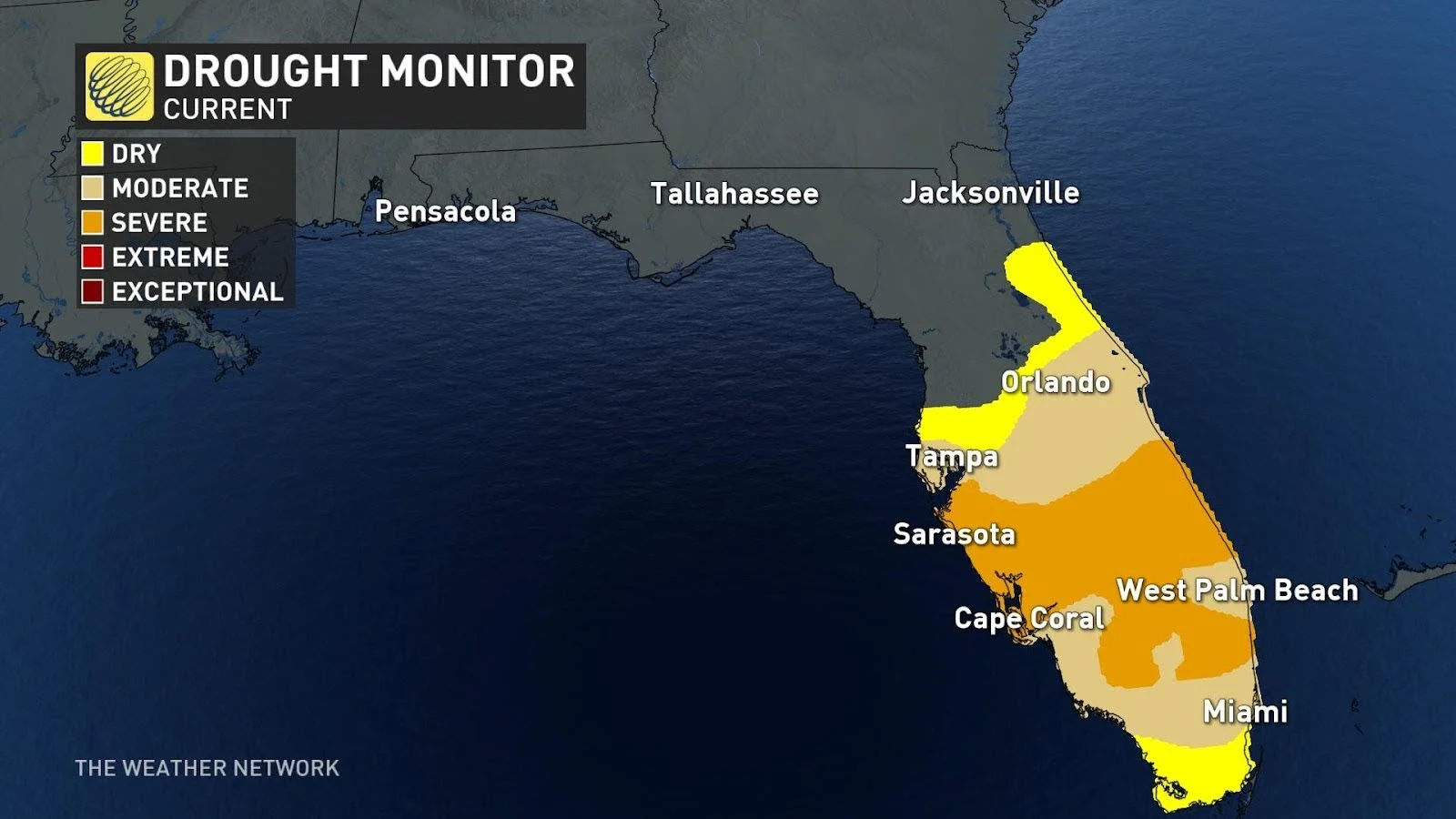
More than 40 percent of Florida has fallen into a moderate or severe drought since the beginning of spring. Downpours on drought-stricken soil will heighten the risk for flooding.
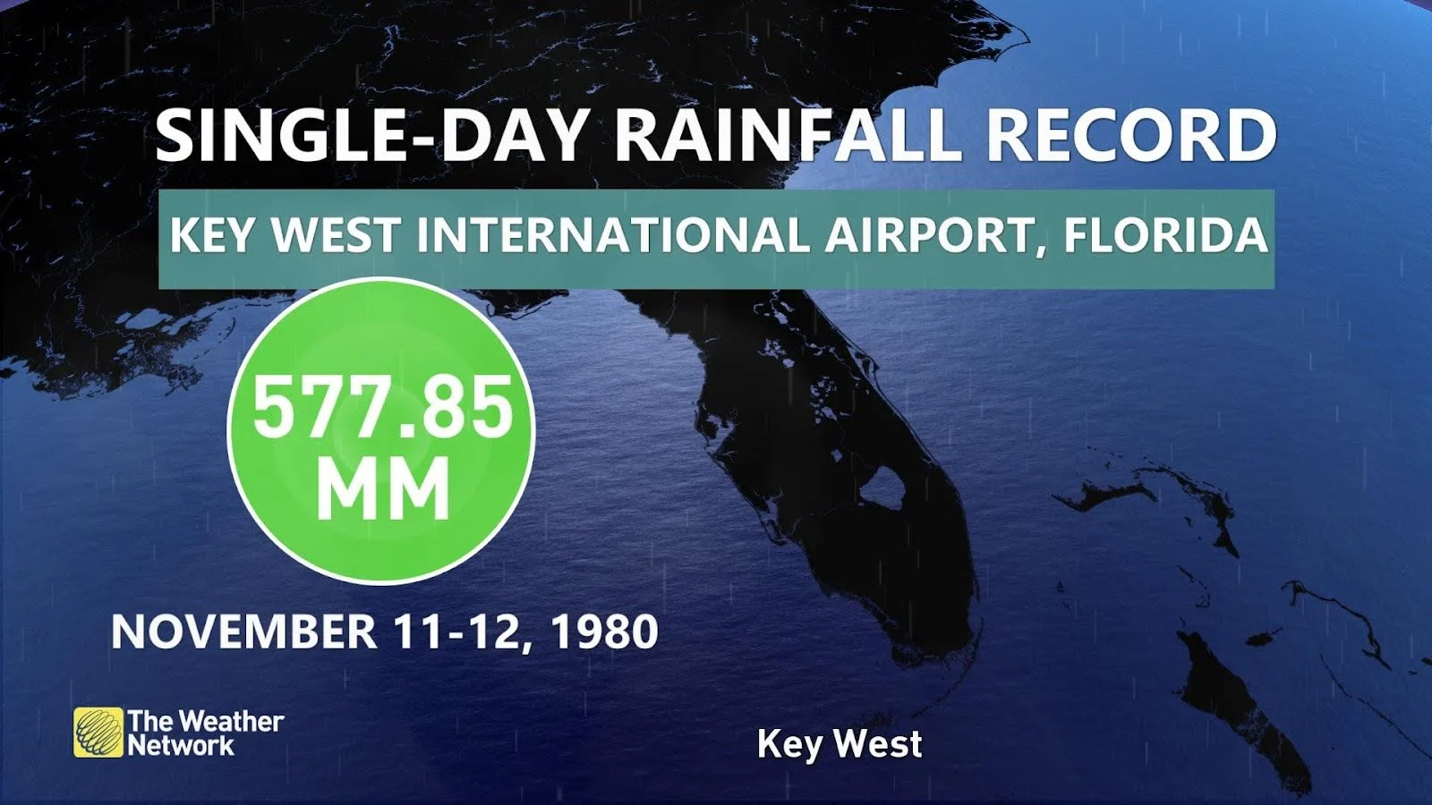
Florida is no stranger to heavy rainfall. Key West holds the record for the state's highest one-day rainfall with more than 575 mm of rain in a single 24-hour period.
SUMMER 2024: Get an in-depth look at the Summer Forecast, tips to plan for it, and much more!
Anyone in the area should take the risk for flash flooding seriously. Make sure you have a way to get severe weather alerts on your mobile devices. Ensure push notifications for emergency alerts are activated for flash flood warnings. These alerts can keep you safe.
Never try to drive across a flooded road. It’s impossible to tell how deep the water is until it’s too late, and sometimes the entire roadway is washed out beneath the water. It only takes about 15-20 cm of moving water for a vehicle to lose traction and begin floating downstream.
Stay away from floodwaters on foot, as well. Not only does the water itself pose a grave risk, but floodwaters in Florida are likely to host unfriendly creatures like alligators and snakes.
Header image created using imagery from Canva and Unsplash.