Heat wave loses its grip Friday as severe storm risk spreads over Alberta

Cooler days – perhaps too much so, depending on your preference – area ahead for Alberta after days baking beneath a 'heat dome' that shattered numerous records this past week. The weekend starts near-seasonal, dropping below that Sunday, while on Saturday, the risk for severe thunderstorms shifts to Saskatchewan and Manitoba. More on the storm threat and what to expect this weekend, below.
SATURDAY: TEMPERATURES RETURN TO NEAR-SEASONAL
The epic, dangerous heat of earlier in the week will be even further in the rearview mirror to start off the weekend.
Aside from some southerly areas where daytime highs will be a little above 30°C, most of Alberta looks to be squarely in the mid 20s.
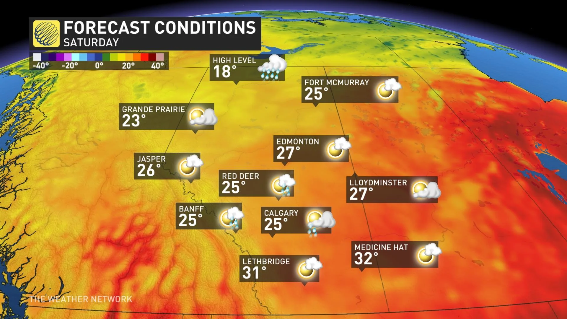
Showers and thunderstorms are possible in the southern half of the province during the afternoon hours, but right now they look like they’ll stay below severe limits.
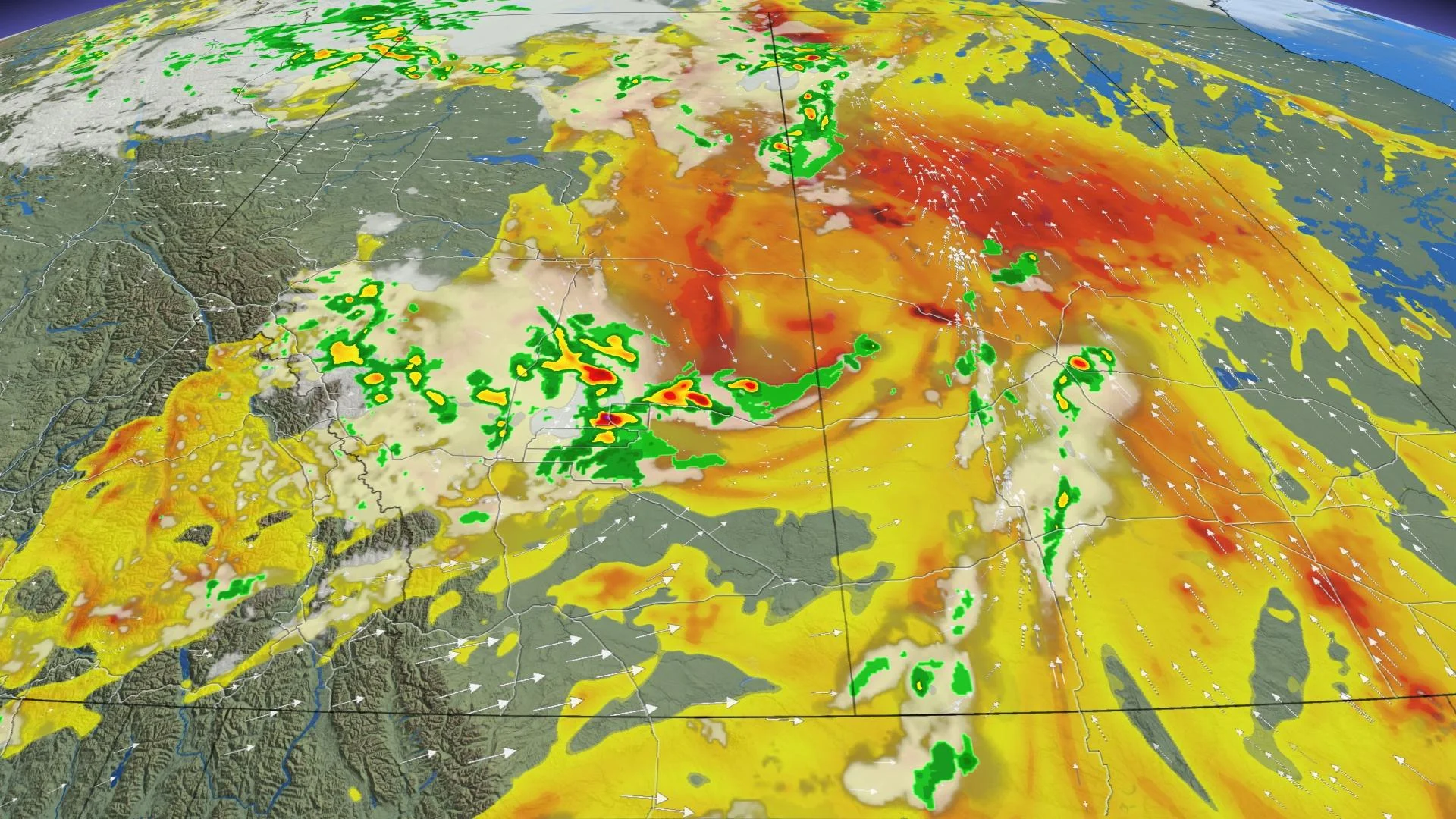
However, farther to the east, the risk for severe thunderstorms straddles the boundary between Saskatchewan and Manitoba on Saturday afternoon.

Any storms that do cross the severe threshold could produce heavy rainfall, gusty winds, and large hail.
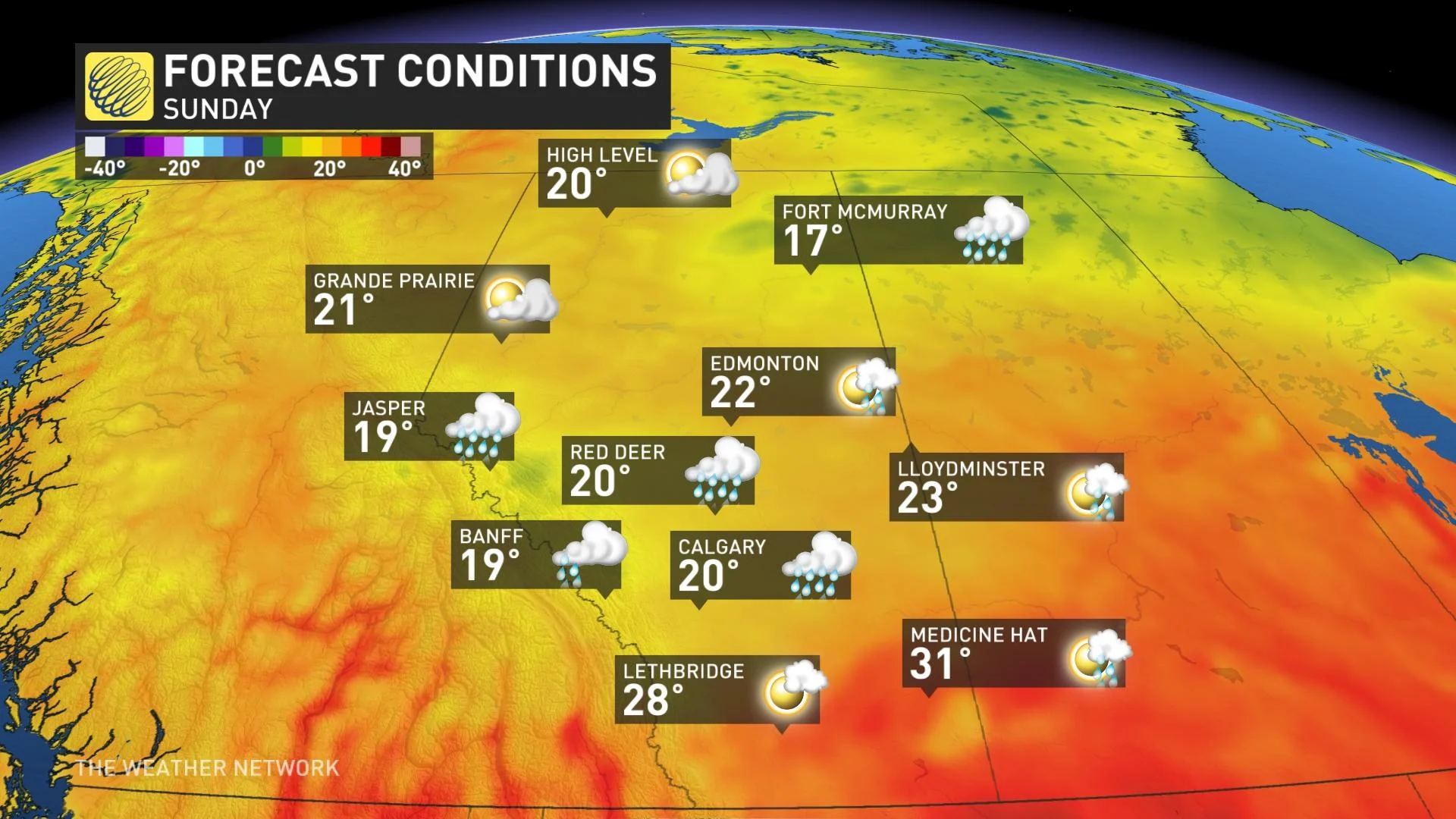
SUNDAY AND MONDAY: A BRIEF BOUT OF COOLER TEMPERATURES TO START THE WEEK
Sunday and Monday could feel a bit chilly as an upper-level trough moves over the Prairies. Daytime highs could struggle to climb out of the teens in many areas, with widespread showers and thunderstorms possible.
Above-seasonal temperatures are likely to return by the end of next week


