Hay River 'well-prepared' for spring breakup, SAO says
Residents of Hay River, Northwest Territories, could see breakup flooding as early as this week, according to the town's senior administrative officer.
This is on trend for Hay River, Glenn Smith said, because breakup tends to happen late April to mid-May. Colder than average temperatures in the last few weeks delayed things for the town, but Smith expects that to change any day now.
"There's no indication yet that the ice is starting to break up," he said. "We're starting to see water at different points throughout the system on the Northwest Territories side."
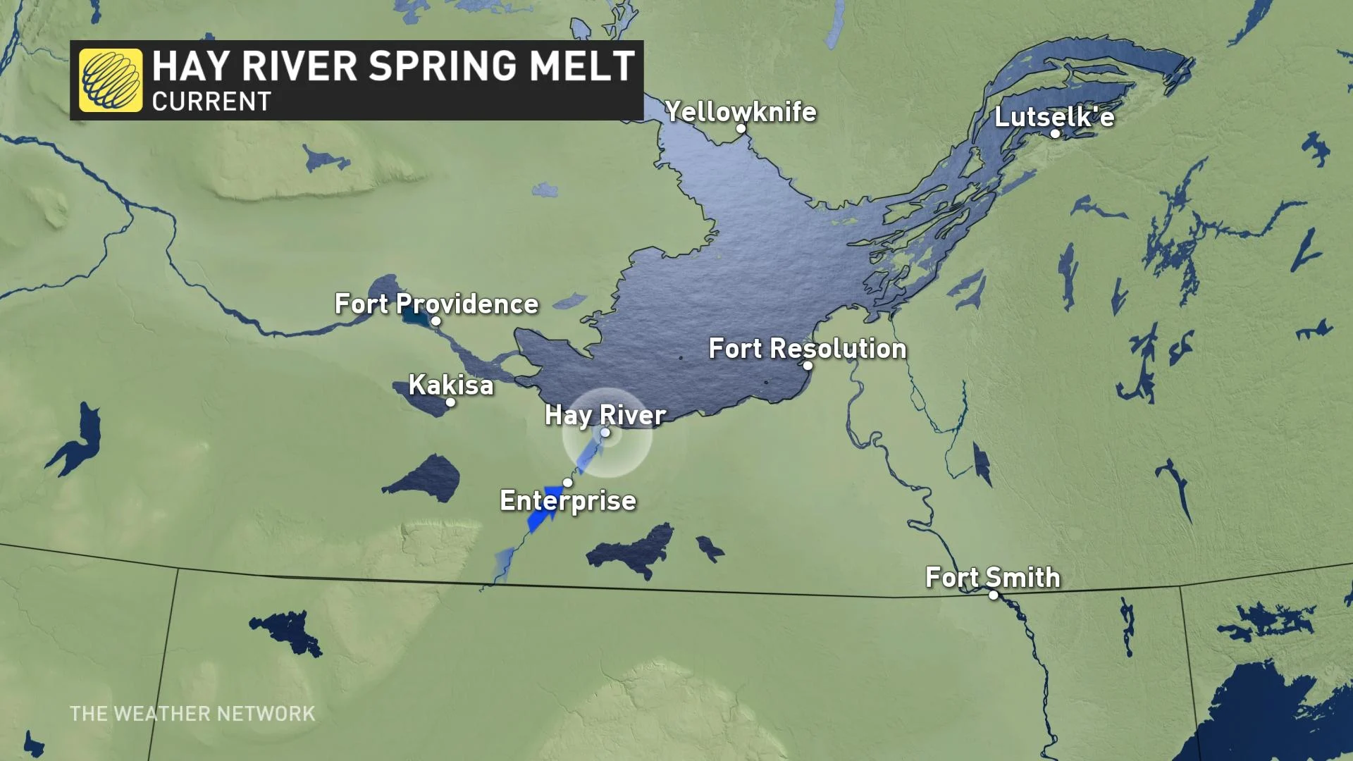
The latest report from the community's emergency response team, dated 5 p.m. on Monday, says water levels have been rising steadily on Hay River at all monitoring stations while dropping at both Sousa Creek and Chinchaga River in northern Alberta, with breakup happening in the Meander, Alta., area.
Water is also flowing at the border station, according to the report, with breakup having occurred in the area and "considerable flow" now coming over Alexandra Falls, outside of Enterprise, N.W.T.
Water is running along the edges of the rivers in town due to overflow, and with temperatures set to rise this week, the report warns that water levels will increase more rapidly too.
Click here for more emergency preparedness content
'WE'RE VERY WELL-PREPARED'
Last week, the territorial government warned residents in parts of the territory to prepare for "near-certain" flooding on the Tazin and Taltson rivers.
They also issued an elevated risk of flooding in Hay River, due to higher-than-normal water levels on Great Slave Lake.
In response, Hay River's director of protective services said residents should be ready for a one-week potential evacuation in May.
"We feel like it's a high-risk situation given the lake level," Smith said.
The 400-odd residents of Vale Island, known locally as Old Town, are the most prone to flooding.
Everyone on the island is expected to also have a plan in line with the N.W.T.'s COVID-19 public health guidelines in case they are evacuated due to high water levels, Smith said.
"We've been encouraging for the last several weeks for people to be prepared," he said.
Unlike last year, Smith said the town will be able to open an evacuation centre at the recreation complex.
Those with RVs or trailers will be able to park behind the complex and stay there as long as needed, he added.
"We're very well-prepared for an evacuation," he said. "That's the biggest response activity that we have as a community."

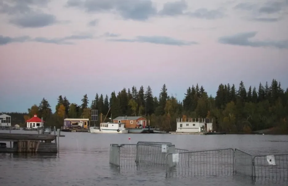
Great Slave Lake reached the highest water levels in its recorded history during the summer and fall of 2020, according to the government of Northwest Territories. (Hannah Paulson/CBC News)
GREAT SLAVE LAKE WATER LEVELS HIGHEST ON RECORD
Ryan Connon, a hydrologist with the territorial government, told CBC ice jamming on the rivers in the territory is always common, but that it's hard to know what's going to happen this year.
"The water levels right now [in Great Slave Lake], we've never seen these before," he said. "So it's tough to look at like a historic analog or other conditions from previous years to really understand how this year is going to play out."
Flooding could still be avoided, Connon added, if there's a slow, gradual temperature warming during spring where the snow and ice wouldn't melt all at once.
Smith said he doesn't know how high water levels in Great Slave Lake will impact Hay River just yet, but it does increase the risk of flooding.
Connon said, if there ends up being a flood, he will want to work with local flood watch groups to create inundation maps, but he hopes it doesn't get to that.
VIDEO ANIMATION REMINDS US WHY WE SHOULD NEVER DRIVE THROUGH FLOODWATER:
PREPARING FOR THE WORST, HOPING FOR THE BEST
Myrtle Graham lives 500 metres from the water's edge in Hay River's West Channel community, a part of town that is at risk of flooding every spring.
Every year, there's flooding in and around her home. The worst was in 1985, when she and all her neighbours were evacuated to the nearby Ptarmigan Inn.
Graham said this year's levels could be just as bad, or worse.
"The taps are running at full and the bathtub is full," Graham told CBC.
Last year, Vale Island residents evacuated the island for 24 hours. Graham, who is on the local flood watch committee, stayed so she could watch the levels as it happened.
She said she's prepared to stay at her son's place if it comes to it. Everyone in her part of town, she said, is "prepar[ing] for the worst, and hop[ing] for the best."
This article was originally published for CBC News. Contains files from Kate Kyle and Loren McGinnis.