Hudson Bay lands Canada's hot spot twice in a row this week
Two communities near Hudson Bay were Canada’s hot spots this week
If you’re on the hunt for summerlike heat in Canada this week, just grab your sunscreen and head for the sunbathed horizons of…Gillam, Manitoba.
Just a short jaunt from the western shores of Hudson Bay, this northern Manitoba community hosts a bustling rec centre, bountiful outdoor activities, and even a beach to enjoy those warm summer afternoons.
DON’T MISS: Sunshine and warm temperatures—is this Canada's ideal summer forecast?
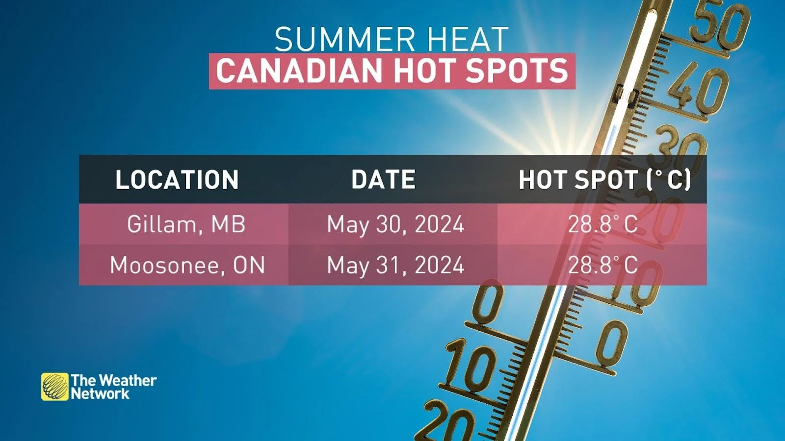
Gillam is one of two towns near Hudson Bay that secured the coveted achievement of Canada’s hot spot this week, registering daytime highs in the upper 20s to round out the month.
Here’s a look at how folks so far north saw warmer weather than anyone else in the country this week.
A twisty pattern sends temperatures soaring
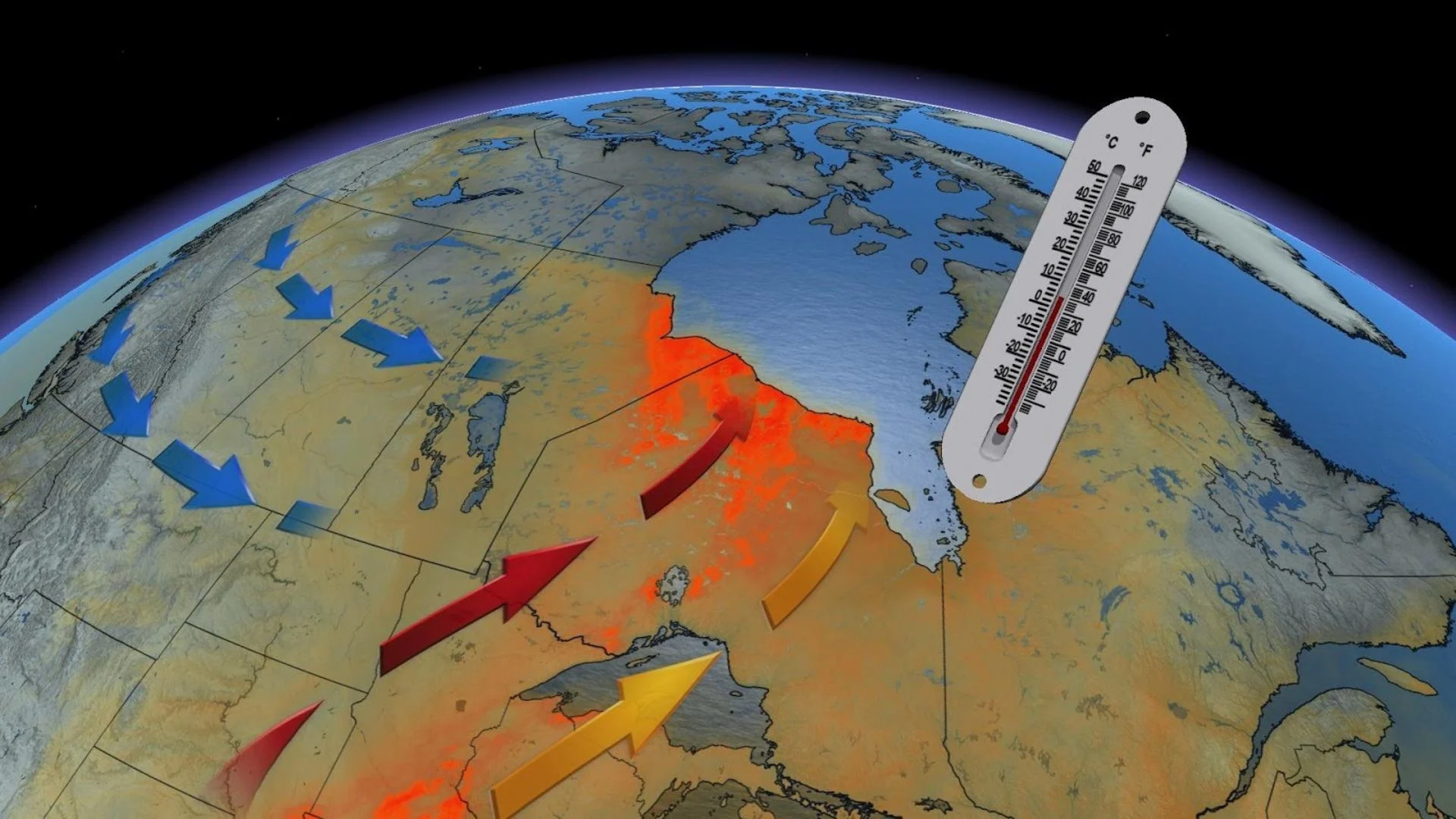
It takes a somewhat contorted pattern to send the heat up north while everyone else looks on in mild envy.
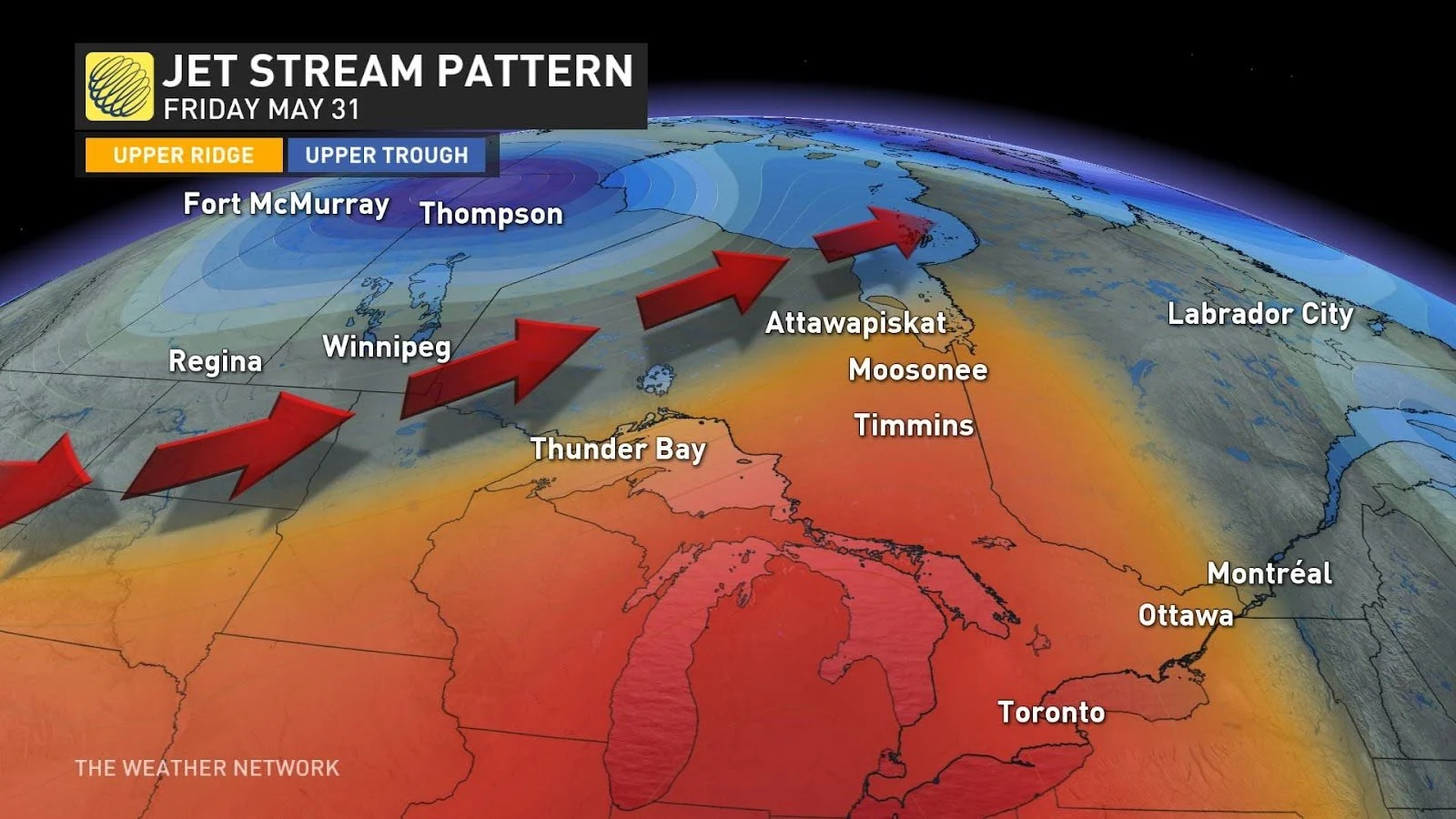
This week’s pattern over the region featured a stubborn low-pressure system over northern Saskatchewan while a nearby ridge of high pressure brought ample sunshine to southern portions of Ontario and Quebec.
Folks on the southern Prairies missed out on the heat due to that pesky low hovering over the area. Meanwhile, winds flowing around the system funneled stateside heat deep into the northern reaches of Manitoba and Ontario.
DON’T MISS: Half of Canada may see a cooler June start with help from a typhoon
While the chilly waters of the Great Lakes took the edge of the heat for many in Ontario, the southerly winds bypassed the cold lakes as it entered northwestern Ontario, allowing temperatures to soar to lofty highs.
Those warm winds heated up even more as they descended into the Hudson Bay lowlands. Sinking air warms up and dries out as it descends, which is the same principle behind a Chinook off of the Rockies—just on a smaller and less extreme scale.
All this combined to send Thursday’s national high temperature to 28.8°C in Gillam, Manitoba, while Friday’s nationwide high also climbed to 28.8°C across the provincial line in Moosonee, Ontario.
SEE ALSO: Winter 2023-2024 shattered records as Canada's warmest ever
This kind of heat isn’t particularly rare for communities near Hudson Bay. In fact, it’s not uncommon for this part of Canada to register the country’s first 30-degree reading of the season.
Extreme temperature swings are a way of life in this part of Canada. Last year, Peawanuck, Ontario, made it up to 32°C at 4:00 p.m. on May 30, with a sharp wind shift off the lake sending readings down to just 2°C by 8:00 a.m. the following day.
Who’s on track for the heat next?
All eyes are on the heat potential as we head into June.
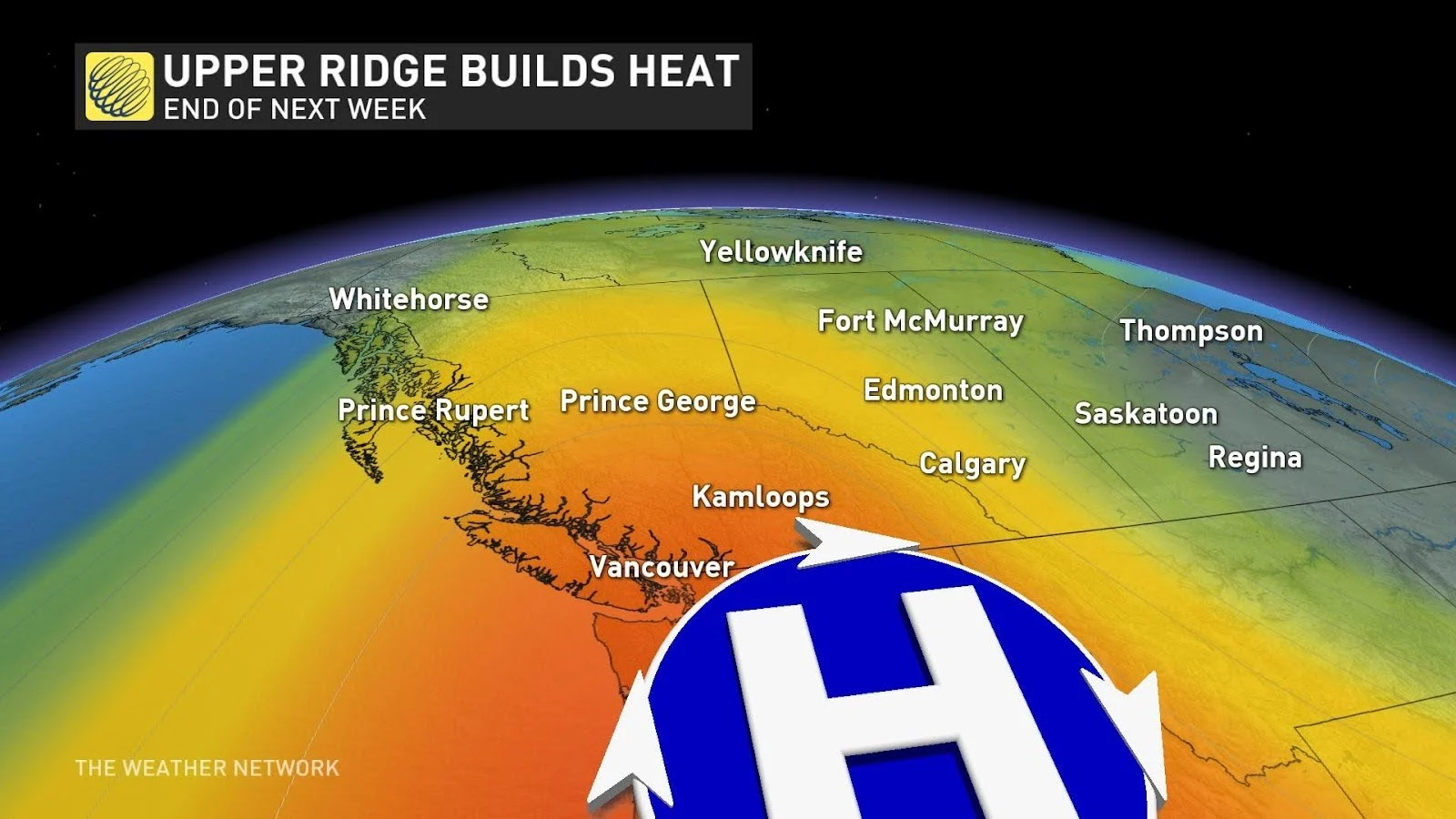
A pattern shift next week will send temperatures falling back toward normal for areas basking in heat this week.
Forecasters will watch a ridge building over the Pacific coast that’ll help raise the heat across parts of British Columbia. There are signs that temperatures could rise above 30°C in the Lower Mainland, while temperatures south of the border in Washington could crack 40 degrees.