How the Great Lakes contribute to dangerous wintry weather

Heads up, southern Ontario! Warm lakes and cold air are a potent mix for lake-effect snow!
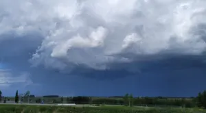
Wintry weather is set to impact southern Ontario in a significant way Monday as the perfect ingredients have come together for bands of lake-effect snow to develop.
This situation is certainly not unusual in the Autumn months and even into early winter, as snow squalls stream off the lakes.
The exact ingredients needed for this weather phenomenon to occur are water, wind, cold air, wind shear and fetch, but what are these, and why does each of them matter?
WATER
The very first ingredient for lake effect snow is the lake - specifically the water in the lake, and even more specifically, we need warm lake water. The lake surface needs to be at least warm enough that the water remains in liquid form, but it also needs to be significantly warmer than the air flowing over it. The warmer, the 'better', but a temperature of about 13 degrees warmer than the air temperature is enough to kick up lake effect squalls.
Right now, the average water temperature for Lake Huron is around 9°C - slightly below average for this time of year. For Lake Erie, the average surface water temperature is between 12°C and 13°C - slightly above average for this time of year.
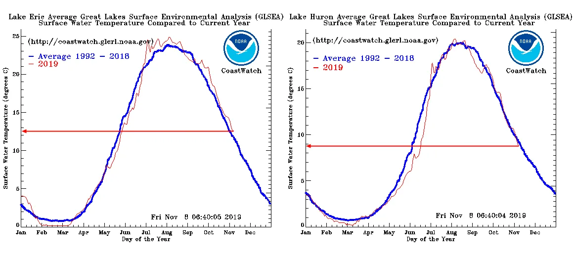
Lake Erie and Lake Huron average surface water temperatures for 2019, up to November 8, compared to the average for 1992-2018. Credit: NOAA GLERL
Air temperatures, on the other hand, are hovering around the freezing mark across southern and southwestern Ontario. This gives us the perfect setup.
So, why is warm lake water so important when we're talking about cold snow forming?
Partly this is because the warm surface water acts as a source of both heat and water vapour. If the lake surface freezes over, both sources are effectively cut off.
For a complete answer to this question, however, we need to take a look at the next ingredient.
WIND
Paired with warm lake water, we need wind blowing over that water, specifically a cold wind, with an air temperature at or below freezing, and (as stated above) at least 13 degrees colder than the water temperature.
This temperature difference provides a strong impulse for the warm, moist air just above the water's surface to rise rapidly. As the warm air cools as it rises, it results in moisture-laden clouds that the winds can then carry over land.
The winds need to be blowing at the right speed for snow squalls, though - not too light and not too strong. Right around 15-20 knots (27-37 km/h) is optimal.
If the prevailing winds are too light, the warm lakes will set up a land breeze situation. Warm air over the water rises, causing the air near the lakeshore to blow from the land to the water to fill the gap left behind. This off-shore flow disrupts the on-shore flow of air needed for squalls.
If instead, the prevailing winds are too strong, the flowing air doesn't really have enough time to pick up a significant amount of water vapour from the lake surface, limiting how much is available to produce clouds and snow.
Just having cold winds blowing at the right speed over warm waters isn't quite enough, though. The winds must satisfy three more requirements.
DEEP ARCTIC AIR
Lake effect snow squalls are a local convective type of precipitation. Thus, they need a good amount of convection to really get going.
What this means is, since squalls aren't driven by a large-scale interaction between warm and cold air like you'd find along a weather front, where cold air is forcing warm air to rise, there needs to be enough 'room' available in the air mass for squalls to develop.
Thus, the warm, humid air that rises off the lake surface into the cold flow of wind must have a sufficient vertical distance available so that it can rise, cool down enough to produce clouds, and cool even further to produce snowflakes.
Typically, this means we need to have a cold layer of air that is between 1,200 and 1,500 metres thick.
If there's is only a shallow cold layer, perhaps due to the presence of a low-level temperature inversion, the convection of the warm air from the lakes may start strong, but it's cut off before it can really get going.
You may see some cloud bands out of this situation, but any snowfall that does happen will be only be scattered and light.
With a deep layer of cold air flowing over warm lake water, at the right speed, we're getting the ball rolling, but we're still missing two things.
LOW SHEAR
In meteorology, shear is the term we use to describe how wind direction and speed change between two points in the atmosphere. Most often, we specifically use this to describe changes with height, typically comparing a point near the ground with a point higher up in the atmosphere.
Velocity shear is how the wind speeds change with height. Its counterpart, directional shear, describes how the wind direction changes with altitude, which is of much greater importance for snow squalls.
When there is low directional wind shear, the winds are more lined up with height. This focuses the heat and moisture from the lake water into thin, intense bands of snowfall. The less direction shear there is, the more concentrated the squall will be.

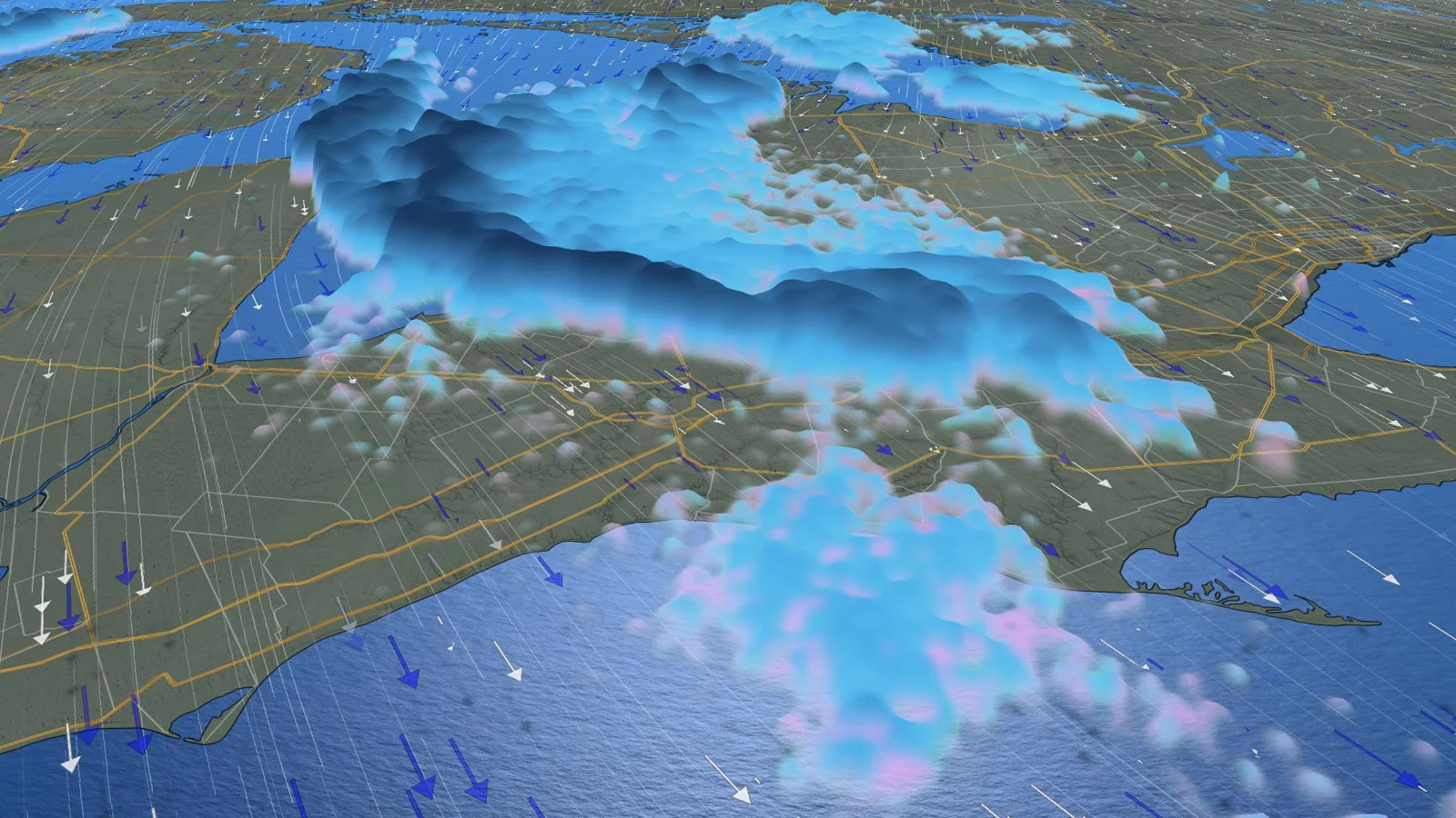
Concentrated lake effect snow bands are shown prominently in this image from orbit. Credit: NASA
The greater the directional shear is, the more the winds diverge with height. You can still see snowfall from this, but it will be much more spread out, rather than in specific bands.
So, we have warm lake water, a deep flow of cold air at least 13°C cooler than the water to generate enough convection, with winds blowing at just the right speed over the lake, and those winds are well-aligned with height.
We need only one final component.
FETCH
Fetch is simply the straight-line distance of continuous lake water surface that the winds blow over before they flow on-shore. In meteorology, fetch basically defines exactly how much water vapour the winds can pick up off the lake surface, to turn into clouds and snow.
If there is only a short fetch, such as when winds are blowing from west to east across the southern part of Lake Huron (between White Rock, MI and Goderich, ON, for example), significant snow squalls are unlikely. Move just 40 km or so further to the north, however, to Point Clark, where the westerly winds can also tap into Saginaw Bay as a source, and the chance of a squall developing increases.
Give the winds an even longer fetch, and they tap into more water vapour. This is especially true when they're blowing from the northwest or north-northwest across Lake Huron and Georgian Bay, or from the west-southwest up the long axis of Lake Erie or Lake Ontario.
In general, weather forecasters start to consider the potential for lake effect squalls when all the other components are present, and the winds have a fetch of around 75 kilometres.
With a fetch of over 100 km, they start talking about heavy snow squalls.
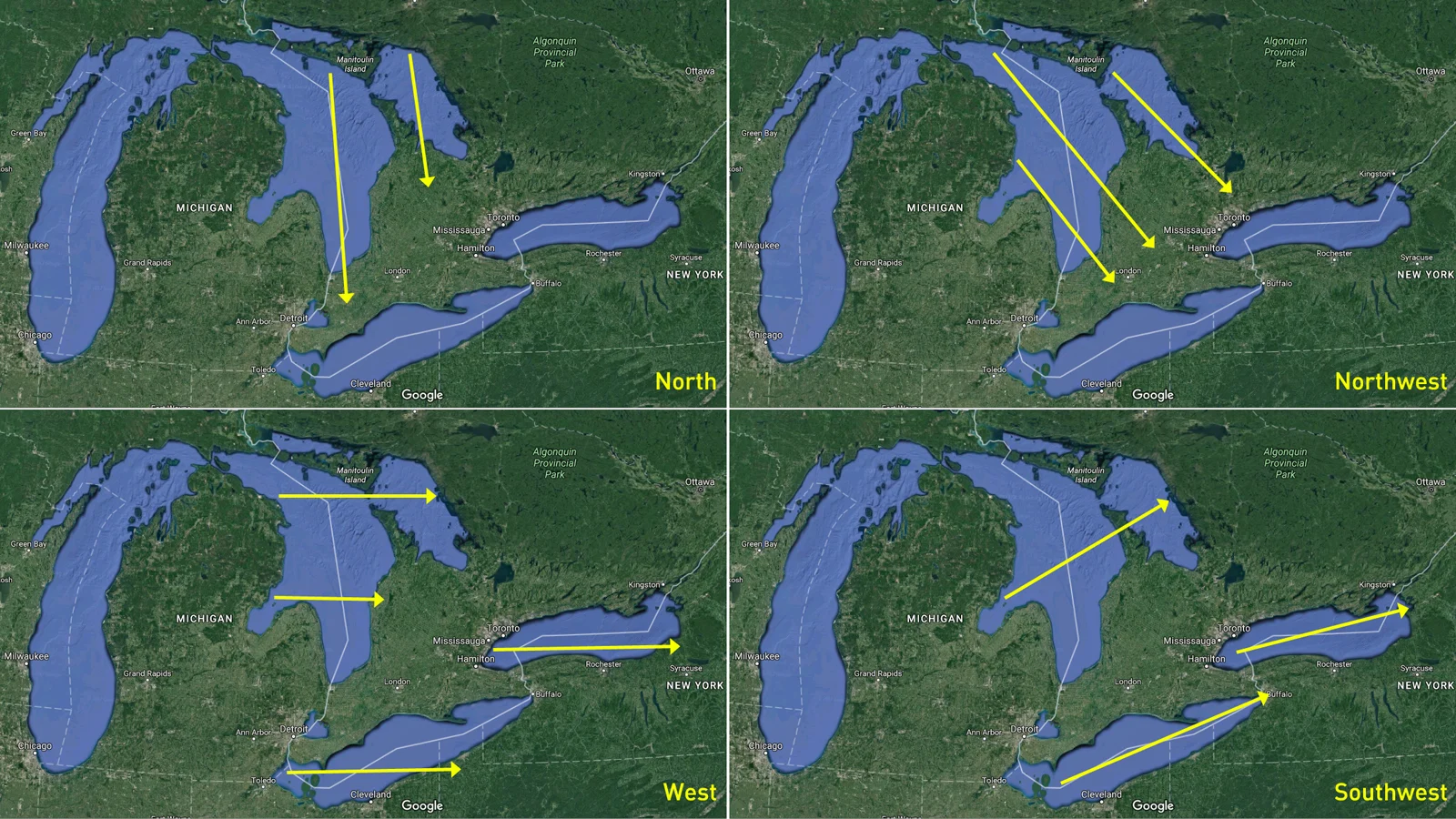
Some typical wind directions across the eastern Great Lakes that produce lake effect snow squalls. The smallest of these fetches is 100 km, for a north wind blowing across Georgian bay. The largest is 350 km, for winds flowing from the southwest across Lake Erie. Credit: Google Earth/Scott Sutherland
So, with all of this, we finally have all the right ingredients: There is a deep layer of cold air, at least 13°C cooler than the lake water it is flowing over. The winds are blowing at the right speed, they are lined up in the same direction with height, and they are blowing from a direction that gives the air sufficient access to the lake surface.
From there, the exact conditions, along with any terrain effects, such as up-slope flow as the winds come on shore, will determine just how bad the squalls are, and who gets the worst impact from them.