How the Pacific warming faster than expected might affect Canada’s summer

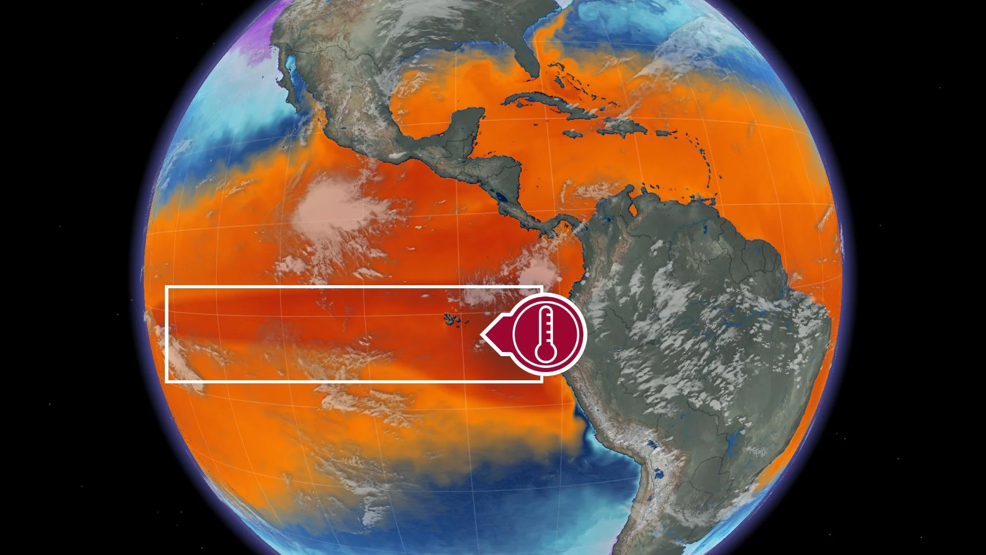
Sea surface temperatures are rising in a hurry across the eastern Pacific Ocean, likely signaling a strong and fast start to El Niño this summer
El Niño might set in stronger and faster than expected this summer if current trends in sea surface temperatures continue in the coming weeks.
Experts have long expected that we’ll see warmer-than-normal temperatures in the eastern equatorial Pacific Ocean this summer, heralding the start of an El Niño that could affect Canada’s summer and the impending hurricane season.
Uncertainty around the strength and timing of El Niño’s onset made its effects on this summer’s weather a bit of a question mark. With confidence growing, here’s a look at how this pattern might influence Canada’s weather in the coming months.
DON’T MISS: Heat incoming? Two ways El Niño could affect Canada’s summer
El Niño and La Niña both describe periods of abnormal Pacific water temperatures off the western coast of South America. We’ve been in the colder grips of La Niña for three consecutive winters. That lengthy spell recently ended and it appears that we’re rapidly heading for the warmer-than-normal sea surface temperatures of an El Niño.
DON’T MISS: Take UV rays seriously! Here are 9 must-haves to for maximum sun protection
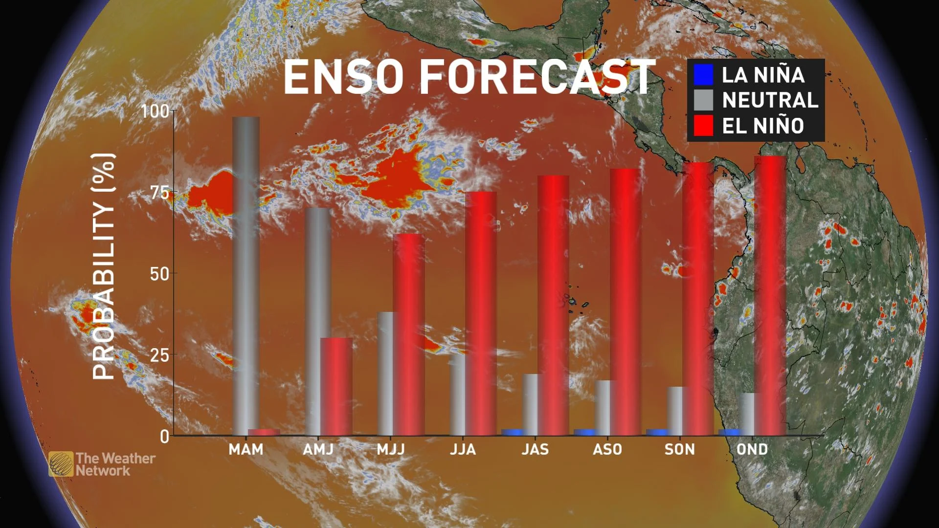
The U.S. Climate Prediction Center’s monthly outlook in April called for better-than-even odds of an El Niño developing by this summer, with some uncertainty in how fast or how strong such a pattern would develop in the coming months.
Since then, however, things have gotten much steamier.
Sea surface temperatures off the western coast of South America are warming up faster than expected. This region of the Pacific Ocean ended April with surface waters coming in more than 2°C above normal in spots—and there’s no sign of this toasty streak letting up any time soon.

Oceans the world over were warmer than usual this past April. Climatologist Brian Brettschneider tweeted Thursday that the world’s sea surface temperatures as a whole were the warmest ever recorded during the month of April.
Much of that warming occurred in the north-central Pacific between Hawaii and Alaska, but the building El Niño near the equator also helped boost those numbers.
The CPC’s next outlook doesn’t arrive until May 11, but given this trend, it’s reasonable to expect that forecasters’ confidence will grow in El Niño’s arrival and influence over the coming summer.
What we might expect in Canada this summer
The sudden warmup of an El Niño event has tremendous effects on the atmosphere above, pushing and pulling on the jet stream in ways that can influence seasonal conditions from Asia to Atlantic Canada.
While an El Niño’s greatest effects are usually felt in winter, these warmer waters in the eastern Pacific can influence Canada’s overall summertime pattern.

Every event is different. Even so, meteorologists often look at past El Niño and La Niña years for clues about how upcoming seasons will progress.
Based on similar flip-flops that happened in 1997 and 2009, a fast dive into El Niño this summer could bring more comfortable conditions to much of the country.
This kind of setup might favour generally below-seasonal conditions east of the Rockies, with warmer conditions possible along the West Coast and in the territories up north.
It's not a lock, though. Other summers influenced by the warmth of an El Niño saw warmer conditions spread across the country. One such year was 2015, in which every major Canadian city notched at least one summer month with above-seasonal temperatures.
But one of the Pacific’s biggest influences on Canada’s summers happens thousands of kilometres away in the neighbouring Atlantic Ocean.
El Niño can influence Atlantic hurricanes—but there’s a catch
The abundance of rising air over a warmer-than-normal Pacific flows east toward the Atlantic Ocean, leading to increased wind shear that can spell doom for any budding tropical cyclones.
Strong westerly winds flowing out of the Pacific can rip the tops off thunderstorms before they have a chance to organize, prematurely ending attempts for tropical waves to build into something more.
RELATED: Uncertainty swirls around 2023 hurricane season as El Niño looms
That’s not always the case, though, and forecasters are a bit concerned this year that warmer waters in the Atlantic might serve to cancel out any effect El Niño might have on the upcoming hurricane season.
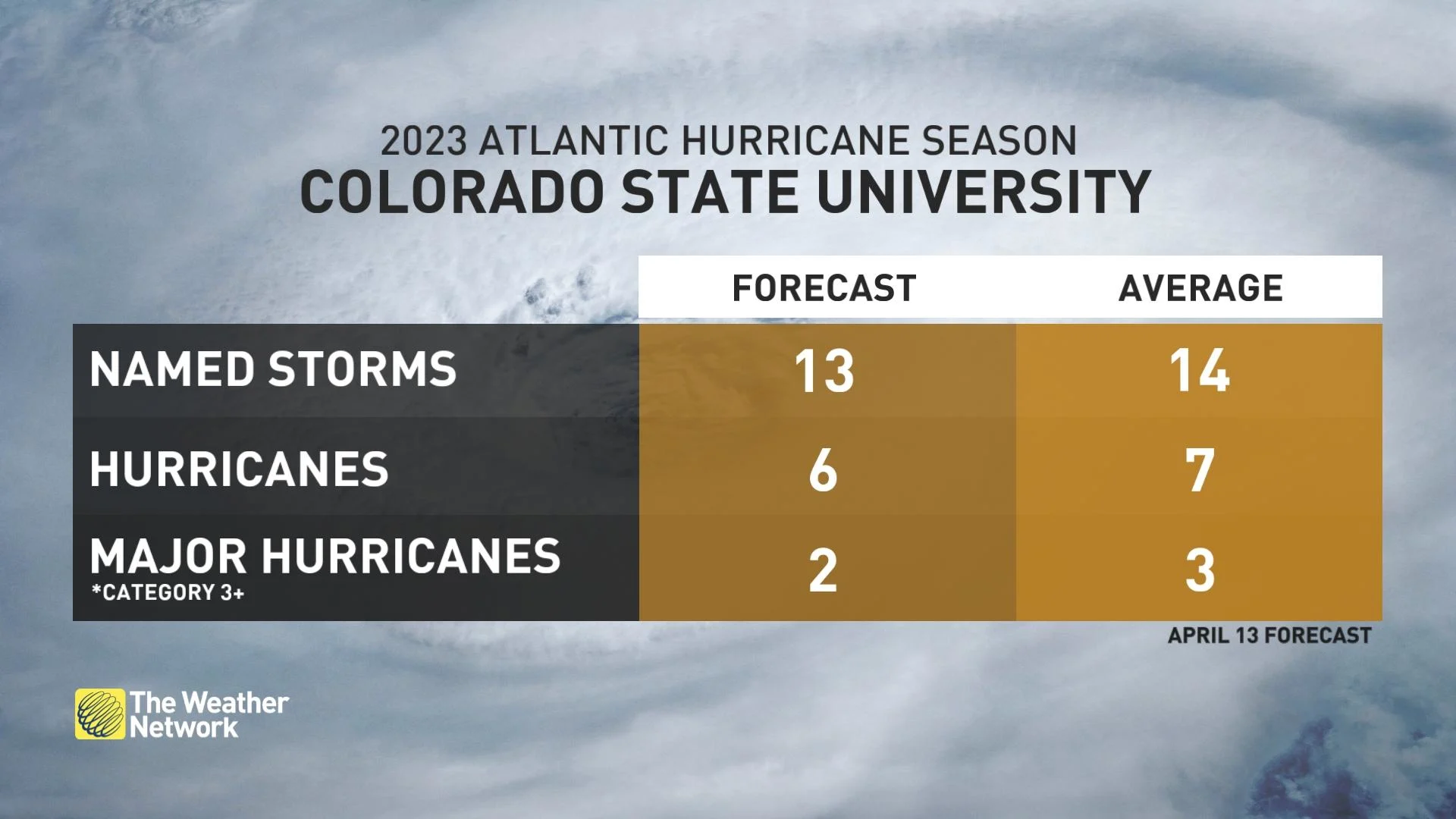
Accordingly, the season’s first outlook from experts at Colorado State University called for only slightly below-average hurricane activity this year.
It’s important to remember that it only takes one storm making landfall to make even the quietest season a tragedy. After all, the 1992 hurricane season started exceptionally slow due to an El Niño that summer.
The first named tropical system in 1992 didn’t form until late August. That storm was Hurricane Andrew, which secured an infamous place in history when it hit southern Florida as a scale-topping hurricane.
Everyone along and near the eastern seaboard should prepare for hurricanes well in advance of the season regardless of the pre-season outlooks. It’s better to over-prepare than to get caught off-guard.