Dorian remnants now impacting Europe's weather

After leaving a trail of destruction across parts of the Bahamas, U.S. and Canada - remnants of what was once Hurricane Dorian are now impacting the weather across Europe. Here's how.
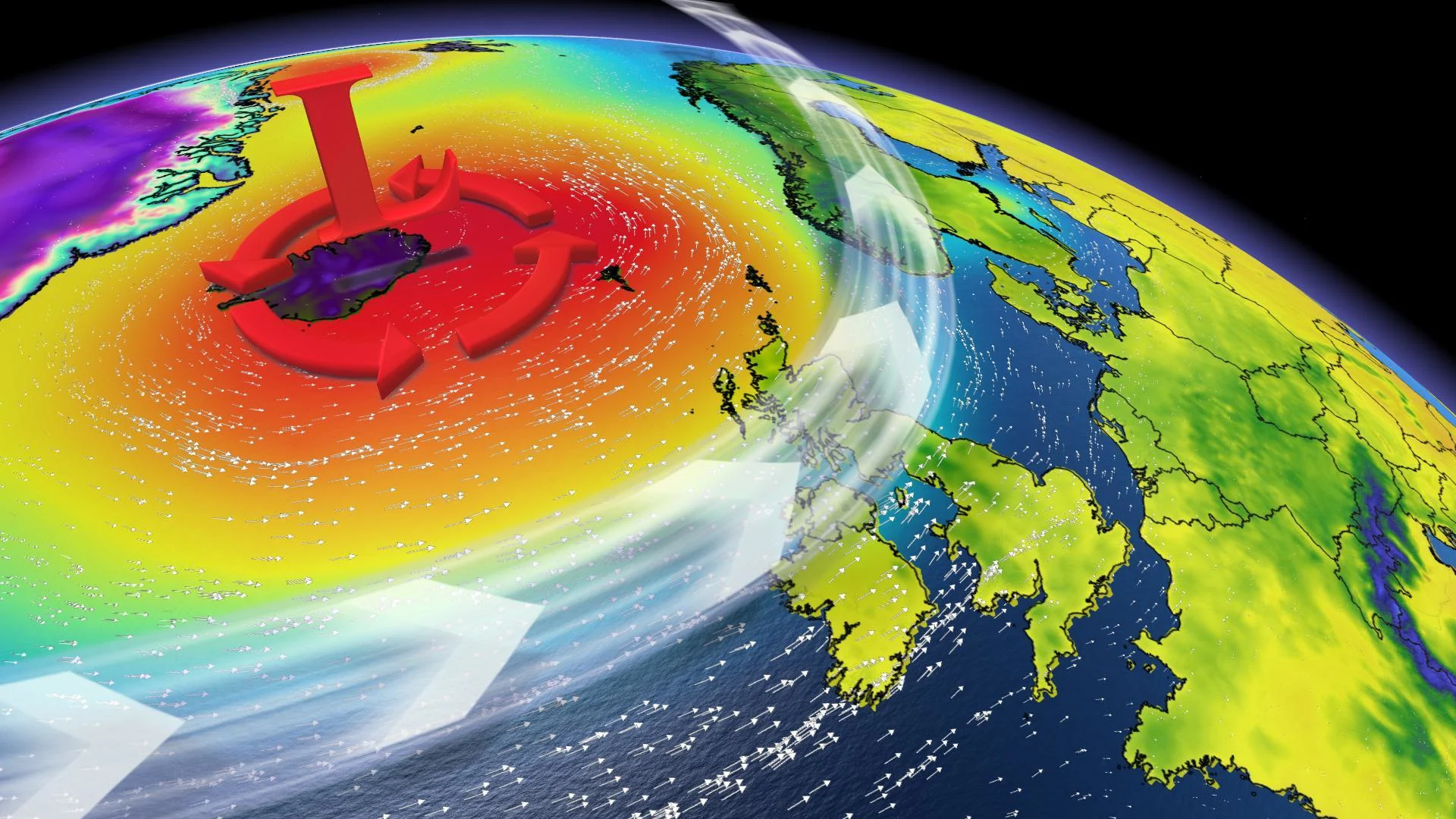
After more than two weeks touring the Atlantic, Dorian weakened over northeast Canada this past weekend. Now, the remnants of the most devastating storm so far this season have mutated into a low pressure center circulating east along the polar jet stream, while crossing the North Atlantic.
The impacts of what was once Dorian are still very present today, as it will continue to influence the atmospheric dynamics in Europe over the next 48 hours.
Model predictions indicate that some of Dorian’s energy is expected to help intensify the north-south flow of the jet stream over much of western Europe, bringing cool and at the same time, severe weather.
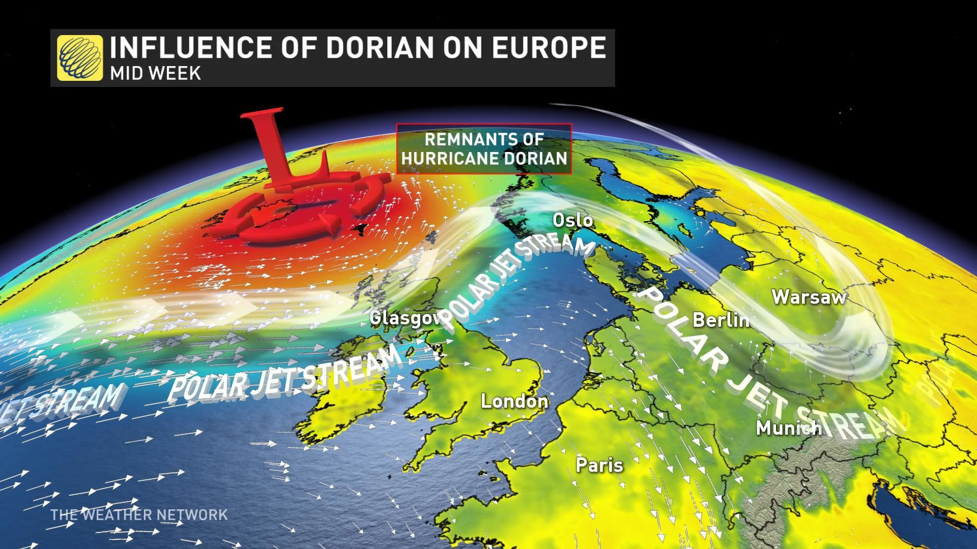
The presence of ex-Dorian as it moved into northwest Europe enhanced the south to north flow towards its center, and the atmospheric response to this pattern was to intensify and elongate the north-south flowing jet stream to the west. This enhancement of the north-south flow is one of the ingredients that has facilitated the formation of a CCL (Cold-Core Low) downstream that will cross portions of southwest Europe starting this Tuesday.
These isolated upper-level lows, with very cold air in their center, produce very extreme weather when they move over the warm Mediterranean waters. During the next three days, very intense precipitation episodes are expected across portions of Spain, Italy, France and even Algeria in northern Africa.
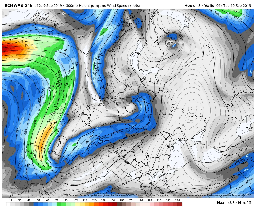
ECMWF 300 mb wind flow map for Tuesday, September 10, 2019.
But while western Europe is dominated by that marked north-south circulation, accompanied by cool unstable weather, the central section of the continent, from Italy to Scandinavia, is expected to be influenced by the opposite circulation.
A south-north flow, which, although not as intense as that coming from the Atlantic, will favor the flow of warm air from North Africa to higher latitudes.
This unusual flow is becoming more common and has occurred off and on during the summer, bringing record heat to a number of countries in northern Europe. This time, temperatures are expected to be considerably higher than usual in some areas of northern Europe. Forecasts suggest that positive anomalies can be as high as 10oC in Scandinavia, the Baltic countries and western Russia. Meanwhile, on the opposite side of the continent, southwestern countries such as Spain will see daytime temperatures 10 to 12 °C below the usual average.
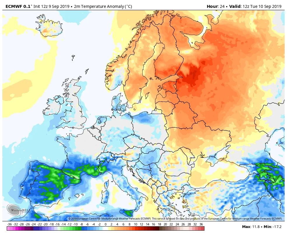
Temperature anomaly across Europe for Tuesday, September 10, 2019. Courtesy: ECMWF.
Dorian’s journey has been a long one, severely impacting millions of people across the Bahamas, the United States and Canada. While recovery efforts continue in Atlantic Canada, the devastation left in Dorian’s wake across the Bahamas is one that will be felt for years to come. Hurricane Dorian's rampage through the Bahamas last week killed at least 50 people, largely on the hard-hit Great Abaco Island, an official said via Reuters on Tuesday.