Tropical Storm Laura remains dangerous as it heads further inland

Although Laura is weakening, the National Hurricane Center (NHC) is warning of high water levels continuing along portions of the Gulf Coast, with damaging winds and flooding rains spreading inland over central and northern portions of Louisiana.
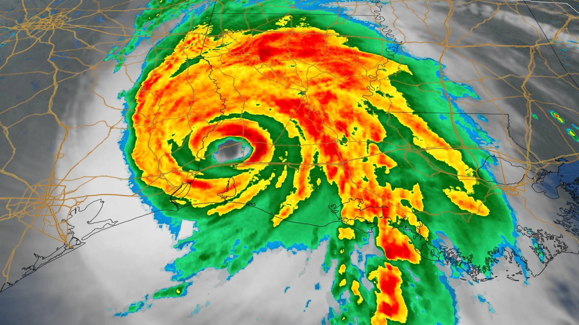
Hurricane Laura slammed into the Louisiana coast early Thursday morning as a high-end Category 4 storm, coming onshore as one of the state's strongest storms ever.
Laura, which made landfall around 1 a.m. local time in Cameron, La., packed winds of 240 km/h as it swept onshore. It is tied with a hurricane from 1856, which also boasted 240 km/h winds, as the strongest to hit the state.
IN PHOTOS: Hurricane Laura devastates Louisiana and Texas
There has been at least six deaths reported in Louisiana as a result of Laura sweeping through.
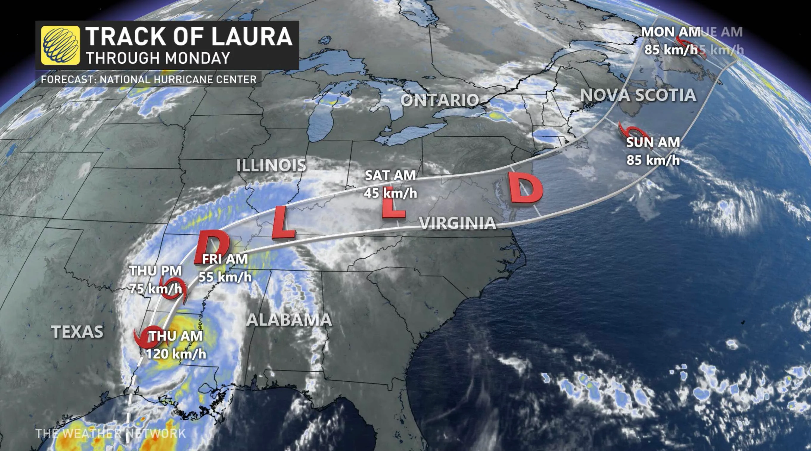
Laura continues to weaken and is currently a tropical storm. Its maximum wind speeds are near 65 km/h with higher gusts. Rapid weakening is forecast and Laura could become a tropical depression tonight, according to the National Hurricane Center (NHC).
The first major hurricane of the 2020 Atlantic season, the NHC is still warning of high water levels continuing along portions of the Gulf Coast, with damaging winds and flooding rains spreading inland over central and northern portions of Louisiana.
At one point, some areas in Louisiana were forecast to see a storm surge reaching as high as 20 feet (more than 6 metres).
"On the forecast track, the center of Laura is forecast to move over Arkansas tonight, the mid-Mississippi Valley on Friday, the mid-Atlantic states on Saturday, and over the western Atlantic on Sunday," NHC said.
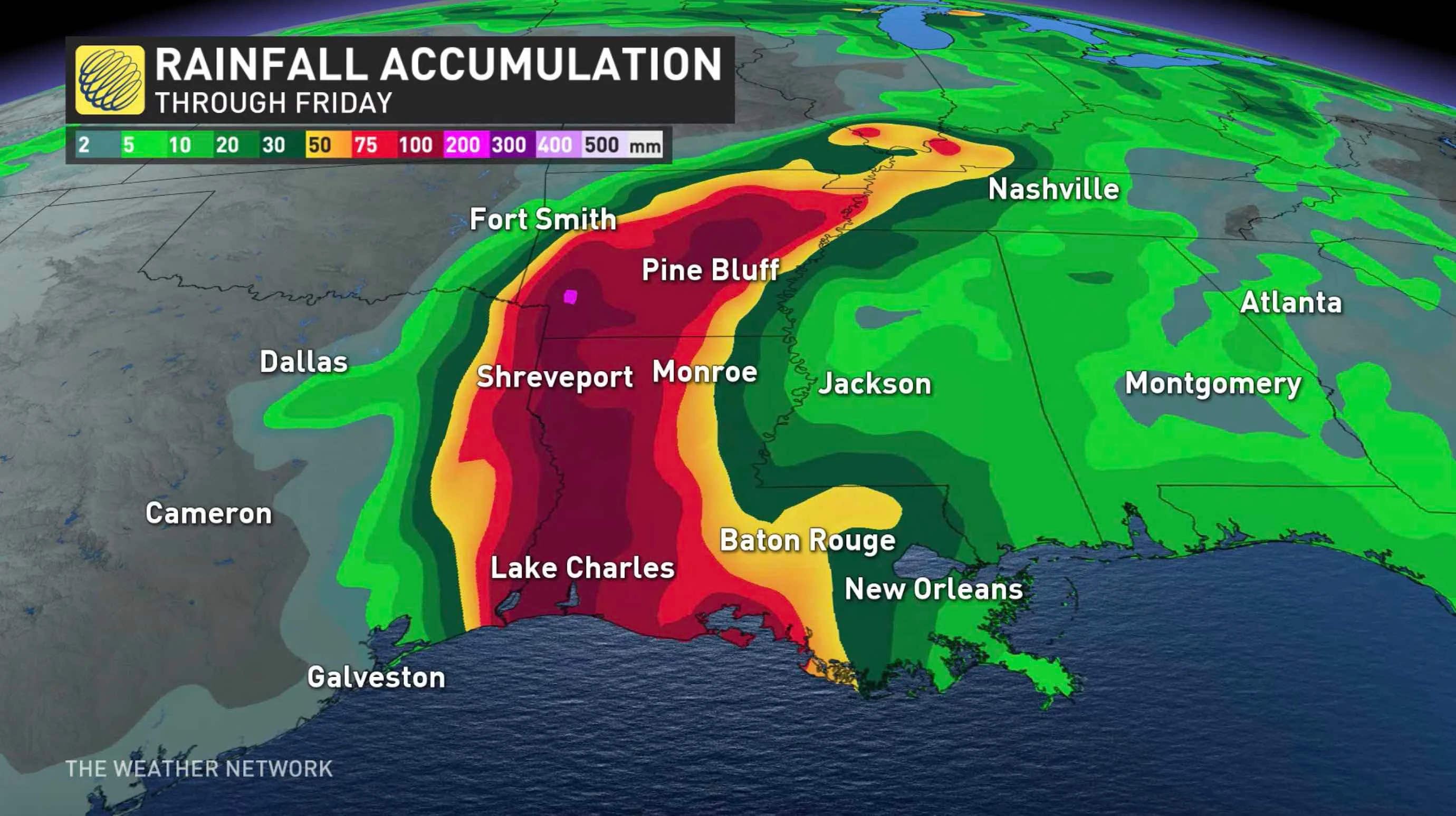
The storm could bring additional rainfall amounts as high as 200 mm to parts of the U.S. Gulf Coast, with local amounts as high as 460 mm for some, and all falling on areas already somewhat waterlogged from Marco's impact.
The rainfall will continue to cause widespread flash and urban flooding, small streams and creeks to overflow their banks and minor to moderate freshwater river flooding.
More than 420,000 Texas residents and another 200,000 people in Louisiana were under mandatory evacuation orders on Wednesday, as reported by Reuters. As well, more than 300 offshore oil facilities were evacuated and 84 per cent of U.S. Gulf of Mexico crude output was shutdown, as well as 61 per cent of the region’s offshore production.
As well, tornadoes are possible through on Friday in the Mid-South and Tennessee Valley regions.
Even after landfall, the storms' remnants are forecast to move deep into North America along the Mississippi Valley. Even though it will pass well south of the Great Lakes, Gulf of Mexico moisture associated with the remnants may enhance rainfall totals with a system moving into southern Ontario on Friday.
Though the longer-range forecast is a little bit less certain, there is a slight chance the storm's remnants may still be coherent enough to reform once it exits back out to sea off the U.S. northeastern coast, potentially impacting Atlantic Canada on the weekend.
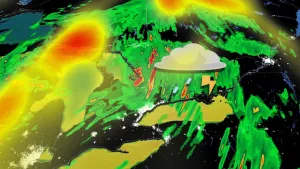
HURRICANE LAURA SIZE COMPARISON
“Hurricane Laura is a fairly large hurricane, and as it (approached) landfall, it contained a clear, wobbling eye over 40 kilometres in diameter. To put this size into perspective, the city of Brampton, Toronto, Mississauga, Vaughan and Scarborough would fit inside the clear eye,” explains The Weather Network meteorologist Tyler Hamilton.
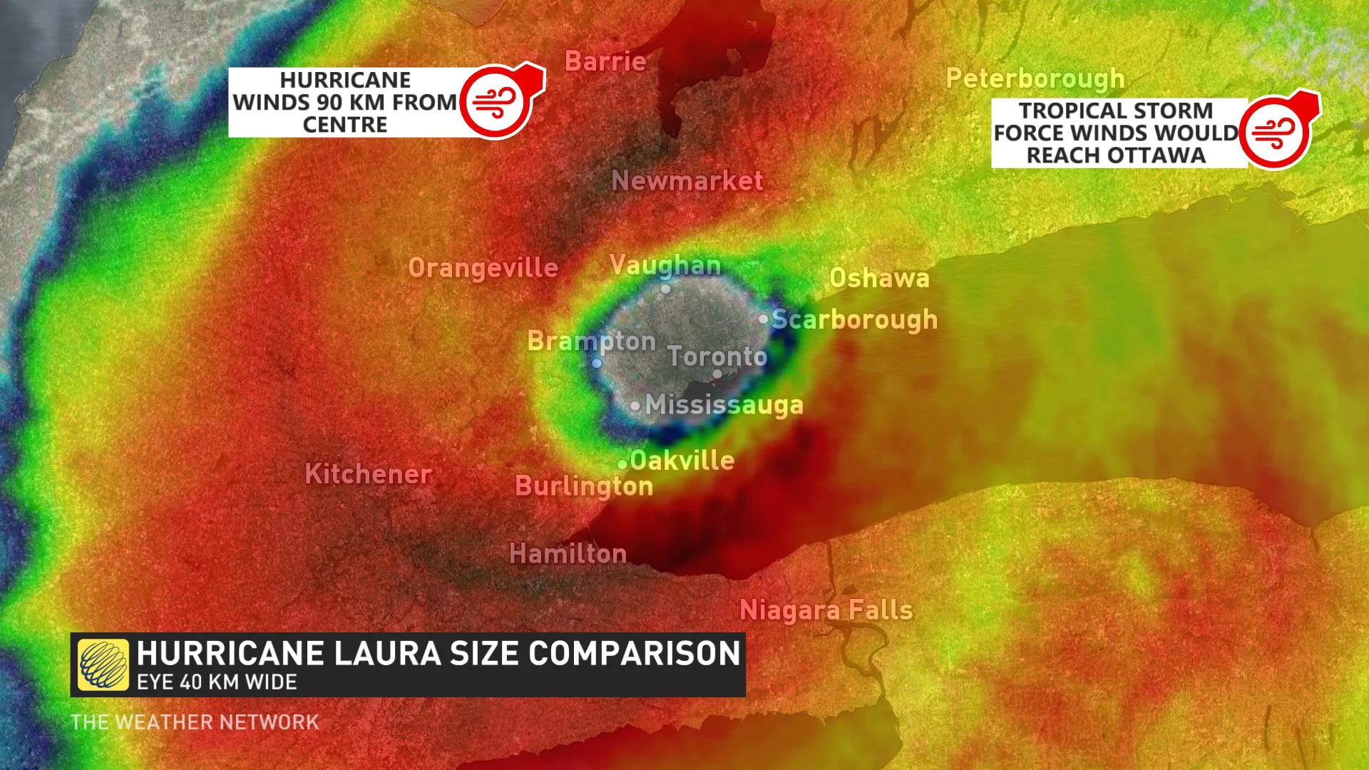
“Hypothetically, if the storm was over Toronto, Barrie would experience hurricane conditions. Tropical Storm-force winds (would) extend over 300 km from the eye. In a similar hypothetical situation, tropical storm conditions would be felt in Ottawa.”
Keep an eye on the forecast as we continue to monitor this storm.