Remnants of Ida to have an impact on Atlantic Canada, heavy downpours ahead

After delivering a soaking to the northeastern U.S. Wednesday, the extratropical remnants of Ida are set to bring very heavy rains to much of Atlantic Canada to close out the week.
Though once a powerful Category 4 hurricane, Ida's post-tropical remnants won't have the same devastating impact on Atlantic Canada when they merge with another system and begin bringing rain and strong winds, starting in the Maritimes Thursday and Newfoundland Friday. Still, there will be copious amounts of moisture from this system, with local extremes of more than 100 mm possible. Beyond, Tropical Storm Larry lurks off the coast of West Africa, on a track which forecasters say may take it toward the Atlantic provinces, though with more than a week between now and then, much is still uncertain. What we know, below.
THURSDAY INTO FRIDAY: REMNANTS OF IDA TO DELIVER SURGE OF TROPICAL MOISTURE TO ATLANTIC CANADA
Days after its devastating hit on Louisiana as a Category 4 hurricane Sunday, Ida has since weakened to a tropical depression, and will likely be extratropical as it moves offshore by early Thursday.

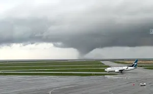
MUST SEE: Louisiana left without power, Mississippi highway collapses in Ida's wake
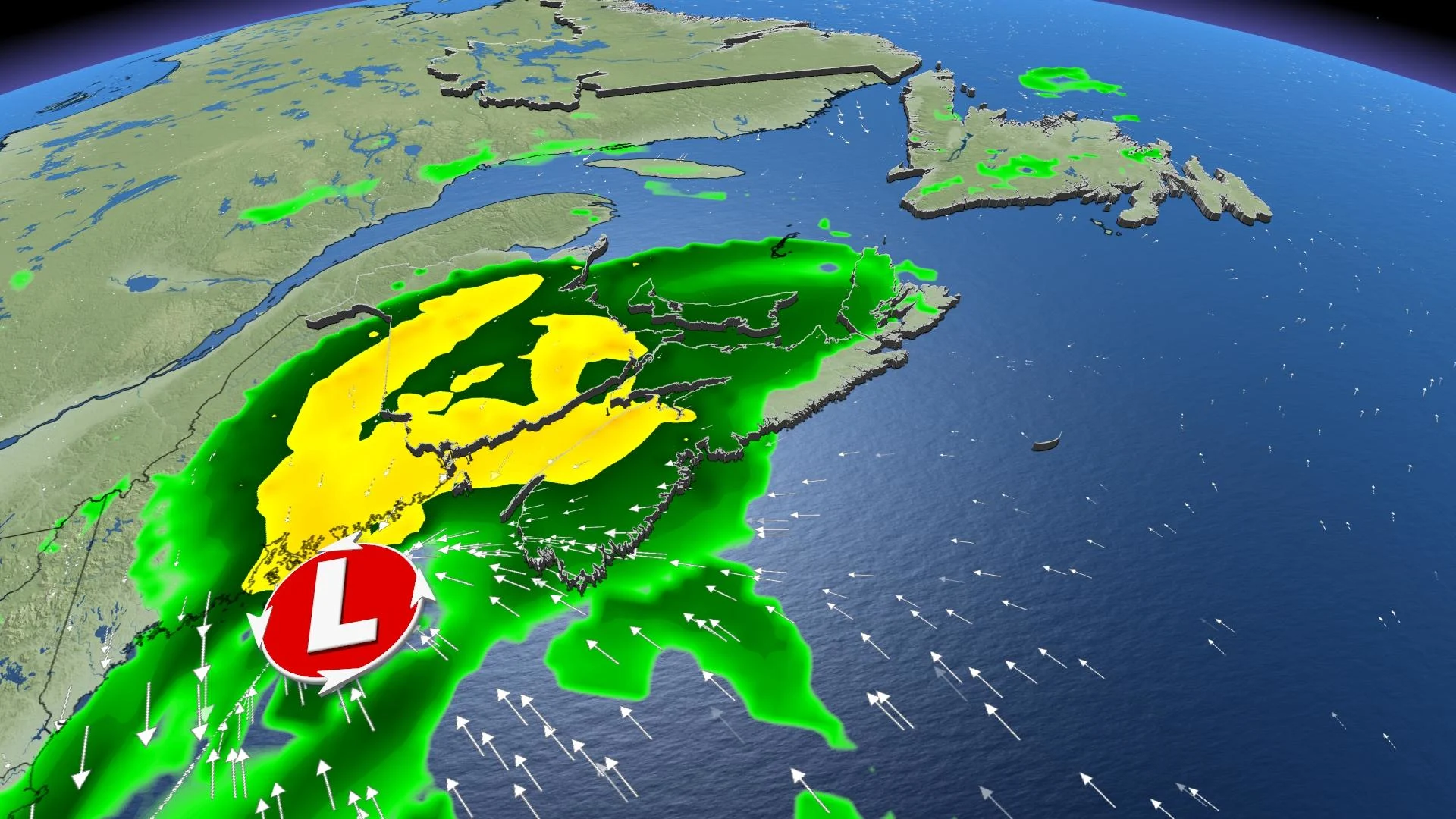
From there, moisture from the storm's remnants is expected to merge with a non-tropical weather system over the northeastern U.S. The result will be significant rain in Atlantic Canada Thursday into Friday.
The rain will spread across the Maritimes during the day and will likely become heavy at times in the evening and overnight hours before pushing into Newfoundland for Friday.
Rain totals of 50-100+ mm are likely for parts of the Maritimes, especially near the Bay of Fundy, and across western Newfoundland.

While it will also be windy across the region, for the most part, the peak wind gusts don’t look to be high enough to be of concern.
Around the Bay of Fundy however, gusts of 80+ km/h are possible with minor tree damage and the risk for localized power outages.

Related: Hang on safely through the Atlantic hurricane season with these tips
There will be a brief break following this soaking, but another system will track into the region early next week with another round of widespread rain and cool temperatures for Labour Day.
CLOSELY WATCHING TROPICAL STORM LARRY NEXT
As one tropical system's impacts are set to impact Canada, forecasters are already eyeing the next potential hit – while stressing that it's several days distant, and much is still unknown.
Tropical Storm Larry, which developed off the west coast of Africa, is forecast to become a major hurricane as it moves over the warm waters of the central Atlantic this weekend and next week.
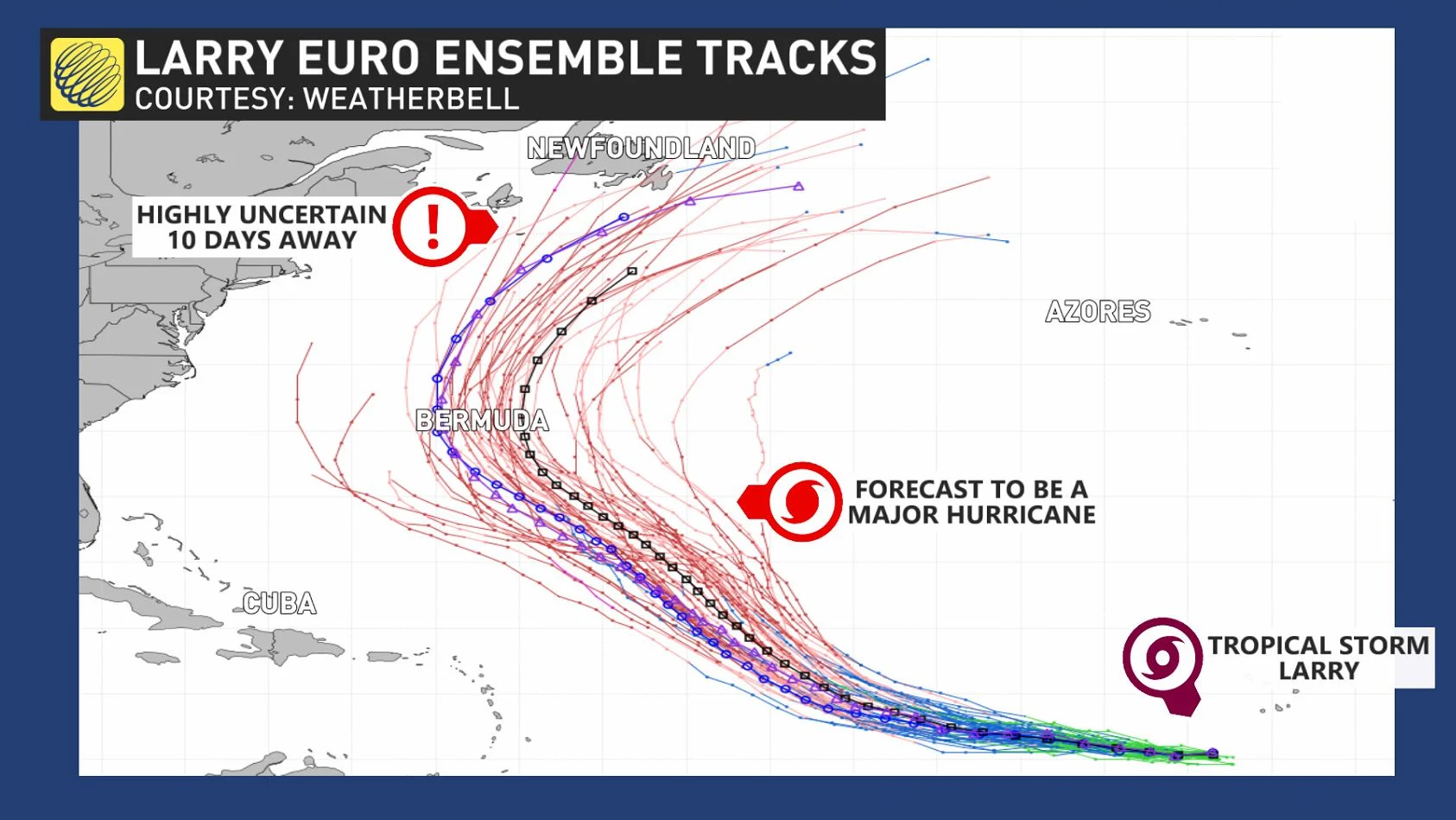
Its ultimate impact on Atlantic Canada is, however, highly uncertain, given that it isn't expected to approach the region until more than a week from now. However, forecasters say it's best to watch the storm's progress
"For Atlantic Canadians, there is no need to worry right now. But check in daily and start paying closer attention this weekend and early next week to the forecast," Weather Network Chief Meteorologist Chris Scott says. "If you're in emergency management or are responsible for weather-related job decisions, this is one to watch."
Be sure to check back for the latest updates on the active Atlantic hurricane season and its impacts across the East Coast.