Incredibly rare and mesmerizing snow squalls dance over Lake Michigan

It’s difficult enough to get the perfect conditions for lake-effect snow—let alone the setup needed to form these twirling squalls that stretch hundreds of kilometres
Folks living around the Great Lakes are no strangers to receiving heaps of lake-effect snow each winter. We even have a name for the regions that receive the most snow -- the Snowbelt.
Each of the Great Lakes is conducive to these intense bands of snow. However, there is a particular lake-effect phenomenon that is unique to Lake Michigan where the squalls can rotate as they move over the lake.

RELATED: 'Mini tornadoes' - The difference between steam, snow, and dust devils
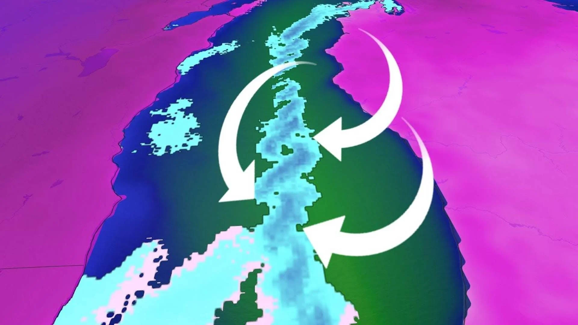
The north-south orientation of the fairly symmetric lake is a major factor in this mesmerizing spectacle.
Standard squalls form when Arctic air passes over relatively warm water, triggering convection as the warm, moist air rises and drifts downwind.
MUST SEE: Why Ontario’s ‘snow snake’ caught many–including forecasters–off guard
In this rare case, Arctic air at the surface races over the lake from both the western and eastern shores, while the wind a couple kilometres above the surface travels south. This elevated wind direction is what steers the squall south into Indiana.

As the wind travels, the continuous inflow from the east and west fuels rotating updrafts within the snow squall. This forms small-scale vortices, much like the structure of supercell thunderstorms in the summer.
The duration of and consistency of the wind allowed Friday’s mesmerizing setup to persist for hours.