Indigenous Guardians mapping Canada's worsening permafrost melt
Edward Cholo doesn't have to drive too far down the road to find land affected by climate change.
Along Highway 1, just north of Fort Simpson en route to Wrigley, N.W.T., Cholo points out rows of so-called drunken trees, tilting over because of the thawing permafrost underneath them. Cholo grew up on this land in the 1960s — a time when his people were able to set up trap lines or rabbit snares in the forest.
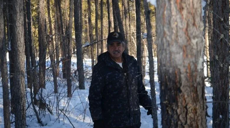
Edward Cholo walks through a forest just north of Fort Simpson. People in the area used to set up traplines here, but can't do so anymore because permafrost thaw has changed the land. (Anna Desmarais/CBC)
They can't do that anymore, he says about that specific area of the forest.
"Being on the land everyday, trapping, hunting, harvesting — you see a lot of changes," Cholo told the CBC. "It could be highwater … it could be driftwood down the river.
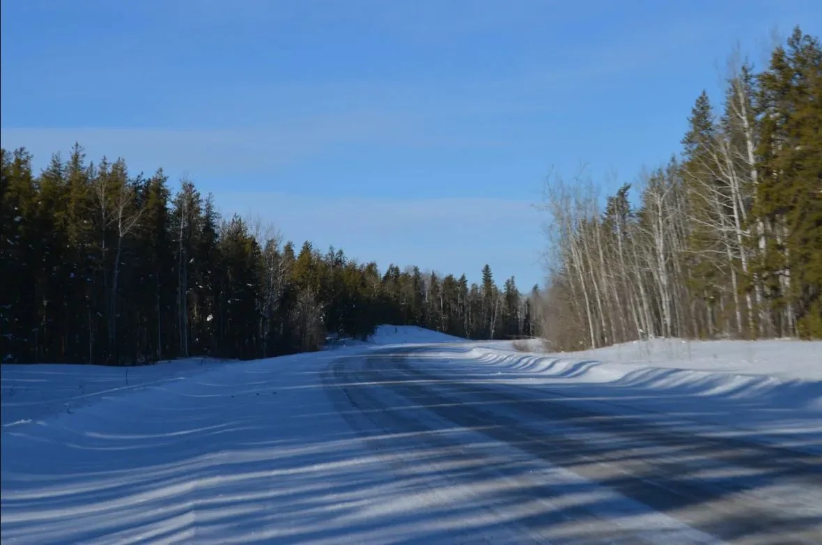
Trees are leaning towards the road in this shot of Highway 1, just north of Fort Simpson, N.W.T. (Anna Desmarais/CBC)
"Everyday is different."
Cholo is an Indigenous Guardian, part of a federally funded environmental stewardship program that monitors the health of the land and species on their traditional territory.
Cholo does most of the environmental monitoring during the summer on behalf of the Liidlii Kue First Nation in Fort Simpson, N.W.T. When he gets to an area with permafrost slumps, he takes photos with a camera that tracks GPS data. He records this data and gives it to the First Nation.
A few weeks ago, Cholo packed into a classroom in Fort Simpson with a dozen other local Indigenous leaders and guardians to take a workshop on digital mapping, which would take his observations from the paper to the computer.
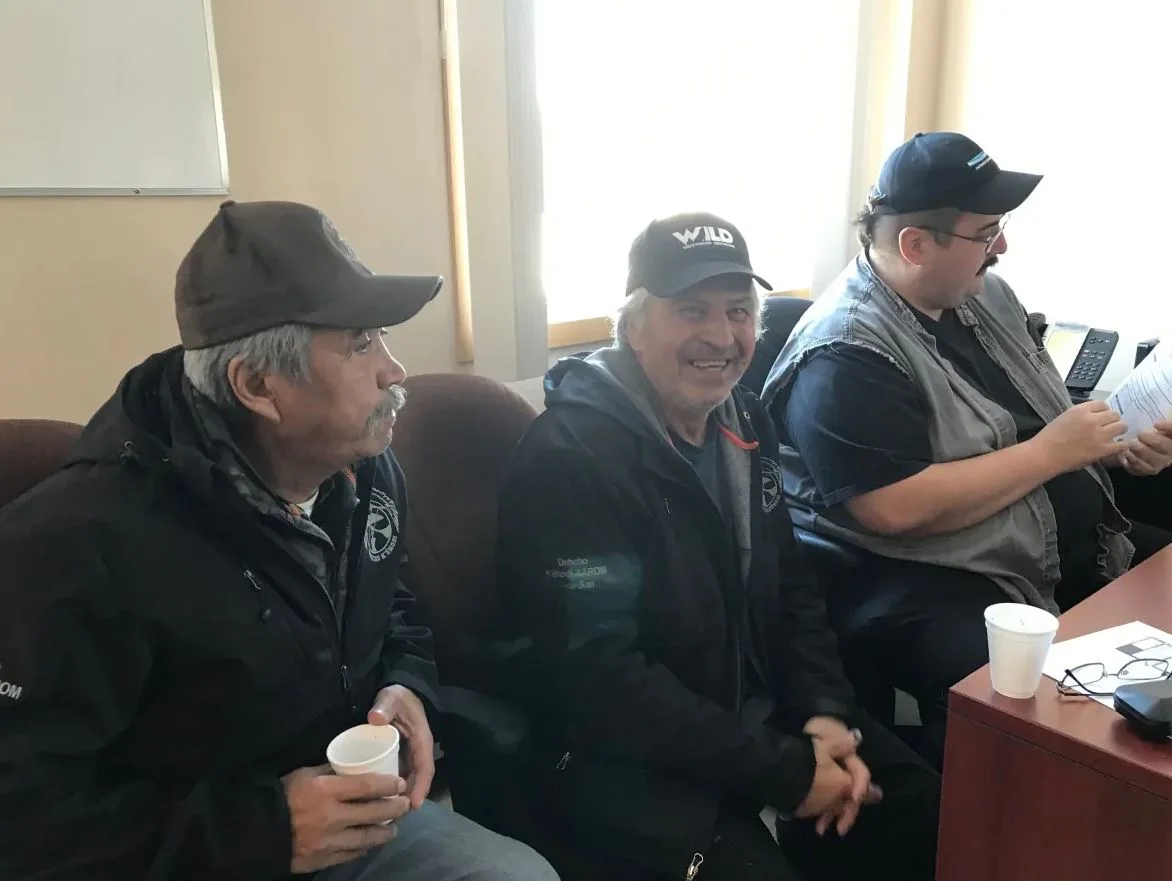
Edward Cholo, left, listens in on a mapping workshop being offered by the Dehcho Collaborative on Permafrost in Fort Simpson, N.W.T. on Feb. 20. The workshop is the first step toward a territory-wide permafrost map. (Anna Desmarais/CBC)
COLLABORATIVE PROJECT
The workshop was being offered by the Dehcho Collaborative on Permafrost (DCOP), a partnership between the Scotty Creek Research Station outside of Fort Simpson (run by Wilfrid Laurier University in Ontario) and the Dehcho First Nations. They are working together to study the effects of permafrost reduction in the Dehcho region.
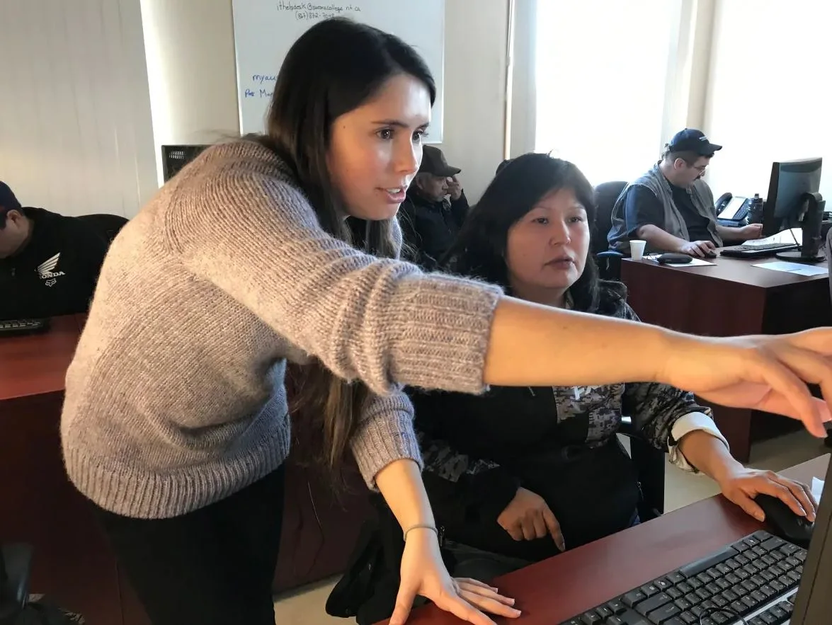
Olivia Carpinto, left, shows an Indigenous Guardian how to record land observations by using an open-source mapping software. (Anna Desmarais/CBC)
This workshop is one of the first steps toward creating a permafrost map for the region.
Bill Quinton, the co-principal investigator of the project, told the CBC that all types of knowledge are needed to figure out why permafrost thaw is happening.
"I think the rate of change in the environment due to climate warming is unprecedented," Quinton said. "So we really need to get all of us on the same page regardless of our backgrounds — whether it's university training … or whether it's traditional knowledge."
PERMAFROST 'VULNERABLE' TO CHANGING CLIMATE
Permafrost is a thick subsurface layer of soil that remains frozen for at least two years. When permafrost begins to thaw, it can cause erosion, landslides and disappearances of lakes.
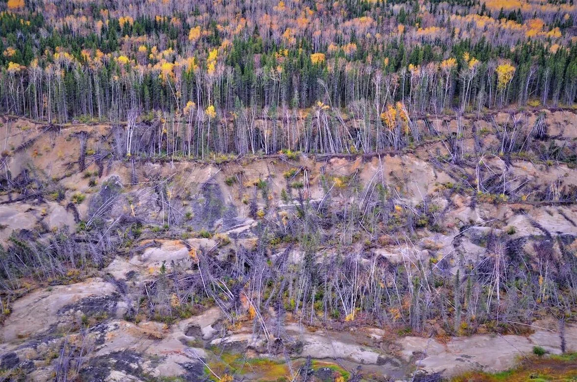
Permafrost slumps captured in an aerial shot near Fort Simpson, N.W.T. (Submitted by ENR-Forest Management)
Olivia Carpino, a PhD student at Wilfrid Laurier University, said permafrost temperatures are close to zero degrees in the Dehcho region, which means it is vulnerable to changes in the climate.
"As permafrost is thawing, we see these forests sort of collapse and become totally covered by water," Carpino told CBC. "We're seeing a transition from habitat, which was maybe originally a lot drier and contained a lot more forest species compared to those that are ... more muskeg or bog-dominated."
To record permafrost, researchers work with a grid-cell system. Each cell represents a specific geographical location or community, where Indigenous leaders can add observations of what they're seeing on the land, including possible signs of erosion or landslides.
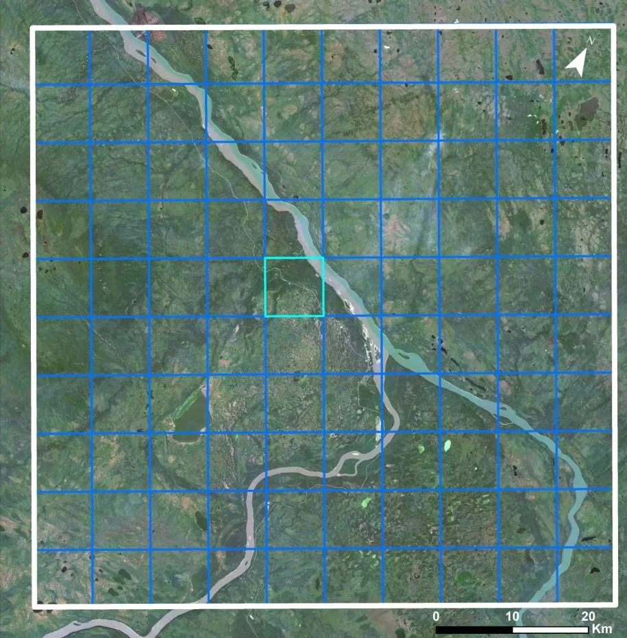
A grided cell system map of Fort Simpson, N.W.T. Researchers use this system to add land observations to specific geographical areas in and around the Dehcho region. (Submitted by Tristan Gringas-Hill)
Margaret Jumbo grew up on Sambaa K'e First Nation land after attending residential school for seven years.
She came to the workshop because she sees a lot of changes to the land and wants to learn more about how permafrost is moving through the region.
"It really hurts," Jumbo said, referring to the changes she has seen to the land, including landslides, dried-up swamps and fewer birds. "I just wish there was a way that we can fix it."
TERRITORY-WIDE PERMAFROST MAP IN MAKING
The Northwest Territories Geological Survey is also researching the effects of permafrost thaw with the hope of creating a territory-wide map by 2021.
Tristan Gringas-Hill, a permafrost researcher, presented their project at the workshop. He said the Northwest Territories Geological Survey will be hiring Indigenous Guardians in the summer to verify what they've captured with their satellite imagery.
The group wrote on their project website that mapping of all communities will be done in 2020, with the goal of creating the territorial map by 2021.
Researchers say the data would eventually help land users like Jumbo and Cholo understand the extent of permafrost thaw across the territory.
As for Cholo, he is waiting for spring. That's when he will head back to that spot along Highway 1 to measure changes to the permafrost thaw as the snow melts away.
Original story by Anna Desmarais published on CBC.ca