African wave train is happening right on cue as hurricane season stirs again

Though, like in 2005, there have been a lot of named storms, the intensity of those storms has been low so far.
Multiple forecasters predicted an above-average Atlantic hurricane season, and they've not been proven wrong, with multiple named storms being their earliest of their letter on record.
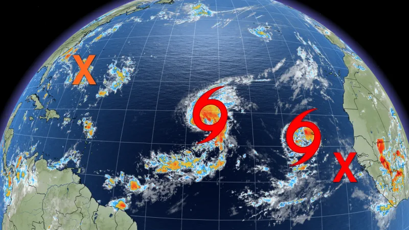
The tropical activity continues with two named storms, Paulette and Rene. Both presently look to take a path toward North America and Rene is expected to be near hurricane strength by Friday night. However, there's currently no indication either of them will have a wider impact on the U.S. or Caribbean.
Forecasters are also eyeing a disturbance around 380 km southeast of Wilmington, North Carolina, that has a 20 per cent chance of becoming a tropical storm in the next five days. A large area of disorganized showers and thunderstorm that is located several hundred kilometres northeast of the Central Bahamas also has a 20 per cent chance of becoming a tropical storm in the same time period.
Near West Africa, a tropical wave is expected to emerge offshore, with an 90 per cent chance of becoming a tropical storm later in the week. Another tropical wave is forecast to emerge from a similar area and has a 20 per cent chance of becoming a tropical storm in the next five days.

These storms are carrying on this season's above-average trend and forecasters are four storms away from running out of names on the official name list -- after which any further storms would be given names from the Greek alphabet.
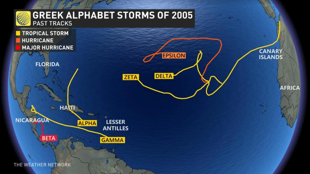
It wouldn't be the first time: The famously active 2005 season ended up needing six names off the Greek list, with the final storm, Zeta, actually lingering into the early days of January 2006, long after the end of the "official" season on November 1st.
So there is plenty of time left for the 2020 season to start relying on names of a more Hellenic flavour -- but one thing people should keep in mind is that the number of storms, expected or actual, has little bearing on the severity of the season.
When forecasters warn of an "above average" season, they are talking purely in terms of expected named storms, and none of these predictions typically make any claims to the expected severity of the storms. Indeed, so far the 2020 season has only produced one major hurricane -- that is, Category 3 or higher -- in the form of Hurricane Laura, which reached Category 4 prior to impacting the U.S. Gulf Coast with extreme winds and major storm surge last month.

Some forecasters, however, do use a metric they call "accumulated cyclone energy" (ACE), which measures a storm's six-hour wind speed and applies a mathematical formula to it to come up with an assessment of that storm's intensity over its lifespan. Even in that case, however, the storms of 2020 look less severe than in 2005.
"While this season is on track to rival the 2005 named amount of storms we are not on track to reach the same ACE number," Weather Network meteorologist Jaclyn Whittal says. "This means we may see many weaker storms adding up on the list of names, but not as many strong storms adding up the overall seasonal ACE number."
We should note, however, that lower storm intensity at one point of the season does not guarantee low intensity later in the season. One case in point is Hurricane Mitch, which was the penultimate named storm of the 1998 hurricane season, forming in late October and dissipating in early November. That storm eventually reached Category 5 status, and with a death toll of more than 11,000 in Central America, it is the deadliest Atlantic hurricane on record in the 20th Century.