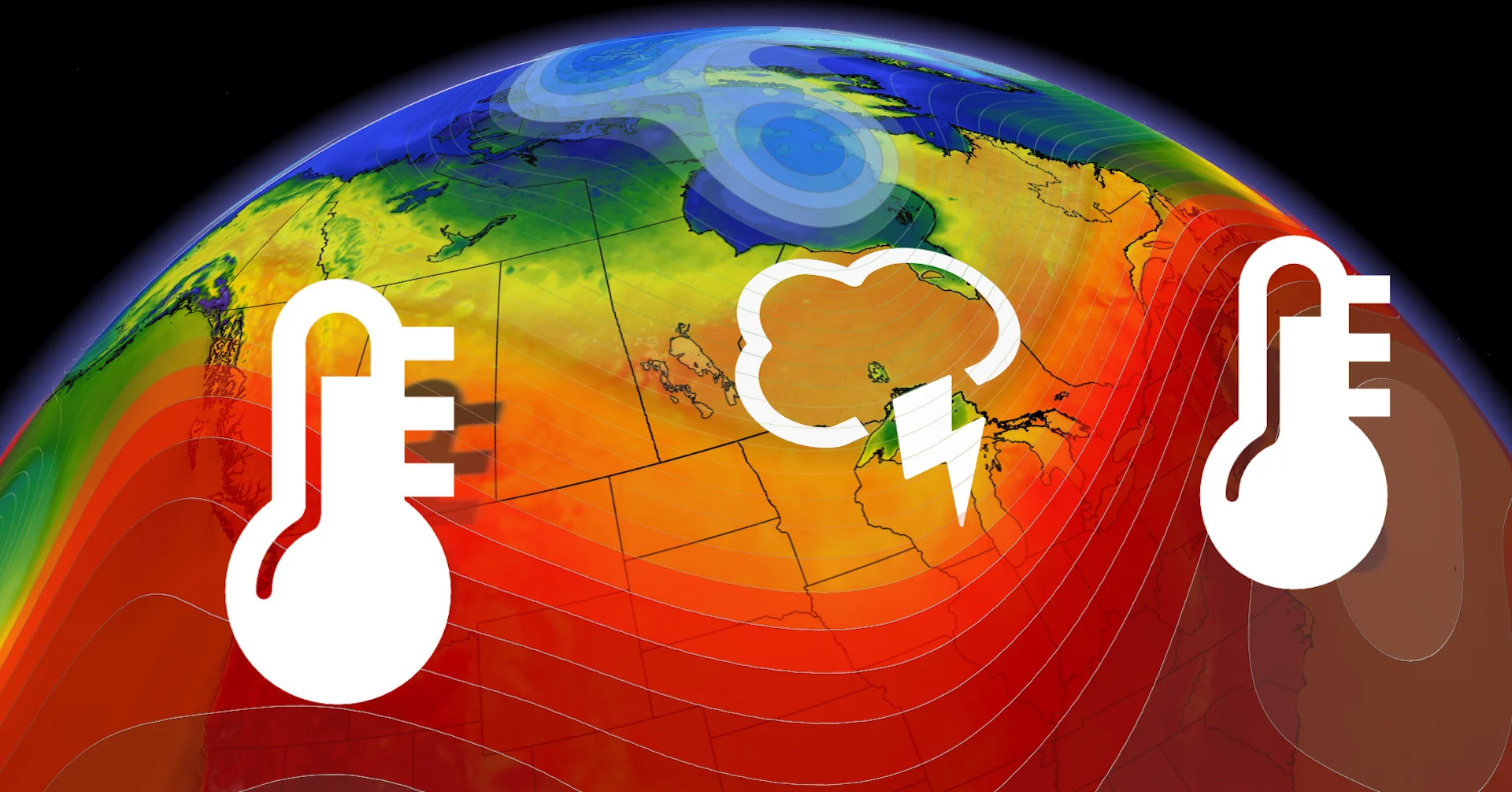
July outlook: Will summer’s sputtering start turn around this month?

A spring-like start to summer may turn around across much of Canada this month
Summer has sputtered along so far this year. While June did feature some record-breaking heat at times, June went into the record books for much of Canada as a cooler-than-normal month.
Of course, the cooler weather has triggered strong and mixed reactions. Regardless of whether you are loving or lamenting the lack of heat, please keep reading for July 2024 forecast to see how long this pattern will continue.
Visit our Complete Guide to Summer for an in-depth look at the Summer Forecast, tips to plan for it and much more!
It feels more like late May or early June across most of Southern Canada as we start the first few days of July.
As we looked at temperatures across the country for Canada Day, there was very little heat to be found, except for you might least expect it. In fact, parts of Northern Canada (including Yellowknife and Churchill) were much warmer than many places across Southern Canada.
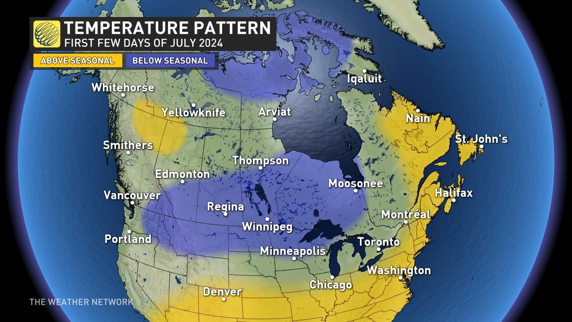
The cool pattern will continue for the first few days of July, but a pattern change will begin to unfold as we progress through the first week of July.
Pattern change arrives
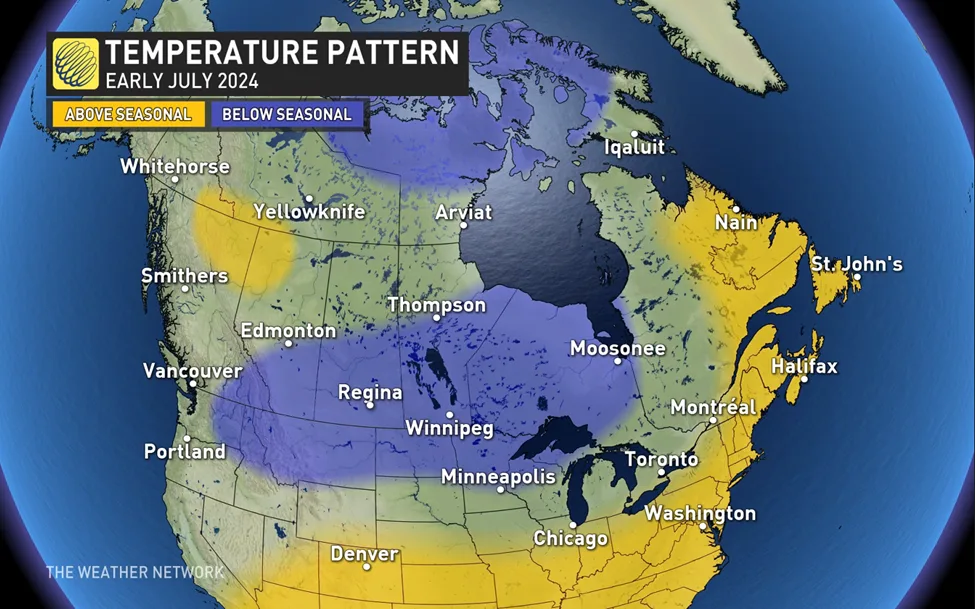
The first change will be the return of warmer and more humid conditions across parts of Eastern Canada from southern Ontario to Atlantic Canada. Meanwhile, temperatures will trend cooler in Northern Canada, and a couple more shots of cooler weather are expected to spread south across the Prairies and into northern Ontario.
It is difficult to show a snapshot of early July with a single graphic since we will see changeable temperatures, but here is an overview of what we can expect during the first week of July – to help provide context for how we expect the pattern to change for the rest of the month.
MUST SEE: Sunshine and warm temperatures—is this Canada's ideal summer forecast?
As we head into and through the second week of July, we expect that a warmer pattern will become more widespread across Canada.
Much warmer weather will arrive across western Canada, but the western heat will be temporary. A warmer pattern is expected to spread east for mid and late July, while western Canada will continue to see shots of cooler weather.
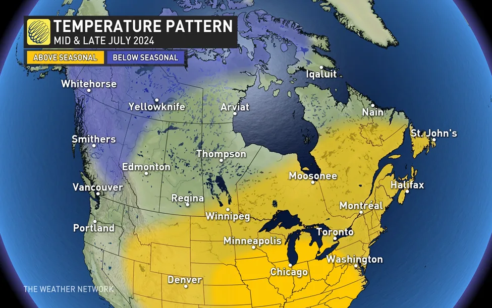
For July as a whole, we expect that most of Western Canada will end up near-seasonal or on the cool side of seasonal while most of the eastern half of Canada will end up warmer than normal.
The hottest weather relative to normal is expected to be across the U.S. Midwest and into the Great Lakes region and, at times, that heat will spread into southern Ontario.
Active pattern slowly diminishes, powerful storms continue
Most of Canada is well-watered as we head into the heart of summer, thanks to a rather active and wet pattern during May and June. We have even seen excessive rain in some areas, including St. John’s, N.L., where the city just experienced its wettest June on record.
While the rain and storms have disrupted many outdoor plans, there are many positive outcomes associated with a wetter pattern, including much less smoke and better air quality than we were seeing this time last year.
One of the reasons for the wet pattern so far has been the frequent and strong cold fronts, and the clash between the contrasting air masses. While this will continue through the first week of July in many areas, as we get deeper into the month we expect fewer low-pressure systems and cold fronts. As a result, we should see fewer rainy days and a drier pattern overall across most of the country.
DON'T MISS: How a U.S. heat dome could bring severe summer storms to Canada
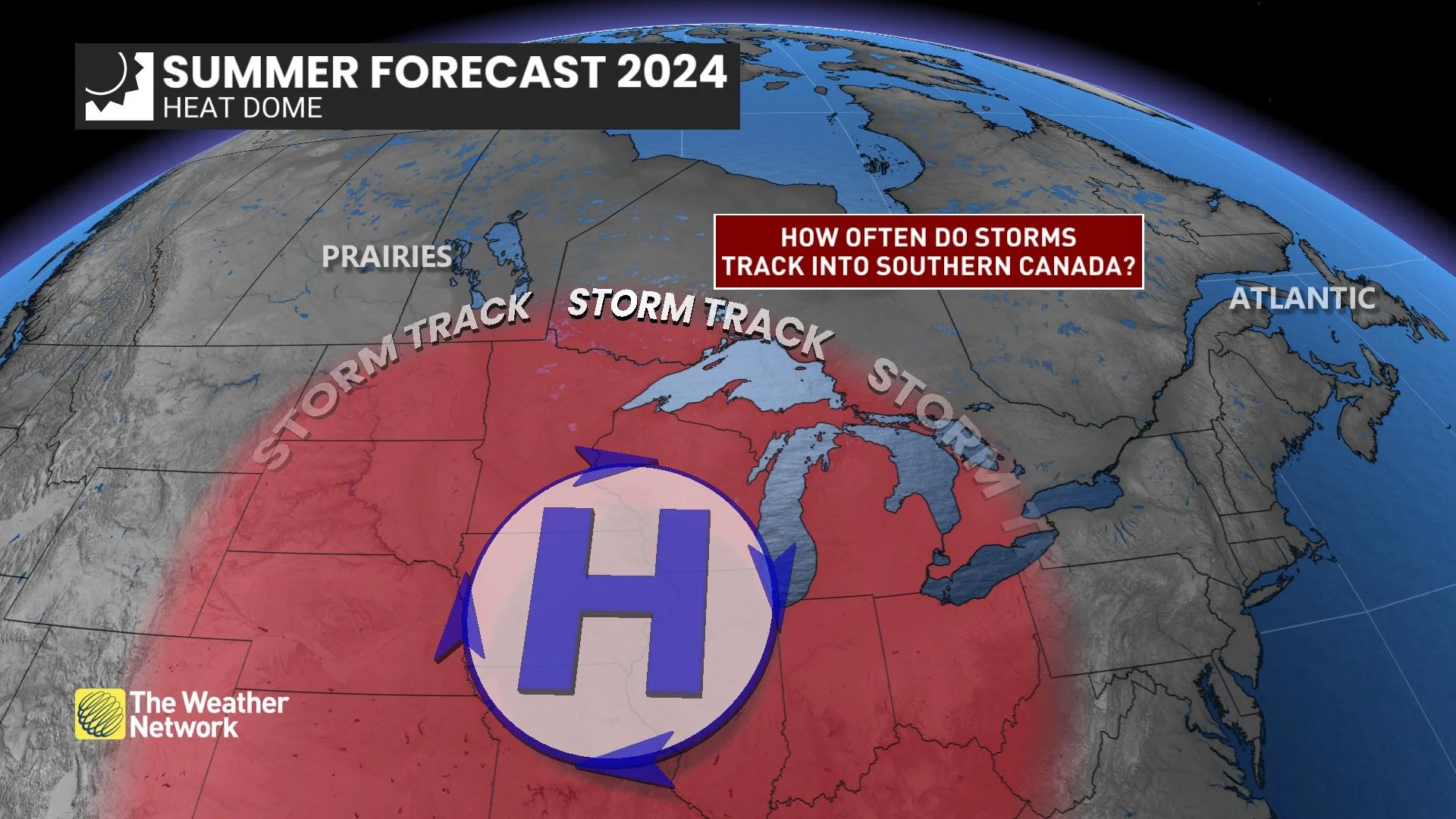
However, during periods of hot weather, we frequently see organized clusters of strong to severe thunderstorms that track around the edge of the hottest conditions. This is often referred to as the “ring of fire.” These powerful storms will track through the Great Lakes region and into southern Ontario at times during July, but the frequency is still uncertain.
Across Western Canada, we still expect a more typical summer pattern with scattered thunderstorms and a risk for strong to severe storms at times, but fewer widespread rain events. As a result, we expect that many areas will need rain before we get to the end of July.